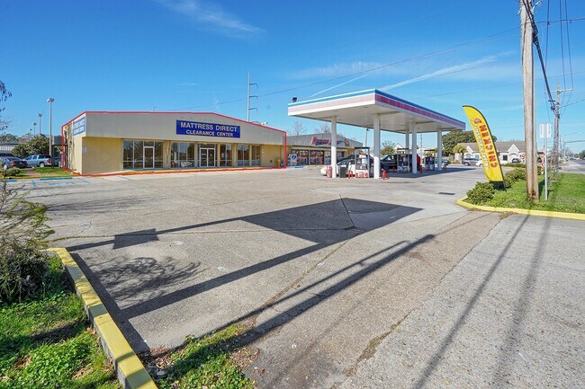
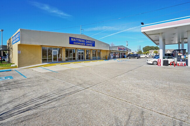
Property Record
4045 Williams Blvd, Kenner, LA 70065

Property Detail
4045 Williams Blvd
New Orleans-Metairie, LA
HIGHWAY PK 10828428
0920003913
Jefferson
Miscpropertynotclassed
Louisiana
AE The base floodplain where base flood elevations are provided. AE Zones are now used on new format FIRMs instead of A1-A30 Zones.
21b
2025
0.59 AC
2025
Kenner
020502
New Orleans/Metairie/Kenner
NEARBY LISTINGS FOR SALE OR LEASE
DEMOGRAPHICS near 4045 Williams Blvd
1 mile
3 mile
5 mile
2025 Total Population
18,665
90,294
163,065
2030 Population
18,398
89,193
160,630
Pop Growth 2025-2030
(1.43%)
(1.22%)
(1.49%)
Average Age
41
41
41
2025 Total Households
7,173
34,430
65,787
HH Growth 2025-2030
(1.52%)
(1.31%)
(1.59%)
Median Household Inc
$70,217
$68,460
$65,791
Avg Household Size
2.50
2.50
2.40
2025 Avg HH Vehicles
2.00
2.00
2.00
Median Home Value
$291,405
$281,701
$282,947
Median Year Built
1978
1975
1973
Nearby Places
Map Layers
Map Styles
 Street
 Aerial
Layers
 Traffic
 Biking
Places
Listings with unknown addresses are not visible on the map
- Restaurants
- Banks
- Shops
- Fitness
- Groceries
PUBLIC TRANSPORTATION
AIRPORT
Louis Armstrong New Orleans International
Drive
Walk
Distance
Louis Armstrong New Orleans International
8 min
4.0 mi
Freight Ports
Port of New Orleans
Drive
Walk
Distance
Port of New Orleans
25 min
15.5 mi
SALE & LEASE HISTORY
LISTING DATE
SALE/LEASE

Jun 06, 2022
For Lease
Jan 21, 2020
For Lease
Aug 04, 2020
For Lease
Apr 27, 2020
For Lease
Nearby Properties
Address
Land Use
TOTAL SIZE
Lot Size
Zoning
Address
Land Use
TOTAL SIZE
Lot Size
Zoning
Address
Land Use
TOTAL SIZE
Lot Size
Zoning
13.64 AC
Address
Land Use
TOTAL SIZE
Lot Size
Zoning
0.09 AC
Address
Land Use
TOTAL SIZE
Lot Size
Zoning
19.90 AC
Address
Land Use
TOTAL SIZE
Lot Size
Zoning
Address
Land Use
TOTAL SIZE
Lot Size
Zoning
31.55 AC
R1A
Address
Land Use
TOTAL SIZE
Lot Size
Zoning
15.97 AC
Address
Land Use
TOTAL SIZE
Lot Size
Zoning
19.35 AC
R1A
Address
Land Use
TOTAL SIZE
Lot Size
Zoning
18.01 AC
Address
Land Use
TOTAL SIZE
Lot Size
Zoning
10.16 AC
Address
Land Use
TOTAL SIZE
Lot Size
Zoning
Address
Land Use
TOTAL SIZE
Lot Size
Zoning
0.15 AC
Address
Land Use
TOTAL SIZE
Lot Size
Zoning
0.13 AC
Address
Land Use
TOTAL SIZE
Lot Size
Zoning
1,295 SF
9.70 AC
R1A
Address
Land Use
TOTAL SIZE
Lot Size
Zoning
2.03 AC
Address
Land Use
TOTAL SIZE
Lot Size
Zoning
Address
Land Use
TOTAL SIZE
Lot Size
Zoning
14.95 AC
Address
Land Use
TOTAL SIZE
Lot Size
Zoning
Address
Land Use
TOTAL SIZE
Lot Size
Zoning
Address
Land Use
TOTAL SIZE
Lot Size
Zoning
25.77 AC
Address
Land Use
TOTAL SIZE
Lot Size
Zoning
22.92 AC
Address
Land Use
TOTAL SIZE
Lot Size
Zoning
Address
Land Use
TOTAL SIZE
Lot Size
Zoning
0.13 AC
Address
Land Use
TOTAL SIZE
Lot Size
Zoning
4.23 AC
Address
Land Use
TOTAL SIZE
Lot Size
Zoning
4.10 AC
Address
Land Use
TOTAL SIZE
Lot Size
Zoning
2.39 AC
Address
Land Use
TOTAL SIZE
Lot Size
Zoning
9.11 AC
BC2
Address
Land Use
TOTAL SIZE
Lot Size
Zoning
39.12 AC
Address
Land Use
TOTAL SIZE
Lot Size
Zoning
15.68 AC
Address
Land Use
TOTAL SIZE
Lot Size
Zoning
3.60 AC
R1A
The World's #1 Commercial Real Estate Marketplace
Connect with us
© 2026 CoStar Group
The information above has been obtained from sources believed reliable. While we do not doubt its accuracy we have not verified it and make no guarantee, warranty or representation about it. It is your responsibility to independently confirm its accuracy and completeness. Any projections, opinions, assumptions, or estimates used are for example only and do not represent the current or future performance of the property. The value of this transaction to you depends on tax and other factors which should be evaluated by your tax, financial, and legal advisors. You and your advisors should conduct a careful, independent investigation of the property to determine to your satisfaction the suitability of the property for your needs.