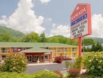
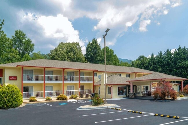
Property Record
4048 Soco Rd, Maggie Valley, NC 28751


Property Detail
4048 Soco Rd
7686-18-3614
4048 SOCO RD
Hotelormotel
Haywood
MC1
North Carolina
AE The base floodplain where base flood elevations are provided. AE Zones are now used on new format FIRMs instead of A1-A30 Zones.
1 AC
0
North Carolina West/Cherokee Area
2025
Asheville
920702
Waynesville, NC
10,212 SF
NEARBY LISTINGS FOR SALE OR LEASE
-
-
View all Maggie Valley listings for sale on LoopNet.com
DEMOGRAPHICS near 4048 Soco Rd
1 mile
3 mile
5 mile
2025 Total Population
1,386
4,705
10,589
2030 Population
1,460
4,967
11,068
Pop Growth 2025-2030
+ 5.34%
+ 5.57%
+ 4.52%
Average Age
53
53
51
2025 Total Households
659
2,262
5,003
HH Growth 2025-2030
+ 5.46%
+ 5.66%
+ 4.58%
Median Household Inc
$66,674
$66,875
$64,893
Avg Household Size
2.00
2.00
2.10
2025 Avg HH Vehicles
2.00
2.00
2.00
Median Home Value
$304,779
$318,094
$324,221
Median Year Built
1989
1990
1990
Nearby Places
Map Layers
Map Styles
 Street
 Aerial
Layers
 Traffic
 Biking
Places
Listings with unknown addresses are not visible on the map
- Restaurants
- Banks
- Shops
- Fitness
- Groceries
PUBLIC TRANSPORTATION
AIRPORT
Asheville Regional
Drive
Walk
Distance
Asheville Regional
54 min
39.6 mi
SALE & LEASE HISTORY
LISTING DATE
SALE/LEASE

May 11, 2023
For Sale
Nearby Properties
Address
Land Use
TOTAL SIZE
Lot Size
Zoning
Address
Land Use
TOTAL SIZE
Lot Size
Zoning
2,924.62 AC
Address
Land Use
TOTAL SIZE
Lot Size
Zoning
43,995 SF
5 AC
Address
Land Use
TOTAL SIZE
Lot Size
Zoning
1,239 SF
18.07 AC
Address
Land Use
TOTAL SIZE
Lot Size
Zoning
15,735 SF
119.65 AC
MR2
Address
Land Use
TOTAL SIZE
Lot Size
Zoning
546 SF
7.47 AC
Address
Land Use
TOTAL SIZE
Lot Size
Zoning
3,850 SF
98.40 AC
MC1
Address
Land Use
TOTAL SIZE
Lot Size
Zoning
5,950 SF
3.93 AC
MC1
Address
Land Use
TOTAL SIZE
Lot Size
Zoning
14,352 SF
2.70 AC
Address
Land Use
TOTAL SIZE
Lot Size
Zoning
13,498 SF
1.20 AC
MC1
Address
Land Use
TOTAL SIZE
Lot Size
Zoning
5,000 SF
1.75 AC
MC1
Address
Land Use
TOTAL SIZE
Lot Size
Zoning
4,753 SF
3.27 AC
MC1
Address
Land Use
TOTAL SIZE
Lot Size
Zoning
7,052 SF
3.35 AC
MC1
Address
Land Use
TOTAL SIZE
Lot Size
Zoning
13,303 SF
1.43 AC
MC1
Address
Land Use
TOTAL SIZE
Lot Size
Zoning
9,504 SF
1.22 AC
MC1
Address
Land Use
TOTAL SIZE
Lot Size
Zoning
10,110 SF
0.93 AC
MC1
Address
Land Use
TOTAL SIZE
Lot Size
Zoning
Address
Land Use
TOTAL SIZE
Lot Size
Zoning
4,523 SF
3.35 AC
Address
Land Use
TOTAL SIZE
Lot Size
Zoning
1,064 SF
1.20 AC
MC1
Address
Land Use
TOTAL SIZE
Lot Size
Zoning
3,982 SF
1.81 AC
MC1
Address
Land Use
TOTAL SIZE
Lot Size
Zoning
11,712 SF
2.06 AC
MC1
Address
Land Use
TOTAL SIZE
Lot Size
Zoning
8,880 SF
1.45 AC
MC1
Address
Land Use
TOTAL SIZE
Lot Size
Zoning
295.26 AC
Address
Land Use
TOTAL SIZE
Lot Size
Zoning
5,568 SF
3.78 AC
MC1
Address
Land Use
TOTAL SIZE
Lot Size
Zoning
6,080 SF
2.01 AC
MC1
Address
Land Use
TOTAL SIZE
Lot Size
Zoning
3,484 SF
6.55 AC
Address
Land Use
TOTAL SIZE
Lot Size
Zoning
418.68 AC
Address
Land Use
TOTAL SIZE
Lot Size
Zoning
4,944 SF
1.11 AC
MC1
Address
Land Use
TOTAL SIZE
Lot Size
Zoning
309.08 AC
Address
Land Use
TOTAL SIZE
Lot Size
Zoning
1,710 SF
8.03 AC
The World's #1 Commercial Real Estate Marketplace
Connect with us
© 2026 CoStar Group
The information above has been obtained from sources believed reliable. While we do not doubt its accuracy we have not verified it and make no guarantee, warranty or representation about it. It is your responsibility to independently confirm its accuracy and completeness. Any projections, opinions, assumptions, or estimates used are for example only and do not represent the current or future performance of the property. The value of this transaction to you depends on tax and other factors which should be evaluated by your tax, financial, and legal advisors. You and your advisors should conduct a careful, independent investigation of the property to determine to your satisfaction the suitability of the property for your needs.