Property Record
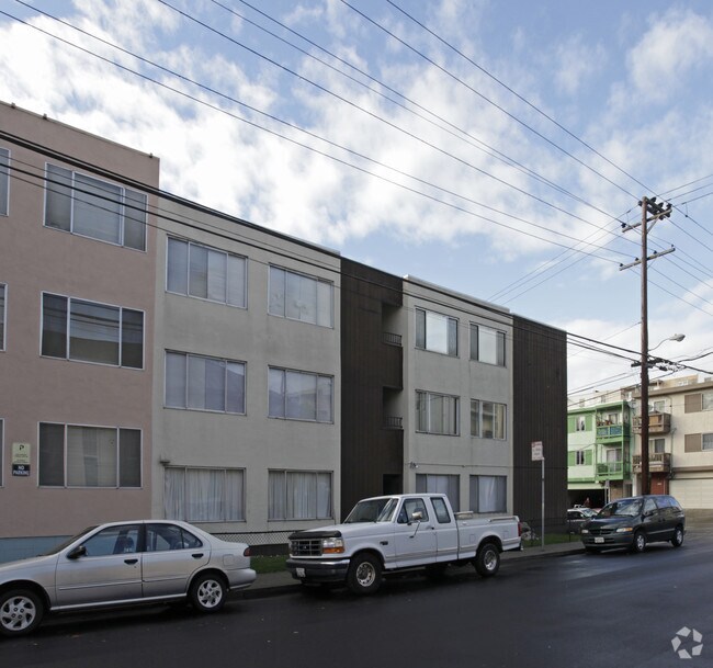
405 89Th St, Daly City, CA 94015


NEARBY LISTINGS FOR SALE OR LEASE
Property Detail
405 89Th St
San Francisco-San Mateo-Redwood City, CA
Dollar Lot Hmstd
006-193-140
63.33 FT X 120 FT AT SWLY COR EDGEWORTH AVE & 89TH ST BEING PTN LOTS 1 THRU 5 BLK 13 SEVENTY FIVE DOLLAR LOT HMSTD RSM 1/6 CITY OF DALY CITY
Multifamilydwelling
San Mateo
X
California
06081C0028F
1-5
2024
0.18 AC
2025
St Francis
601200
San Francisco
18,221 SF
DEMOGRAPHICS near 405 89Th St
1 Mile
3 Mile
5 Mile
2024 Total Population
44,235
196,039
488,526
2029 Population
41,978
182,716
452,795
Pop Growth 2024-2029
(5.10%)
(6.80%)
(7.31%)
Average Age
41
43
43
2024 Total Households
13,610
61,740
164,962
HH Growth 2024-2029
(5.28%)
(6.94%)
(7.65%)
Median Household Inc
$97,413
$105,758
$121,442
Avg Household Size
3.10
3.00
2.80
2024 Avg HH Vehicles
2.00
2.00
2.00
Median Home Value
$1,022,787
$1,040,847
$1,078,786
Median Year Built
1964
1959
1955
Nearby Places
Map Layers
Map Styles
 Street
 Aerial
- Restaurants
- Banks
- Shops
- Fitness
- Groceries
PUBLIC TRANSPORTATION
COMMUTER RAIL
South San Francisco (Caltrain - Caltrain (Caltrain))
DRIVE
WALK
Distance
South San Francisco (Caltrain - Caltrain (Caltrain))
12 min
6.1 mi
DRIVE
WALK
Distance
11 min
6.8 mi
AIRPORT
San Francisco International
DRIVE
WALK
Distance
San Francisco International
16 min
9.4 mi
Metro Oakland International
DRIVE
WALK
Distance
Metro Oakland International
41 min
28.1 mi
Freight Ports
Port of San Francisco
DRIVE
WALK
Distance
Port of San Francisco
18 min
11.5 mi
Nearby Properties
Address
Land Use
TOTAL SIZE
Lot Size
Zoning
Address
Land Use
TOTAL SIZE
Lot Size
Zoning
411,904 SF
21.74 AC
C2
Address
Land Use
TOTAL SIZE
Lot Size
Zoning
53.85 AC
Address
Land Use
TOTAL SIZE
Lot Size
Zoning
312,191 SF
2.74 AC
Address
Land Use
TOTAL SIZE
Lot Size
Zoning
167,105 SF
2.07 AC
C10000
Address
Land Use
TOTAL SIZE
Lot Size
Zoning
42.95 AC
Address
Land Use
TOTAL SIZE
Lot Size
Zoning
447,674 SF
21.51 AC
Address
Land Use
TOTAL SIZE
Lot Size
Zoning
2.03 AC
C2
Address
Land Use
TOTAL SIZE
Lot Size
Zoning
Address
Land Use
TOTAL SIZE
Lot Size
Zoning
88,900 SF
5.37 AC
NCS
Address
Land Use
TOTAL SIZE
Lot Size
Zoning
11.31 AC
RM2
Address
Land Use
TOTAL SIZE
Lot Size
Zoning
160,983 SF
1.84 AC
NC2
Address
Land Use
TOTAL SIZE
Lot Size
Zoning
10.62 AC
Address
Land Use
TOTAL SIZE
Lot Size
Zoning
Address
Land Use
TOTAL SIZE
Lot Size
Zoning
187,865 SF
3.54 AC
Address
Land Use
TOTAL SIZE
Lot Size
Zoning
209,692 SF
8.20 AC
R30000
Address
Land Use
TOTAL SIZE
Lot Size
Zoning
2,011 SF
2.49 AC
Address
Land Use
TOTAL SIZE
Lot Size
Zoning
73,491 SF
4.48 AC
C2
Address
Land Use
TOTAL SIZE
Lot Size
Zoning
175,618 SF
2.44 AC
Address
Land Use
TOTAL SIZE
Lot Size
Zoning
12,555 SF
0.74 AC
NCS
Address
Land Use
TOTAL SIZE
Lot Size
Zoning
176,000 SF
1.64 AC
C2
Address
Land Use
TOTAL SIZE
Lot Size
Zoning
54,131 SF
1.75 AC
C2
Address
Land Use
TOTAL SIZE
Lot Size
Zoning
181,172 SF
2.11 AC
Address
Land Use
TOTAL SIZE
Lot Size
Zoning
108,917 SF
4.61 AC
PD0004
Address
Land Use
TOTAL SIZE
Lot Size
Zoning
153,054 SF
15.13 AC
Address
Land Use
TOTAL SIZE
Lot Size
Zoning
141,956 SF
1.74 AC
Address
Land Use
TOTAL SIZE
Lot Size
Zoning
73.91 AC
Address
Land Use
TOTAL SIZE
Lot Size
Zoning
206.09 AC
Address
Land Use
TOTAL SIZE
Lot Size
Zoning
67,432 SF
4.55 AC
CL00C1
Address
Land Use
TOTAL SIZE
Lot Size
Zoning
113,136 SF
9.09 AC
G10000
Address
Land Use
TOTAL SIZE
Lot Size
Zoning
113,782 SF
2.90 AC
The World's #1 Commercial Real Estate Marketplace
Connect with us
© 2026 CoStar Group
The information above has been obtained from sources believed reliable. While we do not doubt its accuracy we have not verified it and make no guarantee, warranty or representation about it. It is your responsibility to independently confirm its accuracy and completeness. Any projections, opinions, assumptions, or estimates used are for example only and do not represent the current or future performance of the property. The value of this transaction to you depends on tax and other factors which should be evaluated by your tax, financial, and legal advisors. You and your advisors should conduct a careful, independent investigation of the property to determine to your satisfaction the suitability of the property for your needs.