Property Record
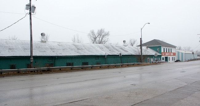
405 E Front St, Bonner Springs, KS 66012

Property Detail
405 E Front St
880015
8800, S29, T11, R23, ACRES 0, 00 TRACT IN SE 1/4 SE 1/4 (BUILDING ONLY)
Heavyindustrial
WYANDOTTE
BCS
Kansas
B and X Area of moderate flood hazard, usually the area between the limits of the 100-year and 500-year floods.
15
2025
Bonner Springs
2025
Kansas City
044807
Kansas City, MO-KS
16,048 SF
NEARBY LISTINGS FOR SALE OR LEASE
DEMOGRAPHICS near 405 E Front St
1 mile
3 mile
5 mile
2025 Total Population
3,880
21,157
45,085
2030 Population
3,930
21,620
46,134
Pop Growth 2025-2030
+ 1.29%
+ 2.19%
+ 2.33%
Average Age
38
38
38
2025 Total Households
1,525
7,308
15,825
HH Growth 2025-2030
+ 1.31%
+ 2.23%
+ 2.36%
Median Household Inc
$72,758
$119,275
$114,583
Avg Household Size
2.50
2.90
2.80
2025 Avg HH Vehicles
2.00
2.00
2.00
Median Home Value
$227,089
$356,730
$365,016
Median Year Built
1964
1995
1999
Nearby Places
Map Layers
Map Styles
 Street
 Aerial
Layers
 Traffic
 Biking
Places
Listings with unknown addresses are not visible on the map
- Restaurants
- Banks
- Shops
- Fitness
- Groceries
PUBLIC TRANSPORTATION
AIRPORT
Kansas City International
Drive
Walk
Distance
Kansas City International
40 min
31.4 mi
Freight Ports
Tulsa Port Of Catoosa
Drive
Walk
Distance
Tulsa Port Of Catoosa
273 min
241.9 mi
Nearby Properties
Address
Land Use
TOTAL SIZE
Lot Size
Zoning
Address
Land Use
TOTAL SIZE
Lot Size
Zoning
575,616 SF
35.52 AC
PI
Address
Land Use
TOTAL SIZE
Lot Size
Zoning
276,310 SF
23.27 AC
PI
Address
Land Use
TOTAL SIZE
Lot Size
Zoning
50,750 SF
42.95 AC
I-1
Address
Land Use
TOTAL SIZE
Lot Size
Zoning
297,198 SF
60.55 AC
Address
Land Use
TOTAL SIZE
Lot Size
Zoning
854,430 SF
43.97 AC
PI
Address
Land Use
TOTAL SIZE
Lot Size
Zoning
170,000 SF
12.71 AC
PI
Address
Land Use
TOTAL SIZE
Lot Size
Zoning
170,000 SF
12.72 AC
PI
Address
Land Use
TOTAL SIZE
Lot Size
Zoning
170,000 SF
12.71 AC
PI
Address
Land Use
TOTAL SIZE
Lot Size
Zoning
141,032 SF
68.59 AC
A1
Address
Land Use
TOTAL SIZE
Lot Size
Zoning
28,210 SF
317.17 AC
Address
Land Use
TOTAL SIZE
Lot Size
Zoning
48,640 SF
12.13 AC
Address
Land Use
TOTAL SIZE
Lot Size
Zoning
22,136 SF
24.15 AC
Address
Land Use
TOTAL SIZE
Lot Size
Zoning
27,784 SF
2.53 AC
BC1
Address
Land Use
TOTAL SIZE
Lot Size
Zoning
6,380 SF
296.16 AC
BA1
Address
Land Use
TOTAL SIZE
Lot Size
Zoning
57,743 SF
6.18 AC
BR2
Address
Land Use
TOTAL SIZE
Lot Size
Zoning
170,000 SF
14.87 AC
PI
Address
Land Use
TOTAL SIZE
Lot Size
Zoning
19,113 SF
2.06 AC
BA2
Address
Land Use
TOTAL SIZE
Lot Size
Zoning
7,167 SF
1.01 AC
BR2
Address
Land Use
TOTAL SIZE
Lot Size
Zoning
167,873 SF
18.68 AC
BR2
Address
Land Use
TOTAL SIZE
Lot Size
Zoning
10,540 SF
15.05 AC
AG
Address
Land Use
TOTAL SIZE
Lot Size
Zoning
15,657 SF
1.46 AC
Address
Land Use
TOTAL SIZE
Lot Size
Zoning
154.64 AC
WC
Address
Land Use
TOTAL SIZE
Lot Size
Zoning
29,615 SF
1.98 AC
BR2
Address
Land Use
TOTAL SIZE
Lot Size
Zoning
20,354 SF
12.54 AC
BI1
Address
Land Use
TOTAL SIZE
Lot Size
Zoning
20,025 SF
5.32 AC
BA2
Address
Land Use
TOTAL SIZE
Lot Size
Zoning
48,142 SF
490.85 AC
Address
Land Use
TOTAL SIZE
Lot Size
Zoning
3,944 SF
38.11 AC
BR
Address
Land Use
TOTAL SIZE
Lot Size
Zoning
9,855 SF
1.57 AC
Address
Land Use
TOTAL SIZE
Lot Size
Zoning
58,688 SF
16.33 AC
Address
Land Use
TOTAL SIZE
Lot Size
Zoning
11,642 SF
1.90 AC
BR1
The World's #1 Commercial Real Estate Marketplace
Connect with us
© 2026 CoStar Group
The information above has been obtained from sources believed reliable. While we do not doubt its accuracy we have not verified it and make no guarantee, warranty or representation about it. It is your responsibility to independently confirm its accuracy and completeness. Any projections, opinions, assumptions, or estimates used are for example only and do not represent the current or future performance of the property. The value of this transaction to you depends on tax and other factors which should be evaluated by your tax, financial, and legal advisors. You and your advisors should conduct a careful, independent investigation of the property to determine to your satisfaction the suitability of the property for your needs.