Property Record
405 E Main St, Sperry, OK 74073

NEARBY LISTINGS FOR SALE OR LEASE
-
-
View all Sperry listings for sale on LoopNet.com
Property Detail
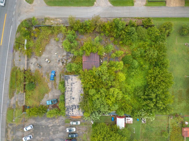
405 E Main St
Tulsa, OK
Lollar Addn
63725-12-13-01400
LT 6 BLK 5
Commercialacreage
Tulsa
AE
Oklahoma
40143C0115L
6
2025
0.38 AC
2025
Northwest
005600
Tulsa
1,856 SF
DEMOGRAPHICS near 405 E Main St
1 Mile
3 Mile
5 Mile
2024 Total Population
788
3,363
21,533
2029 Population
756
3,387
22,340
Pop Growth 2024-2029
(4.06%)
+ 0.71%
+ 3.75%
Average Age
39
41
39
2024 Total Households
304
1,267
7,927
HH Growth 2024-2029
(4.28%)
+ 0.71%
+ 3.75%
Median Household Inc
$45,703
$51,136
$47,955
Avg Household Size
2.60
2.60
2.60
2024 Avg HH Vehicles
2.00
2.00
2.00
Median Home Value
$98,528
$162,105
$120,336
Median Year Built
1970
1977
1973
Nearby Places
Map Layers
Map Styles
 Street
 Aerial
- Restaurants
- Banks
- Shops
- Fitness
- Groceries
PUBLIC TRANSPORTATION
AIRPORT
Tulsa International
DRIVE
WALK
Distance
Tulsa International
22 min
12.4 mi
Freight Ports
Tulsa Port Of Catoosa
DRIVE
WALK
Distance
Tulsa Port Of Catoosa
31 min
19.2 mi
SALE & LEASE HISTORY
LISTING DATE
SALE/LEASE

Oct 01, 2019
For Sale
Nearby Properties
Address
Land Use
TOTAL SIZE
Lot Size
Zoning
Address
Land Use
TOTAL SIZE
Lot Size
Zoning
37,775 SF
2.34 AC
R
Address
Land Use
TOTAL SIZE
Lot Size
Zoning
4,818 SF
2.09 AC
AG
Address
Land Use
TOTAL SIZE
Lot Size
Zoning
18,750 SF
2.05 AC
AG
Address
Land Use
TOTAL SIZE
Lot Size
Zoning
6,909 SF
2.36 AC
R
Address
Land Use
TOTAL SIZE
Lot Size
Zoning
14,395 SF
4.76 AC
CS
Address
Land Use
TOTAL SIZE
Lot Size
Zoning
9,450 SF
7.66 AC
AG
Address
Land Use
TOTAL SIZE
Lot Size
Zoning
7,800 SF
5 AC
AG
Address
Land Use
TOTAL SIZE
Lot Size
Zoning
9,649 SF
0.91 AC
R
Address
Land Use
TOTAL SIZE
Lot Size
Zoning
10,786 SF
2.17 AC
RS
Address
Land Use
TOTAL SIZE
Lot Size
Zoning
1,500 SF
0.41 AC
R
Address
Land Use
TOTAL SIZE
Lot Size
Zoning
4,200 SF
0.88 AC
CS
Address
Land Use
TOTAL SIZE
Lot Size
Zoning
9,086 SF
1.73 AC
AG
Address
Land Use
TOTAL SIZE
Lot Size
Zoning
5,580 SF
0.80 AC
R
Address
Land Use
TOTAL SIZE
Lot Size
Zoning
2,263 SF
0.41 AC
RS
Address
Land Use
TOTAL SIZE
Lot Size
Zoning
8,520 SF
4.90 AC
RS
Address
Land Use
TOTAL SIZE
Lot Size
Zoning
5,960 SF
3.08 AC
R
Address
Land Use
TOTAL SIZE
Lot Size
Zoning
818 SF
14.17 AC
AG
Address
Land Use
TOTAL SIZE
Lot Size
Zoning
4,000 SF
2.03 AC
AG
Address
Land Use
TOTAL SIZE
Lot Size
Zoning
0.70 AC
Address
Land Use
TOTAL SIZE
Lot Size
Zoning
5,200 SF
0.88 AC
CS
Address
Land Use
TOTAL SIZE
Lot Size
Zoning
2,128 SF
41 AC
AG
Address
Land Use
TOTAL SIZE
Lot Size
Zoning
26,718 SF
2.32 AC
R
Address
Land Use
TOTAL SIZE
Lot Size
Zoning
4,800 SF
1.47 AC
CS
Address
Land Use
TOTAL SIZE
Lot Size
Zoning
3,098 SF
0.31 AC
C
Address
Land Use
TOTAL SIZE
Lot Size
Zoning
60 AC
AG
Address
Land Use
TOTAL SIZE
Lot Size
Zoning
2,946 SF
21.15 AC
AG
Address
Land Use
TOTAL SIZE
Lot Size
Zoning
50.02 AC
AG
Address
Land Use
TOTAL SIZE
Lot Size
Zoning
2,050 SF
0.08 AC
C
Address
Land Use
TOTAL SIZE
Lot Size
Zoning
3,500 SF
0.35 AC
R
Address
Land Use
TOTAL SIZE
Lot Size
Zoning
3,000 SF
0.29 AC
R
The World's #1 Commercial Real Estate Marketplace
Connect with us
© 2026 CoStar Group
The information above has been obtained from sources believed reliable. While we do not doubt its accuracy we have not verified it and make no guarantee, warranty or representation about it. It is your responsibility to independently confirm its accuracy and completeness. Any projections, opinions, assumptions, or estimates used are for example only and do not represent the current or future performance of the property. The value of this transaction to you depends on tax and other factors which should be evaluated by your tax, financial, and legal advisors. You and your advisors should conduct a careful, independent investigation of the property to determine to your satisfaction the suitability of the property for your needs.