Property Record
381 Hands Mill Hwy, Rock Hill, SC 29732


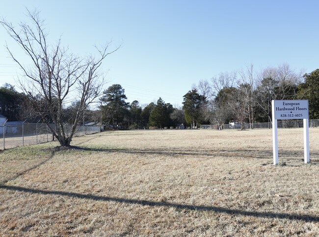
This Property Is For Sale
NEARBY LISTINGS FOR SALE OR LEASE
Property Detail
381 Hands Mill Hwy
Charlotte-Concord-Gastonia, NC-SC
Newport Properties
7870000095
LOT # 4 HWY 274
Commercialacreage
York
X
South Carolina
45091C0301E
4
2025
1 AC
2025
York County
060904
Charlotte
DEMOGRAPHICS near 381 Hands Mill Hwy
1 Mile
3 Mile
5 Mile
2024 Total Population
2,271
16,275
56,036
2029 Population
2,568
18,303
62,790
Pop Growth 2024-2029
+ 13.08%
+ 12.46%
+ 12.05%
Average Age
42
42
42
2024 Total Households
849
6,118
21,988
HH Growth 2024-2029
+ 13.43%
+ 12.75%
+ 12.36%
Median Household Inc
$83,042
$94,382
$87,123
Avg Household Size
2.60
2.60
2.50
2024 Avg HH Vehicles
2.00
2.00
2.00
Median Home Value
$291,208
$298,884
$293,213
Median Year Built
1997
1997
1996
Nearby Places
Map Layers
Map Styles
 Street
 Aerial
- Restaurants
- Banks
- Shops
- Fitness
- Groceries
PUBLIC TRANSPORTATION
AIRPORT
Charlotte/Douglas International
DRIVE
WALK
Distance
Charlotte/Douglas International
42 min
24.8 mi
Freight Ports
North Charleston Terminal
DRIVE
WALK
Distance
North Charleston Terminal
210 min
182.4 mi
Nearby Properties
Address
Land Use
TOTAL SIZE
Lot Size
Zoning
Address
Land Use
TOTAL SIZE
Lot Size
Zoning
20.63 AC
RUD
Address
Land Use
TOTAL SIZE
Lot Size
Zoning
706 AC
RCII
Address
Land Use
TOTAL SIZE
Lot Size
Zoning
28,320 SF
2.67 AC
IG
Address
Land Use
TOTAL SIZE
Lot Size
Zoning
5,624 SF
1 AC
RCI
Address
Land Use
TOTAL SIZE
Lot Size
Zoning
1,254 SF
108.90 AC
RDI
Address
Land Use
TOTAL SIZE
Lot Size
Zoning
152 AC
RUD
Address
Land Use
TOTAL SIZE
Lot Size
Zoning
3,424 SF
1.39 AC
RDII
Address
Land Use
TOTAL SIZE
Lot Size
Zoning
4,241 SF
2.04 AC
RDII
Address
Land Use
TOTAL SIZE
Lot Size
Zoning
176,736 SF
23.29 AC
RDI
Address
Land Use
TOTAL SIZE
Lot Size
Zoning
2,197 SF
1 AC
RDII
Address
Land Use
TOTAL SIZE
Lot Size
Zoning
4,767 SF
0.69 AC
RDI
Address
Land Use
TOTAL SIZE
Lot Size
Zoning
106.27 AC
ID
Address
Land Use
TOTAL SIZE
Lot Size
Zoning
3,418 SF
1 AC
RUDI
Address
Land Use
TOTAL SIZE
Lot Size
Zoning
3,550 SF
1.01 AC
RDII
Address
Land Use
TOTAL SIZE
Lot Size
Zoning
2,950 SF
2.29 AC
RDI
Address
Land Use
TOTAL SIZE
Lot Size
Zoning
3,864 SF
2.20 AC
RDI
Address
Land Use
TOTAL SIZE
Lot Size
Zoning
56.57 AC
BDIII
Address
Land Use
TOTAL SIZE
Lot Size
Zoning
6,375 SF
8.24 AC
SF5
Address
Land Use
TOTAL SIZE
Lot Size
Zoning
2,794 SF
1.11 AC
Address
Land Use
TOTAL SIZE
Lot Size
Zoning
135,186 SF
9.27 AC
Address
Land Use
TOTAL SIZE
Lot Size
Zoning
2,319 SF
1.55 AC
RDII
Address
Land Use
TOTAL SIZE
Lot Size
Zoning
4,200 SF
1 AC
RUDI
Address
Land Use
TOTAL SIZE
Lot Size
Zoning
2,753 SF
1.12 AC
Address
Land Use
TOTAL SIZE
Lot Size
Zoning
4,854 SF
0.20 AC
Address
Land Use
TOTAL SIZE
Lot Size
Zoning
3,916 SF
1 AC
RUDI
Address
Land Use
TOTAL SIZE
Lot Size
Zoning
91,868 SF
13.18 AC
Address
Land Use
TOTAL SIZE
Lot Size
Zoning
5,000 SF
2.61 AC
IG
Address
Land Use
TOTAL SIZE
Lot Size
Zoning
1,608 SF
1 AC
RCII
Address
Land Use
TOTAL SIZE
Lot Size
Zoning
11.99 AC
Address
Land Use
TOTAL SIZE
Lot Size
Zoning
3,576 SF
1 AC
RUDI
The World's #1 Commercial Real Estate Marketplace
Connect with us
© 2026 CoStar Group
The information above has been obtained from sources believed reliable. While we do not doubt its accuracy we have not verified it and make no guarantee, warranty or representation about it. It is your responsibility to independently confirm its accuracy and completeness. Any projections, opinions, assumptions, or estimates used are for example only and do not represent the current or future performance of the property. The value of this transaction to you depends on tax and other factors which should be evaluated by your tax, financial, and legal advisors. You and your advisors should conduct a careful, independent investigation of the property to determine to your satisfaction the suitability of the property for your needs.