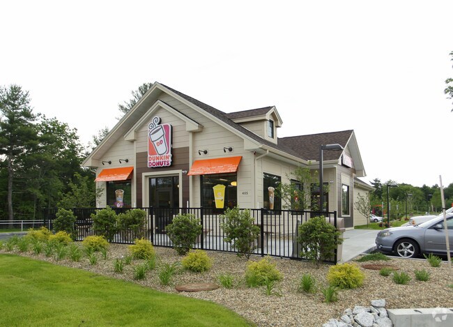
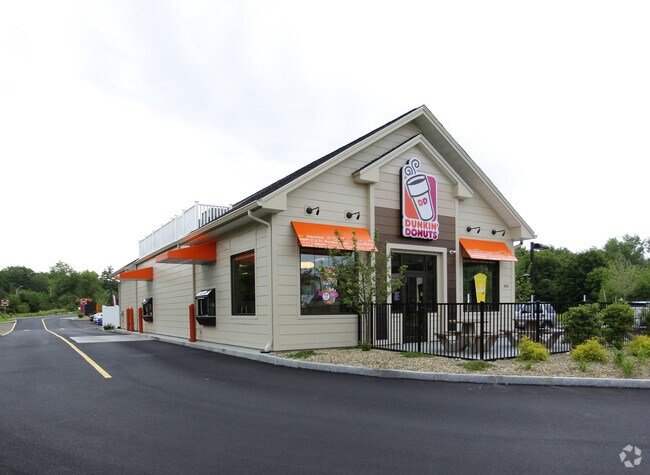
Property Record
405 Hooksett Rd, Auburn, NH 03032

Property Detail
405 Hooksett Rd
Commercialnec
Rockingham
COMM C
New Hampshire
B and X Area of moderate flood hazard, usually the area between the limits of the 100-year and 500-year floods.
5.30 AC
2025
Rockingham
2025
Boston
004000
Boston-Cambridge-Newton, MA-NH
2,433 SF
AUBR-000031-000018
NEARBY LISTINGS FOR SALE OR LEASE
-
-
View all Auburn listings for sale on LoopNet.com
DEMOGRAPHICS near 405 Hooksett Rd
1 mile
3 mile
5 mile
2025 Total Population
913
9,537
63,113
2030 Population
926
9,683
63,465
Pop Growth 2025-2030
+ 1.42%
+ 1.53%
+ 0.56%
Average Age
43
43
41
2025 Total Households
329
3,600
25,352
HH Growth 2025-2030
+ 1.22%
+ 1.56%
+ 0.54%
Median Household Inc
$141,158
$129,493
$97,912
Avg Household Size
2.80
2.60
2.40
2025 Avg HH Vehicles
3.00
2.00
2.00
Median Home Value
$637,574
$453,153
$418,950
Median Year Built
1980
1984
1970
Nearby Places
Map Layers
Map Styles
 Street
 Aerial
Transit
 Traffic
 Biking
Places
Listings with unknown addresses are not visible on the map
- Restaurants
- Banks
- Shops
- Fitness
- Groceries
PUBLIC TRANSPORTATION
AIRPORT
Manchester Boston Regional
Drive
Walk
Distance
Manchester Boston Regional
20 min
10.7 mi
Portsmouth International at Pease
Drive
Walk
Distance
Portsmouth International at Pease
52 min
35.8 mi
Freight Ports
Port of Boston
Drive
Walk
Distance
Port of Boston
82 min
54.7 mi
Nearby Properties
Address
Land Use
TOTAL SIZE
Lot Size
Zoning
Address
Land Use
TOTAL SIZE
Lot Size
Zoning
211,525 SF
93.01 AC
Address
Land Use
TOTAL SIZE
Lot Size
Zoning
109,034 SF
14.30 AC
RESID
Address
Land Use
TOTAL SIZE
Lot Size
Zoning
92,492 SF
85 AC
Address
Land Use
TOTAL SIZE
Lot Size
Zoning
28,888 SF
5.50 AC
Address
Land Use
TOTAL SIZE
Lot Size
Zoning
1,976 SF
40.02 AC
Address
Land Use
TOTAL SIZE
Lot Size
Zoning
29,370 SF
5.31 AC
RESID
Address
Land Use
TOTAL SIZE
Lot Size
Zoning
23,034 SF
21.15 AC
Address
Land Use
TOTAL SIZE
Lot Size
Zoning
44,802 SF
5.98 AC
Address
Land Use
TOTAL SIZE
Lot Size
Zoning
44,802 SF
5.52 AC
Address
Land Use
TOTAL SIZE
Lot Size
Zoning
28,526 SF
9.78 AC
INDUST
Address
Land Use
TOTAL SIZE
Lot Size
Zoning
3,088 SF
5.01 AC
COMM C
Address
Land Use
TOTAL SIZE
Lot Size
Zoning
20,973 SF
1.97 AC
RESID
Address
Land Use
TOTAL SIZE
Lot Size
Zoning
7,725 SF
11.32 AC
INDUST
Address
Land Use
TOTAL SIZE
Lot Size
Zoning
30,657 SF
5.08 AC
INDUST
Address
Land Use
TOTAL SIZE
Lot Size
Zoning
34,030 SF
4.68 AC
IND
Address
Land Use
TOTAL SIZE
Lot Size
Zoning
30,657 SF
3.27 AC
INDUST
Address
Land Use
TOTAL SIZE
Lot Size
Zoning
31,324 SF
4.72 AC
INDUST
Address
Land Use
TOTAL SIZE
Lot Size
Zoning
227.21 AC
RESID
Address
Land Use
TOTAL SIZE
Lot Size
Zoning
21,369 SF
4.82 AC
INDUST
Address
Land Use
TOTAL SIZE
Lot Size
Zoning
110 AC
RESID
Address
Land Use
TOTAL SIZE
Lot Size
Zoning
5,368 SF
3.69 AC
INDUST
Address
Land Use
TOTAL SIZE
Lot Size
Zoning
460 AC
RESID
Address
Land Use
TOTAL SIZE
Lot Size
Zoning
125 AC
1
Address
Land Use
TOTAL SIZE
Lot Size
Zoning
2,128 SF
4.72 AC
Address
Land Use
TOTAL SIZE
Lot Size
Zoning
22,720 SF
19.17 AC
IND
Address
Land Use
TOTAL SIZE
Lot Size
Zoning
6.24 AC
COM
Address
Land Use
TOTAL SIZE
Lot Size
Zoning
2,374 SF
COM
Address
Land Use
TOTAL SIZE
Lot Size
Zoning
23,360 SF
43.50 AC
COM
Address
Land Use
TOTAL SIZE
Lot Size
Zoning
287 AC
RESID
Address
Land Use
TOTAL SIZE
Lot Size
Zoning
36,400 SF
7.70 AC
IND
The World's #1 Commercial Real Estate Marketplace
Connect with us
© 2026 CoStar Group
The information above has been obtained from sources believed reliable. While we do not doubt its accuracy we have not verified it and make no guarantee, warranty or representation about it. It is your responsibility to independently confirm its accuracy and completeness. Any projections, opinions, assumptions, or estimates used are for example only and do not represent the current or future performance of the property. The value of this transaction to you depends on tax and other factors which should be evaluated by your tax, financial, and legal advisors. You and your advisors should conduct a careful, independent investigation of the property to determine to your satisfaction the suitability of the property for your needs.