Property Record
405 Pencader Dr, Newark, DE 19702
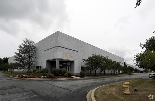


Property Detail
405 Pencader Dr
11-021.00-023
New Castle
Warehouse
Delaware
BP
11
AE The base floodplain where base flood elevations are provided. AE Zones are now used on new format FIRMs instead of A1-A30 Zones.
11.18 AC
2025
New Castle County
2025
Philadelphia
014814
Philadelphia-Camden-Wilmington, PA-NJ-DE-MD
125,726 SF
NEARBY LISTINGS FOR SALE OR LEASE
DEMOGRAPHICS near 405 Pencader Dr
1 mile
3 mile
5 mile
2025 Total Population
4,230
38,506
130,226
2030 Population
4,389
39,363
134,538
Pop Growth 2025-2030
+ 3.76%
+ 2.23%
+ 3.31%
Average Age
41
41
39
2025 Total Households
1,466
14,586
47,206
HH Growth 2025-2030
+ 3.96%
+ 2.31%
+ 3.48%
Median Household Inc
$122,327
$96,419
$86,990
Avg Household Size
2.80
2.60
2.60
2025 Avg HH Vehicles
2.00
2.00
2.00
Median Home Value
$399,678
$371,639
$348,612
Median Year Built
1996
1991
1990
Nearby Places
Map Layers
Map Styles
 Street
 Aerial
Layers
 Traffic
 Biking
Places
Listings with unknown addresses are not visible on the map
- Restaurants
- Banks
- Shops
- Fitness
- Groceries
PUBLIC TRANSPORTATION
COMMUTER RAIL
Newark (R2 - Southeastern Pennsylvania Transportation Authority Regional Rail (SEPTA Regional Rail))
Drive
Walk
Distance
Newark (R2 - Southeastern Pennsylvania Transportation Authority Regional Rail (SEPTA Regional Rail))
9 min
5.1 mi
Churchmans Crossing (R2 - Southeastern Pennsylvania Transportation Authority Regional Rail (SEPTA Regional Rail))
Drive
Walk
Distance
Churchmans Crossing (R2 - Southeastern Pennsylvania Transportation Authority Regional Rail (SEPTA Regional Rail))
18 min
9.7 mi
AIRPORT
Philadelphia International
Drive
Walk
Distance
Philadelphia International
52 min
37.5 mi
Freight Ports
Port Newark Container Terminal
Drive
Walk
Distance
Port Newark Container Terminal
25 min
13.0 mi
SALE & LEASE HISTORY
LISTING DATE
SALE/LEASE

Mar 22, 2017
For Lease
Nearby Properties
Address
Land Use
TOTAL SIZE
Lot Size
Zoning
Address
Land Use
TOTAL SIZE
Lot Size
Zoning
226,878 SF
73.68 AC
CR
Address
Land Use
TOTAL SIZE
Lot Size
Zoning
161,018 SF
97.88 AC
OR
Address
Land Use
TOTAL SIZE
Lot Size
Zoning
766,520 SF
69.52 AC
BI
Address
Land Use
TOTAL SIZE
Lot Size
Zoning
59.70 AC
BP
Address
Land Use
TOTAL SIZE
Lot Size
Zoning
200,880 SF
49.83 AC
R3
Address
Land Use
TOTAL SIZE
Lot Size
Zoning
385,350 SF
43.51 AC
OR
Address
Land Use
TOTAL SIZE
Lot Size
Zoning
266,818 SF
64.16 AC
BP
Address
Land Use
TOTAL SIZE
Lot Size
Zoning
281.01 AC
BP
Address
Land Use
TOTAL SIZE
Lot Size
Zoning
930 SF
52.69 AC
S
Address
Land Use
TOTAL SIZE
Lot Size
Zoning
15,168 SF
7.85 AC
NCAP
Address
Land Use
TOTAL SIZE
Lot Size
Zoning
392,955 SF
16.87 AC
NCAP
Address
Land Use
TOTAL SIZE
Lot Size
Zoning
20,250 SF
71.16 AC
S
Address
Land Use
TOTAL SIZE
Lot Size
Zoning
263,500 SF
15.28 AC
BI
Address
Land Use
TOTAL SIZE
Lot Size
Zoning
91,473 SF
59.44 AC
S
Address
Land Use
TOTAL SIZE
Lot Size
Zoning
294,288 SF
22.25 AC
NCAP
Address
Land Use
TOTAL SIZE
Lot Size
Zoning
82,688 SF
11.30 AC
BI
Address
Land Use
TOTAL SIZE
Lot Size
Zoning
267,840 SF
20.35 AC
BI
Address
Land Use
TOTAL SIZE
Lot Size
Zoning
47.77 AC
OR
Address
Land Use
TOTAL SIZE
Lot Size
Zoning
153,556 SF
30.12 AC
OR
Address
Land Use
TOTAL SIZE
Lot Size
Zoning
3,680 SF
138.68 AC
S
Address
Land Use
TOTAL SIZE
Lot Size
Zoning
132,816 SF
7.11 AC
NCPUD
Address
Land Use
TOTAL SIZE
Lot Size
Zoning
145.78 AC
BP
Address
Land Use
TOTAL SIZE
Lot Size
Zoning
131,806 SF
21.97 AC
BI
Address
Land Use
TOTAL SIZE
Lot Size
Zoning
205,955 SF
24.91 AC
BI
Address
Land Use
TOTAL SIZE
Lot Size
Zoning
165,961 SF
8.95 AC
BP
Address
Land Use
TOTAL SIZE
Lot Size
Zoning
17.50 AC
R3
Address
Land Use
TOTAL SIZE
Lot Size
Zoning
11,671 SF
27.80 AC
ST
Address
Land Use
TOTAL SIZE
Lot Size
Zoning
55,200 SF
11.72 AC
ON
Address
Land Use
TOTAL SIZE
Lot Size
Zoning
9,660 SF
16.90 AC
BP
Address
Land Use
TOTAL SIZE
Lot Size
Zoning
18,415 SF
23.33 AC
OR
The World's #1 Commercial Real Estate Marketplace
Connect with us
© 2026 CoStar Group
The information above has been obtained from sources believed reliable. While we do not doubt its accuracy we have not verified it and make no guarantee, warranty or representation about it. It is your responsibility to independently confirm its accuracy and completeness. Any projections, opinions, assumptions, or estimates used are for example only and do not represent the current or future performance of the property. The value of this transaction to you depends on tax and other factors which should be evaluated by your tax, financial, and legal advisors. You and your advisors should conduct a careful, independent investigation of the property to determine to your satisfaction the suitability of the property for your needs.