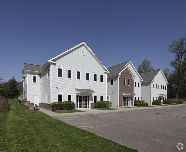
Property Record
405 Rothrock Rd, Copley, OH 44321
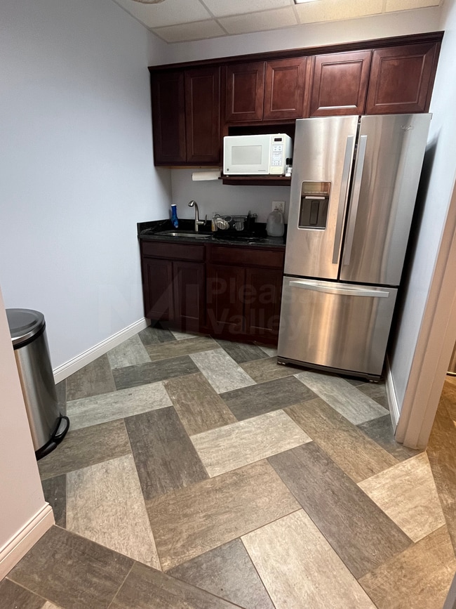

Current Lease Availabilities
Property Detail
405 Rothrock Rd
Akron, OH
JAYLIN OFFICE PARK CONDOMINIUM BLDG A UNIT 100
15-07734
Summit
Officecondo
Ohio
B and X Area of moderate flood hazard, usually the area between the limits of the 100-year and 500-year floods.
8
2023
0.11 AC
2025
Fairlawn/Montrose
533501
Cleveland
4,853 SF
NEARBY LISTINGS FOR SALE OR LEASE
DEMOGRAPHICS near 405 Rothrock Rd
1 mile
3 mile
5 mile
2025 Total Population
5,764
31,329
65,545
2030 Population
5,890
31,341
65,440
Pop Growth 2025-2030
+ 2.19%
+ 0.04%
(0.16%)
Average Age
44
43
43
2025 Total Households
2,634
12,712
27,882
HH Growth 2025-2030
+ 1.86%
+ 0.01%
(0.19%)
Median Household Inc
$126,667
$125,190
$103,209
Avg Household Size
2.10
2.40
2.30
2025 Avg HH Vehicles
2.00
2.00
2.00
Median Home Value
$392,177
$368,209
$295,611
Median Year Built
1998
1981
1969
Nearby Places
Map Layers
Map Styles
 Street
 Aerial
Transit
 Traffic
 Biking
Places
Listings with unknown addresses are not visible on the map
- Restaurants
- Banks
- Shops
- Fitness
- Groceries
PUBLIC TRANSPORTATION
AIRPORT
Akron-Canton Regional
Drive
Walk
Distance
Akron-Canton Regional
26 min
22.7 mi
Cleveland-Hopkins International
Drive
Walk
Distance
Cleveland-Hopkins International
37 min
31.2 mi
Freight Ports
Port of Baltimore
Drive
Walk
Distance
Port of Baltimore
1 min
295.9 mi
Nearby Properties
Address
Land Use
TOTAL SIZE
Lot Size
Zoning
Address
Land Use
TOTAL SIZE
Lot Size
Zoning
12.92 AC
Address
Land Use
TOTAL SIZE
Lot Size
Zoning
676,403 SF
39.06 AC
Address
Land Use
TOTAL SIZE
Lot Size
Zoning
Address
Land Use
TOTAL SIZE
Lot Size
Zoning
324,548 SF
64.18 AC
Address
Land Use
TOTAL SIZE
Lot Size
Zoning
311,093 SF
32.53 AC
Address
Land Use
TOTAL SIZE
Lot Size
Zoning
72,026 SF
7.92 AC
Address
Land Use
TOTAL SIZE
Lot Size
Zoning
192,658 SF
15.34 AC
Address
Land Use
TOTAL SIZE
Lot Size
Zoning
411,220 SF
54.72 AC
Address
Land Use
TOTAL SIZE
Lot Size
Zoning
439,456 SF
26.40 AC
Address
Land Use
TOTAL SIZE
Lot Size
Zoning
164,214 SF
12.92 AC
Address
Land Use
TOTAL SIZE
Lot Size
Zoning
214,600 SF
14.12 AC
Address
Land Use
TOTAL SIZE
Lot Size
Zoning
180,624 SF
24.21 AC
Address
Land Use
TOTAL SIZE
Lot Size
Zoning
135,300 SF
6.75 AC
Address
Land Use
TOTAL SIZE
Lot Size
Zoning
226,341 SF
18.81 AC
Address
Land Use
TOTAL SIZE
Lot Size
Zoning
77,096 SF
6.21 AC
Address
Land Use
TOTAL SIZE
Lot Size
Zoning
Address
Land Use
TOTAL SIZE
Lot Size
Zoning
231,968 SF
29.14 AC
Address
Land Use
TOTAL SIZE
Lot Size
Zoning
87,071 SF
18.03 AC
Address
Land Use
TOTAL SIZE
Lot Size
Zoning
148,292 SF
18.43 AC
Address
Land Use
TOTAL SIZE
Lot Size
Zoning
Address
Land Use
TOTAL SIZE
Lot Size
Zoning
73,301 SF
5.55 AC
Address
Land Use
TOTAL SIZE
Lot Size
Zoning
147,635 SF
15.14 AC
Address
Land Use
TOTAL SIZE
Lot Size
Zoning
36,716 SF
4.37 AC
Address
Land Use
TOTAL SIZE
Lot Size
Zoning
129,308 SF
19.02 AC
Address
Land Use
TOTAL SIZE
Lot Size
Zoning
179,805 SF
12.87 AC
Address
Land Use
TOTAL SIZE
Lot Size
Zoning
132,886 SF
10.87 AC
Address
Land Use
TOTAL SIZE
Lot Size
Zoning
148,199 SF
58.56 AC
Address
Land Use
TOTAL SIZE
Lot Size
Zoning
126,710 SF
12.67 AC
Address
Land Use
TOTAL SIZE
Lot Size
Zoning
61,414 SF
4.88 AC
Address
Land Use
TOTAL SIZE
Lot Size
Zoning
159,086 SF
8.36 AC
The World's #1 Commercial Real Estate Marketplace
Connect with us
© 2026 CoStar Group
The information above has been obtained from sources believed reliable. While we do not doubt its accuracy we have not verified it and make no guarantee, warranty or representation about it. It is your responsibility to independently confirm its accuracy and completeness. Any projections, opinions, assumptions, or estimates used are for example only and do not represent the current or future performance of the property. The value of this transaction to you depends on tax and other factors which should be evaluated by your tax, financial, and legal advisors. You and your advisors should conduct a careful, independent investigation of the property to determine to your satisfaction the suitability of the property for your needs.