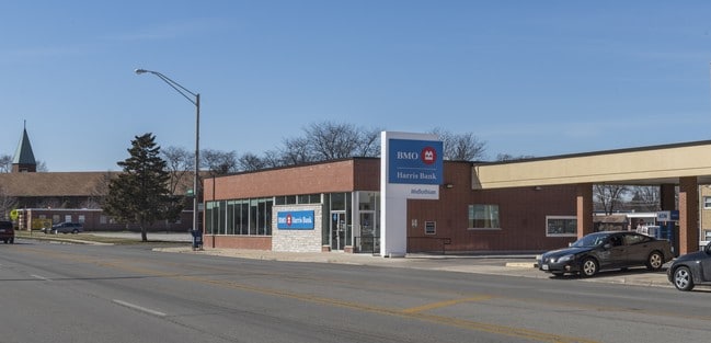
Property Record
4050 147Th St, Midlothian, IL 60445

NEARBY LISTINGS FOR SALE OR LEASE
Property Detail
4050 147Th St
28-10-228-034-0000
Manus Add Midlothian Pk Sub
Financialbuilding
Cook
X
Illinois
17031C0638J
13-17
2023
0.40 AC
2025
Near South Cook
824701
Chicago
4,019 SF
Chicago-Naperville-Elgin, IL-IN
DEMOGRAPHICS near 4050 147Th St
1 Mile
3 Mile
5 Mile
2024 Total Population
15,741
90,490
259,659
2029 Population
15,512
89,472
255,169
Pop Growth 2024-2029
(1.45%)
(1.12%)
(1.73%)
Average Age
40
40
41
2024 Total Households
5,608
33,523
97,533
HH Growth 2024-2029
(1.60%)
(1.32%)
(2.01%)
Median Household Inc
$56,530
$60,471
$62,228
Avg Household Size
2.70
2.60
2.60
2024 Avg HH Vehicles
2.00
2.00
2.00
Median Home Value
$176,598
$174,787
$187,859
Median Year Built
1965
1972
1968
Nearby Places
Map Layers
Map Styles
 Street
 Aerial
- Restaurants
- Banks
- Shops
- Fitness
- Groceries
PUBLIC TRANSPORTATION
TRANSIT/SUBWAY
Midlothian Station (Rock Island District Line - Northeast Illinois Regional Commuter Railroad (Metra))
DRIVE
WALK
Distance
Midlothian Station (Rock Island District Line - Northeast Illinois Regional Commuter Railroad (Metra))
1 min
10 min
0.5 mi
COMMUTER RAIL
Midlothian Station (Rock Island District Line - Northeast Illinois Regional Commuter Railroad (Metra))
DRIVE
WALK
Distance
Midlothian Station (Rock Island District Line - Northeast Illinois Regional Commuter Railroad (Metra))
1 min
10 min
0.5 mi
Robbins Station (Rock Island District Line - Northeast Illinois Regional Commuter Railroad (Metra))
DRIVE
WALK
Distance
Robbins Station (Rock Island District Line - Northeast Illinois Regional Commuter Railroad (Metra))
5 min
2.4 mi
AIRPORT
Chicago Midway International
DRIVE
WALK
Distance
Chicago Midway International
22 min
13.1 mi
Chicago O'Hare International
DRIVE
WALK
Distance
Chicago O'Hare International
48 min
35.1 mi
SALE & LEASE HISTORY
LISTING DATE
SALE/LEASE

Sep 14, 2017
For Sale
Sep 13, 2017
For Sale
Oct 13, 2017
For Sale
Oct 12, 2017
For Sale
Mar 23, 2017
For Sale
Jul 31, 2017
For Sale
Jan 30, 2019
For Sale
Aug 27, 2025
For Sale
Nearby Properties
Address
Land Use
TOTAL SIZE
Lot Size
Zoning
Address
Land Use
TOTAL SIZE
Lot Size
Zoning
Address
Land Use
TOTAL SIZE
Lot Size
Zoning
380,924 SF
19.13 AC
Address
Land Use
TOTAL SIZE
Lot Size
Zoning
Address
Land Use
TOTAL SIZE
Lot Size
Zoning
421,052 SF
26.15 AC
Address
Land Use
TOTAL SIZE
Lot Size
Zoning
152,306 SF
13.40 AC
Address
Land Use
TOTAL SIZE
Lot Size
Zoning
203,995 SF
20.27 AC
Address
Land Use
TOTAL SIZE
Lot Size
Zoning
185,748 SF
15.30 AC
Address
Land Use
TOTAL SIZE
Lot Size
Zoning
405,045 SF
14.49 AC
Address
Land Use
TOTAL SIZE
Lot Size
Zoning
113,963 SF
10.55 AC
Address
Land Use
TOTAL SIZE
Lot Size
Zoning
100,496 SF
9.96 AC
Address
Land Use
TOTAL SIZE
Lot Size
Zoning
0.98 AC
Address
Land Use
TOTAL SIZE
Lot Size
Zoning
Address
Land Use
TOTAL SIZE
Lot Size
Zoning
67,488 SF
10 AC
Address
Land Use
TOTAL SIZE
Lot Size
Zoning
73,696 SF
6.43 AC
Address
Land Use
TOTAL SIZE
Lot Size
Zoning
162,379 SF
10.59 AC
Address
Land Use
TOTAL SIZE
Lot Size
Zoning
Address
Land Use
TOTAL SIZE
Lot Size
Zoning
8,800 SF
8.83 AC
Address
Land Use
TOTAL SIZE
Lot Size
Zoning
9.38 AC
Address
Land Use
TOTAL SIZE
Lot Size
Zoning
25.58 AC
Address
Land Use
TOTAL SIZE
Lot Size
Zoning
1.91 AC
Address
Land Use
TOTAL SIZE
Lot Size
Zoning
121,968 SF
13.31 AC
Address
Land Use
TOTAL SIZE
Lot Size
Zoning
73,718 SF
Address
Land Use
TOTAL SIZE
Lot Size
Zoning
132,322 SF
2 AC
Address
Land Use
TOTAL SIZE
Lot Size
Zoning
77,065 SF
5.56 AC
Address
Land Use
TOTAL SIZE
Lot Size
Zoning
99,029 SF
8.09 AC
Address
Land Use
TOTAL SIZE
Lot Size
Zoning
186,880 SF
15 AC
Address
Land Use
TOTAL SIZE
Lot Size
Zoning
72,365 SF
13.04 AC
Address
Land Use
TOTAL SIZE
Lot Size
Zoning
47,971 SF
1.97 AC
Address
Land Use
TOTAL SIZE
Lot Size
Zoning
1.38 AC
Address
Land Use
TOTAL SIZE
Lot Size
Zoning
78,227 SF
4.63 AC
The World's #1 Commercial Real Estate Marketplace
Connect with us
© 2026 CoStar Group
The information above has been obtained from sources believed reliable. While we do not doubt its accuracy we have not verified it and make no guarantee, warranty or representation about it. It is your responsibility to independently confirm its accuracy and completeness. Any projections, opinions, assumptions, or estimates used are for example only and do not represent the current or future performance of the property. The value of this transaction to you depends on tax and other factors which should be evaluated by your tax, financial, and legal advisors. You and your advisors should conduct a careful, independent investigation of the property to determine to your satisfaction the suitability of the property for your needs.