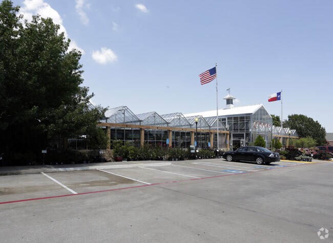
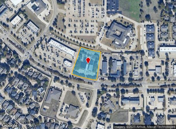
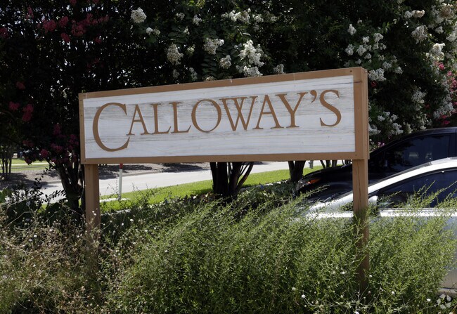
Property Record
4050 Eldorado Pkwy, Mckinney, TX 75070
NEARBY LISTINGS FOR SALE OR LEASE
Property Detail
4050 Eldorado Pkwy
Dallas-Fort Worth-Arlington, TX
Highlands Addition (Cmc)
R-1969-00A-0090-1
HIGHLANDS ADDITION, BLK A, LOT 9
Commercialnec
Collin
X
Texas
48085C0270K
9
2024
2.07 AC
2025
McKinney
030544
Dallas/Ft Worth
11,910 SF
DEMOGRAPHICS near 4050 Eldorado Pkwy
1 Mile
3 Mile
5 Mile
2024 Total Population
16,945
117,135
287,047
2029 Population
20,505
143,265
350,821
Pop Growth 2024-2029
+ 21.01%
+ 22.31%
+ 22.22%
Average Age
39
38
37
2024 Total Households
5,924
43,267
100,957
HH Growth 2024-2029
+ 21.24%
+ 22.57%
+ 22.60%
Median Household Inc
$106,632
$99,447
$108,918
Avg Household Size
2.80
2.70
2.80
2024 Avg HH Vehicles
2.00
2.00
2.00
Median Home Value
$366,638
$404,360
$416,514
Median Year Built
1997
2006
2006
Nearby Places
Map Layers
Map Styles
 Street
 Aerial
- Restaurants
- Banks
- Shops
- Fitness
- Groceries
PUBLIC TRANSPORTATION
AIRPORT
Dallas Love Field
DRIVE
WALK
Distance
Dallas Love Field
42 min
32.2 mi
Dallas-Fort Worth International
DRIVE
WALK
Distance
Dallas-Fort Worth International
39 min
33.1 mi
Nearby Properties
Address
Land Use
TOTAL SIZE
Lot Size
Zoning
Address
Land Use
TOTAL SIZE
Lot Size
Zoning
638,539 SF
42.76 AC
Address
Land Use
TOTAL SIZE
Lot Size
Zoning
472,185 SF
63.51 AC
AO
Address
Land Use
TOTAL SIZE
Lot Size
Zoning
611,780 SF
59.06 AC
L1
Address
Land Use
TOTAL SIZE
Lot Size
Zoning
691,265 SF
53.52 AC
Address
Land Use
TOTAL SIZE
Lot Size
Zoning
256,445 SF
10.42 AC
Address
Land Use
TOTAL SIZE
Lot Size
Zoning
162,000 SF
34 AC
L1
Address
Land Use
TOTAL SIZE
Lot Size
Zoning
387,377 SF
64.34 AC
Address
Land Use
TOTAL SIZE
Lot Size
Zoning
585,170 SF
18.69 AC
MF RG-18
Address
Land Use
TOTAL SIZE
Lot Size
Zoning
495,048 SF
7.37 AC
Address
Land Use
TOTAL SIZE
Lot Size
Zoning
557,288 SF
9.18 AC
Address
Land Use
TOTAL SIZE
Lot Size
Zoning
518,353 SF
28.51 AC
MF-M
Address
Land Use
TOTAL SIZE
Lot Size
Zoning
479,620 SF
14.02 AC
Address
Land Use
TOTAL SIZE
Lot Size
Zoning
475,847 SF
16.34 AC
RG-18
Address
Land Use
TOTAL SIZE
Lot Size
Zoning
435,382 SF
6.95 AC
MF-E
Address
Land Use
TOTAL SIZE
Lot Size
Zoning
291,577 SF
69.24 AC
APTTOWNH
Address
Land Use
TOTAL SIZE
Lot Size
Zoning
464,454 SF
11.04 AC
PD
Address
Land Use
TOTAL SIZE
Lot Size
Zoning
397,395 SF
12.25 AC
Address
Land Use
TOTAL SIZE
Lot Size
Zoning
350,018 SF
7.02 AC
MF-E
Address
Land Use
TOTAL SIZE
Lot Size
Zoning
370,860 SF
25.48 AC
Address
Land Use
TOTAL SIZE
Lot Size
Zoning
260,340 SF
18.64 AC
RG-18
Address
Land Use
TOTAL SIZE
Lot Size
Zoning
379,701 SF
17.58 AC
MULTI-FAMI
Address
Land Use
TOTAL SIZE
Lot Size
Zoning
344,076 SF
15.49 AC
MULTI-FAMI
Address
Land Use
TOTAL SIZE
Lot Size
Zoning
442,463 SF
17.34 AC
Address
Land Use
TOTAL SIZE
Lot Size
Zoning
349,991 SF
13.53 AC
MF-M
Address
Land Use
TOTAL SIZE
Lot Size
Zoning
407,094 SF
15.04 AC
MF RG-18
Address
Land Use
TOTAL SIZE
Lot Size
Zoning
381,990 SF
13.80 AC
MF-H
Address
Land Use
TOTAL SIZE
Lot Size
Zoning
725,223 SF
46.60 AC
Address
Land Use
TOTAL SIZE
Lot Size
Zoning
329,086 SF
13.89 AC
MF-M
Address
Land Use
TOTAL SIZE
Lot Size
Zoning
356,096 SF
19.50 AC
MF-M
Address
Land Use
TOTAL SIZE
Lot Size
Zoning
301,764 SF
20.88 AC
MF
The World's #1 Commercial Real Estate Marketplace
Connect with us
© 2026 CoStar Group
The information above has been obtained from sources believed reliable. While we do not doubt its accuracy we have not verified it and make no guarantee, warranty or representation about it. It is your responsibility to independently confirm its accuracy and completeness. Any projections, opinions, assumptions, or estimates used are for example only and do not represent the current or future performance of the property. The value of this transaction to you depends on tax and other factors which should be evaluated by your tax, financial, and legal advisors. You and your advisors should conduct a careful, independent investigation of the property to determine to your satisfaction the suitability of the property for your needs.