Property Record
40500 Garfield Rd, Clinton Township, MI 48038

NEARBY LISTINGS FOR SALE OR LEASE
-
-
View all Clinton Township listings for sale on LoopNet.com
Property Detail
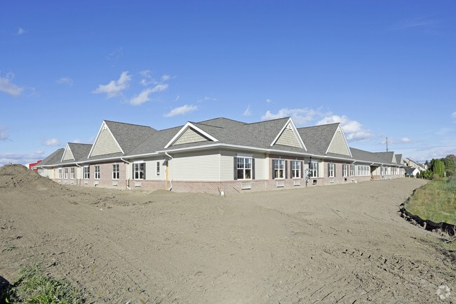
40500 Garfield Rd
16-11-17-100-036
50-11-17-100-036 D178B2C2B & C3, C2B2C2B & C3,C2A1C2B &C3, C2A2C2B&C3 98SC T2N R13E SEC 17 COMM AT A PT 1032.66 FT S 00 DEG
Commercialnec
Macomb
AE
Michigan
26099C0327G
2.18 AC
2025
Macomb East
2025
Detroit
240602
Detroit-Warren-Dearborn, MI
35,661 SF
DEMOGRAPHICS near 40500 Garfield Rd
1 Mile
3 Mile
5 Mile
2024 Total Population
14,300
104,084
283,849
2029 Population
14,359
103,069
280,792
Pop Growth 2024-2029
+ 0.41%
(0.98%)
(1.08%)
Average Age
45
43
42
2024 Total Households
6,424
44,890
117,577
HH Growth 2024-2029
+ 0.59%
(0.98%)
(1.07%)
Median Household Inc
$71,821
$71,244
$69,572
Avg Household Size
2.20
2.30
2.40
2024 Avg HH Vehicles
2.00
2.00
2.00
Median Home Value
$210,825
$225,599
$218,624
Median Year Built
1982
1982
1978
Nearby Places
Map Layers
Map Styles
 Street
 Aerial
- Restaurants
- Banks
- Shops
- Fitness
- Groceries
PUBLIC TRANSPORTATION
AIRPORT
Windsor International
DRIVE
WALK
Distance
Windsor International
61 min
36.1 mi
Freight Ports
Port of Toledo
DRIVE
WALK
Distance
Port of Toledo
111 min
84.0 mi
Nearby Properties
Address
Land Use
TOTAL SIZE
Lot Size
Zoning
Address
Land Use
TOTAL SIZE
Lot Size
Zoning
426,076 SF
42.79 AC
B-4
Address
Land Use
TOTAL SIZE
Lot Size
Zoning
35 AC
RML
Address
Land Use
TOTAL SIZE
Lot Size
Zoning
20,560 SF
37.09 AC
R2
Address
Land Use
TOTAL SIZE
Lot Size
Zoning
401,014 SF
32.54 AC
RML
Address
Land Use
TOTAL SIZE
Lot Size
Zoning
366,656 SF
30.08 AC
RM-2
Address
Land Use
TOTAL SIZE
Lot Size
Zoning
40.39 AC
RML
Address
Land Use
TOTAL SIZE
Lot Size
Zoning
22.52 AC
RMH
Address
Land Use
TOTAL SIZE
Lot Size
Zoning
182,708 SF
10.69 AC
RMH
Address
Land Use
TOTAL SIZE
Lot Size
Zoning
74,382 SF
3.99 AC
OS-1
Address
Land Use
TOTAL SIZE
Lot Size
Zoning
23.78 AC
RML
Address
Land Use
TOTAL SIZE
Lot Size
Zoning
98,265 SF
7.04 AC
RM-2
Address
Land Use
TOTAL SIZE
Lot Size
Zoning
148,330 SF
37.86 AC
RM-2
Address
Land Use
TOTAL SIZE
Lot Size
Zoning
182,102 SF
11.04 AC
SP-1
Address
Land Use
TOTAL SIZE
Lot Size
Zoning
24.38 AC
RML
Address
Land Use
TOTAL SIZE
Lot Size
Zoning
15.94 AC
RMH
Address
Land Use
TOTAL SIZE
Lot Size
Zoning
15.90 AC
RML
Address
Land Use
TOTAL SIZE
Lot Size
Zoning
79,504 SF
SP-2
Address
Land Use
TOTAL SIZE
Lot Size
Zoning
57,316 SF
26.07 AC
RML
Address
Land Use
TOTAL SIZE
Lot Size
Zoning
37.44 AC
RML
Address
Land Use
TOTAL SIZE
Lot Size
Zoning
45,000 SF
7.58 AC
B-4
Address
Land Use
TOTAL SIZE
Lot Size
Zoning
15.46 AC
RMH
Address
Land Use
TOTAL SIZE
Lot Size
Zoning
146,106 SF
6.03 AC
RM-2
Address
Land Use
TOTAL SIZE
Lot Size
Zoning
175,143 SF
22.87 AC
B-4
Address
Land Use
TOTAL SIZE
Lot Size
Zoning
233,584 SF
26.03 AC
C-3
Address
Land Use
TOTAL SIZE
Lot Size
Zoning
171,634 SF
3.90 AC
RM-2
Address
Land Use
TOTAL SIZE
Lot Size
Zoning
94,332 SF
3.47 AC
B-3
Address
Land Use
TOTAL SIZE
Lot Size
Zoning
4.72 AC
SP-1
Address
Land Use
TOTAL SIZE
Lot Size
Zoning
128,086 SF
4.20 AC
C-2
Address
Land Use
TOTAL SIZE
Lot Size
Zoning
148,446 SF
10.01 AC
RMH
Address
Land Use
TOTAL SIZE
Lot Size
Zoning
214,201 SF
24.10 AC
B-3
The World's #1 Commercial Real Estate Marketplace
Connect with us
© 2026 CoStar Group
The information above has been obtained from sources believed reliable. While we do not doubt its accuracy we have not verified it and make no guarantee, warranty or representation about it. It is your responsibility to independently confirm its accuracy and completeness. Any projections, opinions, assumptions, or estimates used are for example only and do not represent the current or future performance of the property. The value of this transaction to you depends on tax and other factors which should be evaluated by your tax, financial, and legal advisors. You and your advisors should conduct a careful, independent investigation of the property to determine to your satisfaction the suitability of the property for your needs.