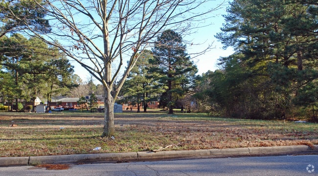
Property Record
406 Lillian Rd W, Wilson, NC 27893


NEARBY LISTINGS FOR SALE OR LEASE
Property Detail
406 Lillian Rd W
Wilson, NC
Property Eb Jordan & Og Rand H
3712-61-3702.000
406 LILLIAN RD W L3 1.52AC
Residentialacreage
Wilson
X
North Carolina
3720371200J
1.52 AC
2024
Downtown Wilson
2025
Other Market Areas
000200
DEMOGRAPHICS near 406 Lillian Rd W
1 Mile
3 Mile
5 Mile
2024 Total Population
7,672
44,006
54,792
2029 Population
7,626
44,435
55,169
Pop Growth 2024-2029
(0.60%)
+ 0.97%
+ 0.69%
Average Age
43
41
41
2024 Total Households
3,370
18,430
22,787
HH Growth 2024-2029
(0.74%)
+ 0.92%
+ 0.65%
Median Household Inc
$46,058
$45,528
$47,810
Avg Household Size
2.20
2.30
2.30
2024 Avg HH Vehicles
2.00
2.00
2.00
Median Home Value
$149,149
$150,255
$153,607
Median Year Built
1968
1981
1984
Nearby Places
Map Layers
Map Styles
 Street
 Aerial
- Restaurants
- Banks
- Shops
- Fitness
- Groceries
PUBLIC TRANSPORTATION
COMMUTER RAIL
DRIVE
WALK
Distance
5 min
2.2 mi
AIRPORT
Pitt-Greenville
DRIVE
WALK
Distance
Pitt-Greenville
49 min
37.9 mi
SALE & LEASE HISTORY
LISTING DATE
SALE/LEASE

Mar 09, 2022
For Sale
Jun 03, 2019
For Sale
Nearby Properties
Address
Land Use
TOTAL SIZE
Lot Size
Zoning
Address
Land Use
TOTAL SIZE
Lot Size
Zoning
25,554 SF
18.75 AC
RMX
Address
Land Use
TOTAL SIZE
Lot Size
Zoning
11,771 SF
31.78 AC
ICD
Address
Land Use
TOTAL SIZE
Lot Size
Zoning
21,655 SF
34.44 AC
ICD
Address
Land Use
TOTAL SIZE
Lot Size
Zoning
220,639 SF
1.94 AC
CCMX
Address
Land Use
TOTAL SIZE
Lot Size
Zoning
6,704 SF
75.58 AC
ICD
Address
Land Use
TOTAL SIZE
Lot Size
Zoning
4,803 SF
10.23 AC
RMX
Address
Land Use
TOTAL SIZE
Lot Size
Zoning
98,777 SF
50 AC
ICD
Address
Land Use
TOTAL SIZE
Lot Size
Zoning
10,152 SF
29.71 AC
ICD
Address
Land Use
TOTAL SIZE
Lot Size
Zoning
59,319 SF
1.01 AC
CCMX
Address
Land Use
TOTAL SIZE
Lot Size
Zoning
77,125 SF
2.98 AC
GC
Address
Land Use
TOTAL SIZE
Lot Size
Zoning
150,316 SF
10.97 AC
RMX
Address
Land Use
TOTAL SIZE
Lot Size
Zoning
30,488 SF
49.06 AC
GR6
Address
Land Use
TOTAL SIZE
Lot Size
Zoning
90,035 SF
91.87 AC
ICD
Address
Land Use
TOTAL SIZE
Lot Size
Zoning
185,515 SF
19.58 AC
HC
Address
Land Use
TOTAL SIZE
Lot Size
Zoning
11,664 SF
10.13 AC
HC
Address
Land Use
TOTAL SIZE
Lot Size
Zoning
11,760 SF
56.76 AC
ICD
Address
Land Use
TOTAL SIZE
Lot Size
Zoning
25,888 SF
73.36 AC
LI
Address
Land Use
TOTAL SIZE
Lot Size
Zoning
192,420 SF
34.36 AC
HI
Address
Land Use
TOTAL SIZE
Lot Size
Zoning
91,637 SF
1.95 AC
CCMX
Address
Land Use
TOTAL SIZE
Lot Size
Zoning
78,875 SF
34.82 AC
ICD
Address
Land Use
TOTAL SIZE
Lot Size
Zoning
111,191 SF
10.64 AC
B4
Address
Land Use
TOTAL SIZE
Lot Size
Zoning
75,622 SF
9.13 AC
ICD
Address
Land Use
TOTAL SIZE
Lot Size
Zoning
33,650 SF
35.52 AC
ICD
Address
Land Use
TOTAL SIZE
Lot Size
Zoning
133,549 SF
21.49 AC
HC
Address
Land Use
TOTAL SIZE
Lot Size
Zoning
1,944 SF
13.64 AC
GR6
Address
Land Use
TOTAL SIZE
Lot Size
Zoning
13,672 SF
7.68 AC
NC
Address
Land Use
TOTAL SIZE
Lot Size
Zoning
8,616 SF
40 AC
ICD
Address
Land Use
TOTAL SIZE
Lot Size
Zoning
20,705 SF
7.88 AC
GR6
Address
Land Use
TOTAL SIZE
Lot Size
Zoning
27,488 SF
17.21 AC
GR6
Address
Land Use
TOTAL SIZE
Lot Size
Zoning
35,406 SF
2.91 AC
GR6
The World's #1 Commercial Real Estate Marketplace
Connect with us
© 2025 CoStar Group
The information above has been obtained from sources believed reliable. While we do not doubt its accuracy we have not verified it and make no guarantee, warranty or representation about it. It is your responsibility to independently confirm its accuracy and completeness. Any projections, opinions, assumptions, or estimates used are for example only and do not represent the current or future performance of the property. The value of this transaction to you depends on tax and other factors which should be evaluated by your tax, financial, and legal advisors. You and your advisors should conduct a careful, independent investigation of the property to determine to your satisfaction the suitability of the property for your needs.