Property Record
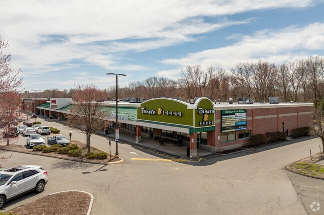
406 N Main St, East Longmeadow, MA 01028
NEARBY LISTINGS FOR SALE OR LEASE
Property Detail
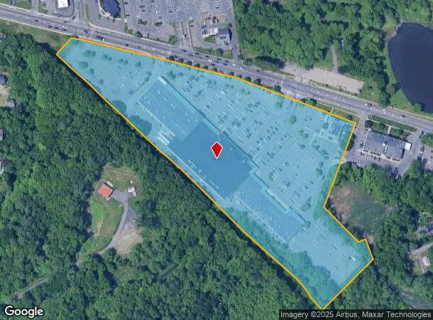
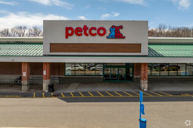
406 N Main St
ELON-000013-000014-D000000
Hampden
Commercialnec
Massachusetts
A
d
25013C0409E
13.22 AC
2025
Hampden County
2025
Hartford
813401
Springfield, MA
27,200 SF
DEMOGRAPHICS near 406 N Main St
1 Mile
3 Mile
5 Mile
2024 Total Population
10,958
90,403
198,591
2029 Population
10,787
88,786
195,188
Pop Growth 2024-2029
(1.56%)
(1.79%)
(1.71%)
Average Age
41
39
39
2024 Total Households
4,394
32,733
74,307
HH Growth 2024-2029
(1.59%)
(1.82%)
(1.78%)
Median Household Inc
$70,613
$62,908
$57,770
Avg Household Size
2.40
2.50
2.50
2024 Avg HH Vehicles
2.00
2.00
2.00
Median Home Value
$239,926
$254,453
$243,793
Median Year Built
1955
1954
1954
Nearby Places
Map Layers
Map Styles
 Street
 Aerial
- Restaurants
- Banks
- Shops
- Fitness
- Groceries
PUBLIC TRANSPORTATION
AIRPORT
Bradley International
DRIVE
WALK
Distance
Bradley International
34 min
21.1 mi
Freight Ports
Port of Davisville, RI
DRIVE
WALK
Distance
Port of Davisville, RI
1 min
65.8 mi
SALE & LEASE HISTORY
LISTING DATE
SALE/LEASE

Sep 25, 2016
For Lease
Jun 06, 2023
For Lease
Nearby Properties
Address
Land Use
TOTAL SIZE
Lot Size
Zoning
Address
Land Use
TOTAL SIZE
Lot Size
Zoning
44,886 SF
2.69 AC
R2
Address
Land Use
TOTAL SIZE
Lot Size
Zoning
236,616 SF
31.07 AC
RA1
Address
Land Use
TOTAL SIZE
Lot Size
Zoning
207,383 SF
37.44 AC
R6
Address
Land Use
TOTAL SIZE
Lot Size
Zoning
51,808 SF
11.01 AC
SR2B1
Address
Land Use
TOTAL SIZE
Lot Size
Zoning
431,476 SF
88.64 AC
SC2B1
Address
Land Use
TOTAL SIZE
Lot Size
Zoning
162,232 SF
3.06 AC
R2
Address
Land Use
TOTAL SIZE
Lot Size
Zoning
1.89 AC
SR2I2
Address
Land Use
TOTAL SIZE
Lot Size
Zoning
36,446 SF
25 AC
R1
Address
Land Use
TOTAL SIZE
Lot Size
Zoning
153,742 SF
22.34 AC
R1
Address
Land Use
TOTAL SIZE
Lot Size
Zoning
75,000 SF
3.10 AC
B1
Address
Land Use
TOTAL SIZE
Lot Size
Zoning
105,494 SF
2.33 AC
I2
Address
Land Use
TOTAL SIZE
Lot Size
Zoning
232,510 SF
61.40 AC
RB
Address
Land Use
TOTAL SIZE
Lot Size
Zoning
142,872 SF
57.41 AC
INDG
Address
Land Use
TOTAL SIZE
Lot Size
Zoning
42,412 SF
2.22 AC
SR2B1
Address
Land Use
TOTAL SIZE
Lot Size
Zoning
127,645 SF
20 AC
RC
Address
Land Use
TOTAL SIZE
Lot Size
Zoning
5,802 SF
49.19 AC
R2
Address
Land Use
TOTAL SIZE
Lot Size
Zoning
196,530 SF
19.74 AC
SR1C1
Address
Land Use
TOTAL SIZE
Lot Size
Zoning
9.69 AC
B
Address
Land Use
TOTAL SIZE
Lot Size
Zoning
84,605 SF
13.15 AC
RB
Address
Land Use
TOTAL SIZE
Lot Size
Zoning
4,400 SF
675 AC
SR1R2
Address
Land Use
TOTAL SIZE
Lot Size
Zoning
40,212 SF
5.12 AC
R6
Address
Land Use
TOTAL SIZE
Lot Size
Zoning
62,548 SF
10.50 AC
R1
Address
Land Use
TOTAL SIZE
Lot Size
Zoning
38,850 SF
10.06 AC
R1
Address
Land Use
TOTAL SIZE
Lot Size
Zoning
19,380 SF
3.30 AC
R2
Address
Land Use
TOTAL SIZE
Lot Size
Zoning
10,344 SF
9.54 AC
R4
Address
Land Use
TOTAL SIZE
Lot Size
Zoning
11,115 SF
57.72 AC
R1
Address
Land Use
TOTAL SIZE
Lot Size
Zoning
27,384 SF
1.20 AC
R3
Address
Land Use
TOTAL SIZE
Lot Size
Zoning
55,881 SF
2 AC
R2
Address
Land Use
TOTAL SIZE
Lot Size
Zoning
513,160 SF
38 AC
INDG
The World's #1 Commercial Real Estate Marketplace
Connect with us
© 2026 CoStar Group
The information above has been obtained from sources believed reliable. While we do not doubt its accuracy we have not verified it and make no guarantee, warranty or representation about it. It is your responsibility to independently confirm its accuracy and completeness. Any projections, opinions, assumptions, or estimates used are for example only and do not represent the current or future performance of the property. The value of this transaction to you depends on tax and other factors which should be evaluated by your tax, financial, and legal advisors. You and your advisors should conduct a careful, independent investigation of the property to determine to your satisfaction the suitability of the property for your needs.