Property Record
4060 E Peak View Rd, Cave Creek, AZ 85331


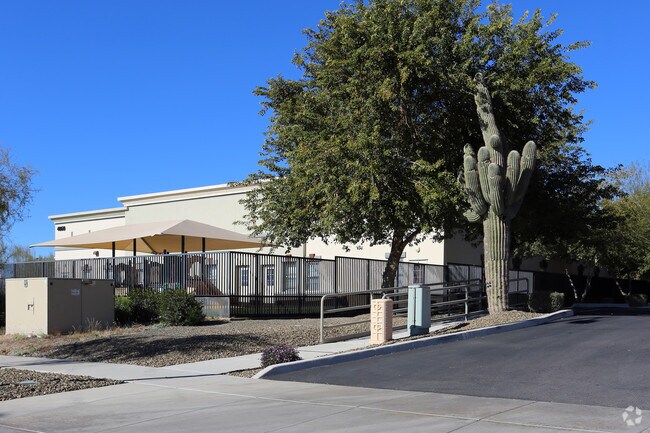
Property Detail
4060 E Peak View Rd
Phoenix-Mesa-Chandler, AZ
TOY BARN ON CAVE CREEK ROAD MCR 1018-11
211-38-358
Maricopa
Daycare
Arizona
I-P
2
2025
1.88 AC
2025
N Phoenix/Cave Creek
612800
Phoenix
8,230 SF
NEARBY LISTINGS FOR SALE OR LEASE
-
-
View all Cave Creek listings for sale on LoopNet.com
DEMOGRAPHICS near 4060 E Peak View Rd
1 mile
3 mile
5 mile
2025 Total Population
4,338
22,723
65,084
2030 Population
4,387
23,056
67,233
Pop Growth 2025-2030
+ 1.13%
+ 1.47%
+ 3.30%
Average Age
44
44
44
2025 Total Households
1,747
8,680
25,370
HH Growth 2025-2030
+ 1.09%
+ 1.42%
+ 3.50%
Median Household Inc
$122,932
$136,345
$147,821
Avg Household Size
2.50
2.60
2.50
2025 Avg HH Vehicles
2.00
2.00
2.00
Median Home Value
$672,920
$722,850
$782,611
Median Year Built
1995
1996
1999
Nearby Places
Map Layers
Map Styles
 Street
 Aerial
Layers
 Traffic
 Biking
Places
Listings with unknown addresses are not visible on the map
- Restaurants
- Banks
- Shops
- Fitness
- Groceries
PUBLIC TRANSPORTATION
AIRPORT
Phoenix Sky Harbor International
Drive
Walk
Distance
Phoenix Sky Harbor International
39 min
27.1 mi
Phoenix-Mesa Gateway
Drive
Walk
Distance
Phoenix-Mesa Gateway
69 min
49.3 mi
Nearby Properties
Address
Land Use
TOTAL SIZE
Lot Size
Zoning
Address
Land Use
TOTAL SIZE
Lot Size
Zoning
328 SF
96.24 AC
R-43AG
Address
Land Use
TOTAL SIZE
Lot Size
Zoning
108,124 SF
26.19 AC
R-35
Address
Land Use
TOTAL SIZE
Lot Size
Zoning
10 SF
13.75 AC
R-35
Address
Land Use
TOTAL SIZE
Lot Size
Zoning
79,429 SF
17.76 AC
R-35
Address
Land Use
TOTAL SIZE
Lot Size
Zoning
34,576 SF
23 AC
R-43
Address
Land Use
TOTAL SIZE
Lot Size
Zoning
15.34 AC
PAD
Address
Land Use
TOTAL SIZE
Lot Size
Zoning
13,960 SF
33.20 AC
R-35
Address
Land Use
TOTAL SIZE
Lot Size
Zoning
65,728 SF
12.07 AC
C-C
Address
Land Use
TOTAL SIZE
Lot Size
Zoning
74,132 SF
7.93 AC
PAD
Address
Land Use
TOTAL SIZE
Lot Size
Zoning
43,674 SF
9.26 AC
C-C
Address
Land Use
TOTAL SIZE
Lot Size
Zoning
135,578 SF
2.85 AC
C-C
Address
Land Use
TOTAL SIZE
Lot Size
Zoning
116,269 SF
5.01 AC
C-N
Address
Land Use
TOTAL SIZE
Lot Size
Zoning
68,338 SF
16.15 AC
R-43
Address
Land Use
TOTAL SIZE
Lot Size
Zoning
45,425 SF
22.94 AC
R-43AG
Address
Land Use
TOTAL SIZE
Lot Size
Zoning
34,693 SF
5.73 AC
R-35
Address
Land Use
TOTAL SIZE
Lot Size
Zoning
52,022 SF
10.01 AC
R-43
Address
Land Use
TOTAL SIZE
Lot Size
Zoning
55,478 SF
5.24 AC
C-C
Address
Land Use
TOTAL SIZE
Lot Size
Zoning
1,010.34 AC
R-35
Address
Land Use
TOTAL SIZE
Lot Size
Zoning
102,591 SF
3.81 AC
C-C
Address
Land Use
TOTAL SIZE
Lot Size
Zoning
40,743 SF
6.90 AC
C-N
Address
Land Use
TOTAL SIZE
Lot Size
Zoning
12.17 AC
R-6
Address
Land Use
TOTAL SIZE
Lot Size
Zoning
34,888 SF
4.69 AC
S-1
Address
Land Use
TOTAL SIZE
Lot Size
Zoning
27,015 SF
3.14 AC
C-2
Address
Land Use
TOTAL SIZE
Lot Size
Zoning
13,982 SF
5.34 AC
R-43AG
Address
Land Use
TOTAL SIZE
Lot Size
Zoning
25,217 SF
1.43 AC
R-35
Address
Land Use
TOTAL SIZE
Lot Size
Zoning
7,276 SF
6.09 AC
R-43
Address
Land Use
TOTAL SIZE
Lot Size
Zoning
27,125 SF
3.22 AC
C-C
Address
Land Use
TOTAL SIZE
Lot Size
Zoning
60,792 SF
4.79 AC
I-P
Address
Land Use
TOTAL SIZE
Lot Size
Zoning
400 AC
R-35
Address
Land Use
TOTAL SIZE
Lot Size
Zoning
9,690 SF
9.62 AC
R-43AG
The World's #1 Commercial Real Estate Marketplace
Connect with us
© 2026 CoStar Group
The information above has been obtained from sources believed reliable. While we do not doubt its accuracy we have not verified it and make no guarantee, warranty or representation about it. It is your responsibility to independently confirm its accuracy and completeness. Any projections, opinions, assumptions, or estimates used are for example only and do not represent the current or future performance of the property. The value of this transaction to you depends on tax and other factors which should be evaluated by your tax, financial, and legal advisors. You and your advisors should conduct a careful, independent investigation of the property to determine to your satisfaction the suitability of the property for your needs.