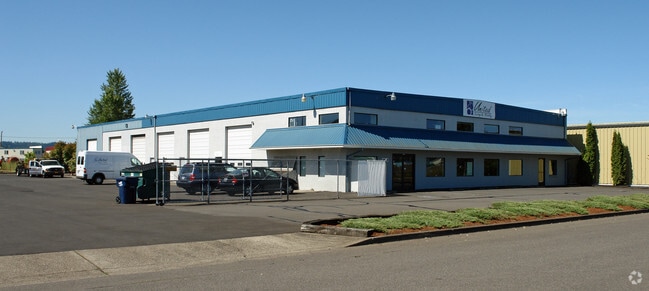
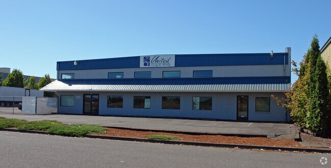
Property Record
4060 Stewart Rd, Eugene, OR 97402

Current Lease Availabilities
Property Detail
4060 Stewart Rd
Eugene-Springfield, OR
TL 00201
1495231
Lane
Industrialgeneral
Oregon
E-2
201
B and X Area of moderate flood hazard, usually the area between the limits of the 100-year and 500-year floods.
1.01 AC
2025
Lane County
2025
Portland
004300
NEARBY LISTINGS FOR SALE OR LEASE
DEMOGRAPHICS near 4060 Stewart Rd
1 mile
3 mile
5 mile
2025 Total Population
4,966
71,239
165,059
2030 Population
4,932
70,446
163,589
Pop Growth 2025-2030
(0.68%)
(1.11%)
(0.89%)
Average Age
38
41
40
2025 Total Households
2,015
28,584
67,832
HH Growth 2025-2030
(0.60%)
(1.25%)
(1.01%)
Median Household Inc
$68,915
$63,238
$63,994
Avg Household Size
2.40
2.30
2.20
2025 Avg HH Vehicles
2.00
2.00
2.00
Median Home Value
$363,127
$399,166
$445,115
Median Year Built
1984
1975
1976
Nearby Places
Map Layers
Map Styles
 Street
 Aerial
Transit
 Traffic
 Biking
Places
Listings with unknown addresses are not visible on the map
- Restaurants
- Banks
- Shops
- Fitness
- Groceries
PUBLIC TRANSPORTATION
AIRPORT
Mahlon Sweet Field
Drive
Walk
Distance
Mahlon Sweet Field
16 min
7.7 mi
Nearby Properties
Address
Land Use
TOTAL SIZE
Lot Size
Zoning
Address
Land Use
TOTAL SIZE
Lot Size
Zoning
44.56 AC
PL
Address
Land Use
TOTAL SIZE
Lot Size
Zoning
Address
Land Use
TOTAL SIZE
Lot Size
Zoning
25.78 AC
C-2
Address
Land Use
TOTAL SIZE
Lot Size
Zoning
12.12 AC
C-2
Address
Land Use
TOTAL SIZE
Lot Size
Zoning
45.78 AC
I-3
Address
Land Use
TOTAL SIZE
Lot Size
Zoning
75.36 AC
PL
Address
Land Use
TOTAL SIZE
Lot Size
Zoning
14.14 AC
R-1
Address
Land Use
TOTAL SIZE
Lot Size
Zoning
19.65 AC
C-2
Address
Land Use
TOTAL SIZE
Lot Size
Zoning
3,324 SF
8.70 AC
NR
Address
Land Use
TOTAL SIZE
Lot Size
Zoning
12.07 AC
NR
Address
Land Use
TOTAL SIZE
Lot Size
Zoning
46.88 AC
PL
Address
Land Use
TOTAL SIZE
Lot Size
Zoning
29.96 AC
AG
Address
Land Use
TOTAL SIZE
Lot Size
Zoning
14.20 AC
R-1
Address
Land Use
TOTAL SIZE
Lot Size
Zoning
17.68 AC
PL
Address
Land Use
TOTAL SIZE
Lot Size
Zoning
Address
Land Use
TOTAL SIZE
Lot Size
Zoning
6.94 AC
R-1
Address
Land Use
TOTAL SIZE
Lot Size
Zoning
6.67 AC
PL
Address
Land Use
TOTAL SIZE
Lot Size
Zoning
Address
Land Use
TOTAL SIZE
Lot Size
Zoning
37.58 AC
PL
Address
Land Use
TOTAL SIZE
Lot Size
Zoning
13.14 AC
I-2
Address
Land Use
TOTAL SIZE
Lot Size
Zoning
4.97 AC
I-3
Address
Land Use
TOTAL SIZE
Lot Size
Zoning
23.08 AC
PL
Address
Land Use
TOTAL SIZE
Lot Size
Zoning
10.50 AC
C-2
Address
Land Use
TOTAL SIZE
Lot Size
Zoning
Address
Land Use
TOTAL SIZE
Lot Size
Zoning
5.13 AC
I-3
Address
Land Use
TOTAL SIZE
Lot Size
Zoning
3.12 AC
I-2
Address
Land Use
TOTAL SIZE
Lot Size
Zoning
7.68 AC
PL
Address
Land Use
TOTAL SIZE
Lot Size
Zoning
12.30 AC
C-2
Address
Land Use
TOTAL SIZE
Lot Size
Zoning
Address
Land Use
TOTAL SIZE
Lot Size
Zoning
16.18 AC
E-1
The World's #1 Commercial Real Estate Marketplace
Connect with us
© 2026 CoStar Group
The information above has been obtained from sources believed reliable. While we do not doubt its accuracy we have not verified it and make no guarantee, warranty or representation about it. It is your responsibility to independently confirm its accuracy and completeness. Any projections, opinions, assumptions, or estimates used are for example only and do not represent the current or future performance of the property. The value of this transaction to you depends on tax and other factors which should be evaluated by your tax, financial, and legal advisors. You and your advisors should conduct a careful, independent investigation of the property to determine to your satisfaction the suitability of the property for your needs.