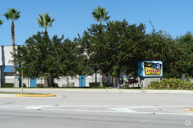
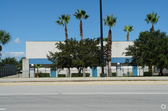
Property Record
4061 S Nova Rd, Port Orange, FL 32127


NEARBY LISTINGS FOR SALE OR LEASE
Property Detail
4061 S Nova Rd
6315-07-05-001A
Commonwealth Mobile Estates Add 02
Warehouse
THAT PORTION OF BLKS 8 5 6 & 7 LYING E OF DURANT ST & N OF NOVA RD MEAS 720 FT ON NOVA RD & 237.65 FT ON DURANT ST PER OR 4652 PGS 0033-0034
AE
Volusia
12127C0526J
Florida
2025
4.28 AC
2026
South Beach Cities
082503
Deltona/Daytona Beach
60,540 SF
Deltona-Daytona Beach-Ormond Beach, FL
DEMOGRAPHICS near 4061 S Nova Rd
1 Mile
3 Mile
5 Mile
2024 Total Population
11,354
51,600
113,850
2029 Population
12,576
57,395
126,656
Pop Growth 2024-2029
+ 10.76%
+ 11.23%
+ 11.25%
Average Age
46
47
47
2024 Total Households
5,103
23,434
51,808
HH Growth 2024-2029
+ 10.93%
+ 11.61%
+ 11.71%
Median Household Inc
$42,505
$55,950
$56,708
Avg Household Size
2.20
2.10
2.10
2024 Avg HH Vehicles
2.00
2.00
2.00
Median Home Value
$154,150
$237,469
$252,388
Median Year Built
1979
1983
1985
Nearby Places
Map Layers
Map Styles
 Street
 Aerial
- Restaurants
- Banks
- Shops
- Fitness
- Groceries
PUBLIC TRANSPORTATION
AIRPORT
Daytona Beach International
DRIVE
WALK
Distance
Daytona Beach International
15 min
8.1 mi
Orlando Sanford International
DRIVE
WALK
Distance
Orlando Sanford International
55 min
38.7 mi
Freight Ports
Port Canaveral
DRIVE
WALK
Distance
Port Canaveral
79 min
67.3 mi
Nearby Properties
Address
Land Use
TOTAL SIZE
Lot Size
Zoning
Address
Land Use
TOTAL SIZE
Lot Size
Zoning
354,546 SF
24.71 AC
Address
Land Use
TOTAL SIZE
Lot Size
Zoning
448,867 SF
5.54 AC
Address
Land Use
TOTAL SIZE
Lot Size
Zoning
408,078 SF
50.07 AC
Address
Land Use
TOTAL SIZE
Lot Size
Zoning
325,744 SF
12.23 AC
Address
Land Use
TOTAL SIZE
Lot Size
Zoning
10,360 SF
1.56 AC
Address
Land Use
TOTAL SIZE
Lot Size
Zoning
150,197 SF
16.07 AC
Address
Land Use
TOTAL SIZE
Lot Size
Zoning
94,338 SF
7.39 AC
Address
Land Use
TOTAL SIZE
Lot Size
Zoning
412,064 SF
60 AC
Address
Land Use
TOTAL SIZE
Lot Size
Zoning
60,449 SF
7.14 AC
16PCD
Address
Land Use
TOTAL SIZE
Lot Size
Zoning
184,242 SF
14.43 AC
Address
Land Use
TOTAL SIZE
Lot Size
Zoning
9,952 SF
9.30 AC
16RMH
Address
Land Use
TOTAL SIZE
Lot Size
Zoning
269,160 SF
72.17 AC
16A
Address
Land Use
TOTAL SIZE
Lot Size
Zoning
156,994 SF
47.82 AC
16A
Address
Land Use
TOTAL SIZE
Lot Size
Zoning
155,590 SF
11.08 AC
16R3H
Address
Land Use
TOTAL SIZE
Lot Size
Zoning
9,061 SF
0.23 AC
16RMH
Address
Land Use
TOTAL SIZE
Lot Size
Zoning
148,848 SF
9.99 AC
16R3H
Address
Land Use
TOTAL SIZE
Lot Size
Zoning
3,886 SF
3.99 AC
16RMH
Address
Land Use
TOTAL SIZE
Lot Size
Zoning
9,833 SF
52.38 AC
16RMH
Address
Land Use
TOTAL SIZE
Lot Size
Zoning
4,166 SF
51.05 AC
Address
Land Use
TOTAL SIZE
Lot Size
Zoning
157,147 SF
47.79 AC
16A
Address
Land Use
TOTAL SIZE
Lot Size
Zoning
212,681 SF
21.50 AC
Address
Land Use
TOTAL SIZE
Lot Size
Zoning
111,379 SF
16.62 AC
Address
Land Use
TOTAL SIZE
Lot Size
Zoning
138,930 SF
13.70 AC
16PCD
Address
Land Use
TOTAL SIZE
Lot Size
Zoning
91,967 SF
7.31 AC
16CC
Address
Land Use
TOTAL SIZE
Lot Size
Zoning
184,730 SF
16.46 AC
Address
Land Use
TOTAL SIZE
Lot Size
Zoning
80,836 SF
3.03 AC
R3
Address
Land Use
TOTAL SIZE
Lot Size
Zoning
62,574 SF
6.90 AC
MH1
Address
Land Use
TOTAL SIZE
Lot Size
Zoning
102,229 SF
1.60 AC
Address
Land Use
TOTAL SIZE
Lot Size
Zoning
105,676 SF
11.77 AC
Address
Land Use
TOTAL SIZE
Lot Size
Zoning
154,409 SF
14.10 AC
The World's #1 Commercial Real Estate Marketplace
Connect with us
© 2025 CoStar Group
The information above has been obtained from sources believed reliable. While we do not doubt its accuracy we have not verified it and make no guarantee, warranty or representation about it. It is your responsibility to independently confirm its accuracy and completeness. Any projections, opinions, assumptions, or estimates used are for example only and do not represent the current or future performance of the property. The value of this transaction to you depends on tax and other factors which should be evaluated by your tax, financial, and legal advisors. You and your advisors should conduct a careful, independent investigation of the property to determine to your satisfaction the suitability of the property for your needs.