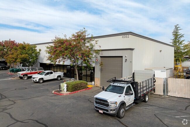
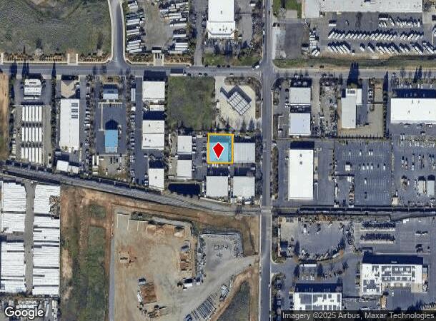
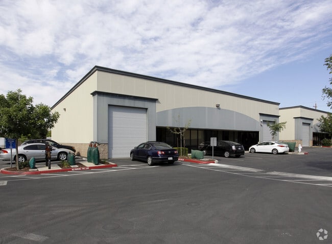
Property Record
4062 Cincinnati Ave, Rocklin, CA 95765
Current Lease Availabilities
NEARBY LISTINGS FOR SALE OR LEASE
Property Detail
4062 Cincinnati Ave
485-020-003
PAR 3 PMOR 32-48
Lightindustrial
Placer
X
California
06061C0937H
0.29 AC
2024
Roseville/Rocklin
2025
Sacramento
021328
Sacramento--Roseville--Arden-Arcade, CA
7,200 SF
DEMOGRAPHICS near 4062 Cincinnati Ave
1 Mile
3 Mile
5 Mile
2024 Total Population
2,562
82,911
207,331
2029 Population
2,735
89,707
223,997
Pop Growth 2024-2029
+ 6.75%
+ 8.20%
+ 8.04%
Average Age
37
39
41
2024 Total Households
795
28,558
75,304
HH Growth 2024-2029
+ 6.79%
+ 8.16%
+ 8.01%
Median Household Inc
$135,819
$123,080
$112,475
Avg Household Size
3.20
2.80
2.70
2024 Avg HH Vehicles
2.00
2.00
2.00
Median Home Value
$645,496
$695,959
$662,684
Median Year Built
2004
2003
2001
Nearby Places
- Restaurants
- Banks
- Shops
- Fitness
- Groceries
PUBLIC TRANSPORTATION
COMMUTER RAIL
Rocklin Amtrak Station (Capitol Corridor - Amtrak)
DRIVE
WALK
Distance
Rocklin Amtrak Station (Capitol Corridor - Amtrak)
13 min
6.0 mi
Roseville (California Zephyr - Amtrak, Capitol Corridor - Amtrak)
DRIVE
WALK
Distance
Roseville (California Zephyr - Amtrak, Capitol Corridor - Amtrak)
13 min
6.3 mi
AIRPORT
Sacramento International
DRIVE
WALK
Distance
Sacramento International
43 min
32.3 mi
Freight Ports
Port of Stockton
DRIVE
WALK
Distance
Port of Stockton
86 min
72.5 mi
Nearby Properties
Address
Land Use
TOTAL SIZE
Lot Size
Zoning
Address
Land Use
TOTAL SIZE
Lot Size
Zoning
341,145 SF
12 AC
Address
Land Use
TOTAL SIZE
Lot Size
Zoning
471,741 SF
15.14 AC
Address
Land Use
TOTAL SIZE
Lot Size
Zoning
280,129 SF
14.90 AC
Address
Land Use
TOTAL SIZE
Lot Size
Zoning
401,656 SF
28 AC
Address
Land Use
TOTAL SIZE
Lot Size
Zoning
130,228 SF
11.10 AC
Address
Land Use
TOTAL SIZE
Lot Size
Zoning
1,032,692 SF
81.30 AC
INPDC
Address
Land Use
TOTAL SIZE
Lot Size
Zoning
243,765 SF
14.24 AC
Address
Land Use
TOTAL SIZE
Lot Size
Zoning
144,760 SF
26.70 AC
Address
Land Use
TOTAL SIZE
Lot Size
Zoning
222,702 SF
10.57 AC
Address
Land Use
TOTAL SIZE
Lot Size
Zoning
769,698 SF
50.39 AC
Address
Land Use
TOTAL SIZE
Lot Size
Zoning
411,344 SF
41.50 AC
Address
Land Use
TOTAL SIZE
Lot Size
Zoning
244,077 SF
8.70 AC
Address
Land Use
TOTAL SIZE
Lot Size
Zoning
401,175 SF
19.80 AC
Address
Land Use
TOTAL SIZE
Lot Size
Zoning
162,800 SF
11.70 AC
Address
Land Use
TOTAL SIZE
Lot Size
Zoning
193,126 SF
75.84 AC
Address
Land Use
TOTAL SIZE
Lot Size
Zoning
217,756 SF
8.90 AC
Address
Land Use
TOTAL SIZE
Lot Size
Zoning
132,784 SF
9.80 AC
Address
Land Use
TOTAL SIZE
Lot Size
Zoning
191,820 SF
12.40 AC
Address
Land Use
TOTAL SIZE
Lot Size
Zoning
718,131 SF
42 AC
Address
Land Use
TOTAL SIZE
Lot Size
Zoning
159,069 SF
6.09 AC
Address
Land Use
TOTAL SIZE
Lot Size
Zoning
12,176 SF
22.70 AC
Address
Land Use
TOTAL SIZE
Lot Size
Zoning
198,530 SF
11.50 AC
Address
Land Use
TOTAL SIZE
Lot Size
Zoning
314,360 SF
18.90 AC
Address
Land Use
TOTAL SIZE
Lot Size
Zoning
222,453 SF
27.60 AC
Address
Land Use
TOTAL SIZE
Lot Size
Zoning
198,824 SF
29.66 AC
Address
Land Use
TOTAL SIZE
Lot Size
Zoning
474,641 SF
30.80 AC
Address
Land Use
TOTAL SIZE
Lot Size
Zoning
200,928 SF
3.65 AC
The World's #1 Commercial Real Estate Marketplace
Connect with us
© 2025 CoStar Group
The information above has been obtained from sources believed reliable. While we do not doubt its accuracy we have not verified it and make no guarantee, warranty or representation about it. It is your responsibility to independently confirm its accuracy and completeness. Any projections, opinions, assumptions, or estimates used are for example only and do not represent the current or future performance of the property. The value of this transaction to you depends on tax and other factors which should be evaluated by your tax, financial, and legal advisors. You and your advisors should conduct a careful, independent investigation of the property to determine to your satisfaction the suitability of the property for your needs.