Property Record
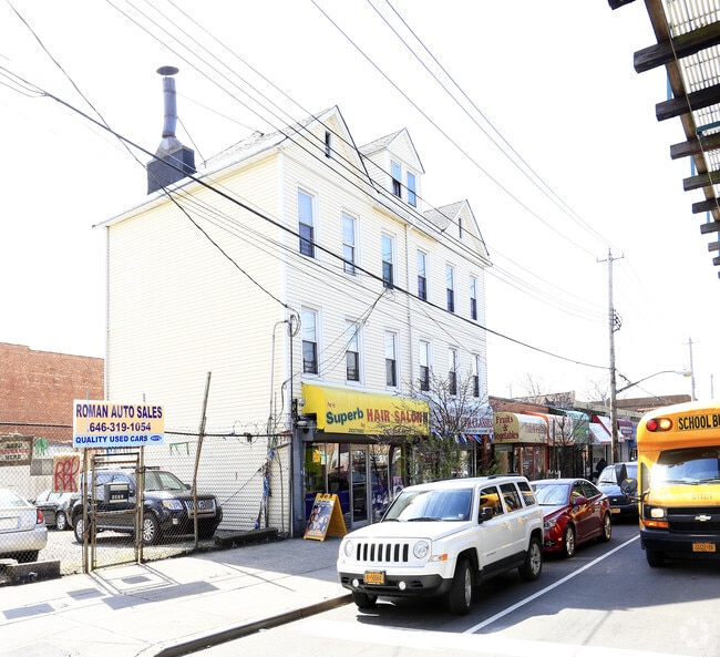
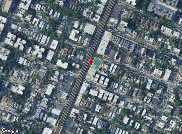
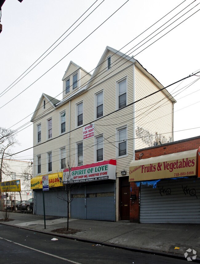
4062 White Plains Rd, Bronx, NY 10466

NEARBY LISTINGS FOR SALE OR LEASE
Property Detail
4062 White Plains Rd
04842-0045
Bronx
Storebuilding
New York
X
45
36119C0338F
0.21 AC
2024
Bronx
2025
Westchester/So Connecticut
040600
New York-Jersey City-White Plains, NY-NJ
6,100 SF
DEMOGRAPHICS near 4062 White Plains Rd
1 Mile
3 Mile
5 Mile
2024 Total Population
82,161
640,257
1,523,099
2029 Population
73,282
595,065
1,423,728
Pop Growth 2024-2029
(10.81%)
(7.06%)
(6.52%)
Average Age
39
40
39
2024 Total Households
29,469
235,631
550,865
HH Growth 2024-2029
(11.40%)
(7.57%)
(7.00%)
Median Household Inc
$57,422
$56,650
$51,700
Avg Household Size
2.70
2.60
2.60
2024 Avg HH Vehicles
1.00
1.00
1.00
Median Home Value
$589,124
$460,996
$511,621
Median Year Built
1950
1950
1950
Nearby Places
Map Layers
Map Styles
 Street
 Aerial
- Restaurants
- Banks
- Shops
- Fitness
- Groceries
PUBLIC TRANSPORTATION
TRANSIT/SUBWAY
225 Street (2 - New York MTA Subway (The Subway), 5 - New York MTA Subway (The Subway))
DRIVE
WALK
Distance
225 Street (2 - New York MTA Subway (The Subway), 5 - New York MTA Subway (The Subway))
2 min
4 min
0.2 mi
233 Street (2 - New York MTA Subway (The Subway), 5 - New York MTA Subway (The Subway))
DRIVE
WALK
Distance
233 Street (2 - New York MTA Subway (The Subway), 5 - New York MTA Subway (The Subway))
2 min
5 min
0.2 mi
219 Street (2 - New York MTA Subway (The Subway), 5 - New York MTA Subway (The Subway))
DRIVE
WALK
Distance
219 Street (2 - New York MTA Subway (The Subway), 5 - New York MTA Subway (The Subway))
4 min
10 min
0.5 mi
Nereid Avenue (2 - New York MTA Subway (The Subway), 5 - New York MTA Subway (The Subway))
DRIVE
WALK
Distance
Nereid Avenue (2 - New York MTA Subway (The Subway), 5 - New York MTA Subway (The Subway))
3 min
13 min
0.6 mi
Gun Hill Road (2,5 Line) (2 - New York MTA Subway (The Subway), 5 - New York MTA Subway (The Subway))
DRIVE
WALK
Distance
Gun Hill Road (2,5 Line) (2 - New York MTA Subway (The Subway), 5 - New York MTA Subway (The Subway))
6 min
20 min
1.0 mi
COMMUTER RAIL
Woodlawn Station (Harlem Line - Metro-North Commuter Railroad Company (Metro-North))
DRIVE
WALK
Distance
Woodlawn Station (Harlem Line - Metro-North Commuter Railroad Company (Metro-North))
4 min
14 min
0.6 mi
Wakefield Station (Harlem Line - Metro-North Commuter Railroad Company (Metro-North))
DRIVE
WALK
Distance
Wakefield Station (Harlem Line - Metro-North Commuter Railroad Company (Metro-North))
4 min
1.6 mi
AIRPORT
LaGuardia
DRIVE
WALK
Distance
LaGuardia
22 min
14.0 mi
Westchester County
DRIVE
WALK
Distance
Westchester County
28 min
19.9 mi
John F Kennedy International
DRIVE
WALK
Distance
John F Kennedy International
33 min
22.3 mi
SALE & LEASE HISTORY
LISTING DATE
SALE/LEASE

Sep 24, 2016
For Sale
Sep 21, 2018
For Lease
Nearby Properties
Address
Land Use
TOTAL SIZE
Lot Size
Zoning
Address
Land Use
TOTAL SIZE
Lot Size
Zoning
1,299,700 SF
29.82 AC
R6
Address
Land Use
TOTAL SIZE
Lot Size
Zoning
550,000 SF
8.75 AC
M1-1
Address
Land Use
TOTAL SIZE
Lot Size
Zoning
1,743,584 SF
77.87 AC
R6
Address
Land Use
TOTAL SIZE
Lot Size
Zoning
1,427,393 SF
39.94 AC
R4
Address
Land Use
TOTAL SIZE
Lot Size
Zoning
481,172 SF
205.58 AC
PARK
Address
Land Use
TOTAL SIZE
Lot Size
Zoning
1,132,500 SF
62.44 AC
R6
Address
Land Use
TOTAL SIZE
Lot Size
Zoning
895,256 SF
8.32 AC
R7-1
Address
Land Use
TOTAL SIZE
Lot Size
Zoning
1,237,424 SF
21.25 AC
R6
Address
Land Use
TOTAL SIZE
Lot Size
Zoning
485,484 SF
39.63 AC
R5
Address
Land Use
TOTAL SIZE
Lot Size
Zoning
204,200 SF
1.68 AC
R7-1
Address
Land Use
TOTAL SIZE
Lot Size
Zoning
667,405 SF
5.51 AC
R6
Address
Land Use
TOTAL SIZE
Lot Size
Zoning
4,000 SF
19.83 AC
BUS
Address
Land Use
TOTAL SIZE
Lot Size
Zoning
390,750 SF
265 AC
PARK
Address
Land Use
TOTAL SIZE
Lot Size
Zoning
617,567 SF
3.19 AC
R7-1
Address
Land Use
TOTAL SIZE
Lot Size
Zoning
537,208 SF
4.73 AC
C4-3
Address
Land Use
TOTAL SIZE
Lot Size
Zoning
545,388 SF
29.07 AC
C4-3
Address
Land Use
TOTAL SIZE
Lot Size
Zoning
707,353 SF
29.34 AC
R6
Address
Land Use
TOTAL SIZE
Lot Size
Zoning
851,821 SF
7.95 AC
R4
Address
Land Use
TOTAL SIZE
Lot Size
Zoning
Address
Land Use
TOTAL SIZE
Lot Size
Zoning
Address
Land Use
TOTAL SIZE
Lot Size
Zoning
224,037 SF
0.82 AC
C45X
Address
Land Use
TOTAL SIZE
Lot Size
Zoning
269,100 SF
1.63 AC
R4
Address
Land Use
TOTAL SIZE
Lot Size
Zoning
87,000 SF
455.70 AC
PARK
Address
Land Use
TOTAL SIZE
Lot Size
Zoning
361,354 SF
C4-2
Address
Land Use
TOTAL SIZE
Lot Size
Zoning
450,784 SF
42.36 AC
R4
Address
Land Use
TOTAL SIZE
Lot Size
Zoning
18,445 SF
510.83 AC
PARK
Address
Land Use
TOTAL SIZE
Lot Size
Zoning
251,884 SF
21.53 AC
R6
Address
Land Use
TOTAL SIZE
Lot Size
Zoning
165,529 SF
7.05 AC
RA3
Address
Land Use
TOTAL SIZE
Lot Size
Zoning
601,260 SF
3.27 AC
R4
Address
Land Use
TOTAL SIZE
Lot Size
Zoning
1,028,976 SF
23.03 AC
R5
The World's #1 Commercial Real Estate Marketplace
Connect with us
© 2026 CoStar Group
The information above has been obtained from sources believed reliable. While we do not doubt its accuracy we have not verified it and make no guarantee, warranty or representation about it. It is your responsibility to independently confirm its accuracy and completeness. Any projections, opinions, assumptions, or estimates used are for example only and do not represent the current or future performance of the property. The value of this transaction to you depends on tax and other factors which should be evaluated by your tax, financial, and legal advisors. You and your advisors should conduct a careful, independent investigation of the property to determine to your satisfaction the suitability of the property for your needs.