Property Record
40649 N Gantzel Rd, San Tan Valley, AZ 85140


NEARBY LISTINGS FOR SALE OR LEASE
Property Detail
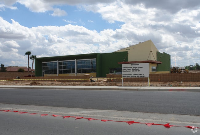
40649 N Gantzel Rd
Phoenix-Mesa-Scottsdale, AZ
Ocotillo Crossing
104-87-152H
LOT 1 OF REPLAT OF OCOTILLO CROSSING, ACCORDING TO THE PLAT OF RE CORD IN THE OFFICE OF THE PINAL COUNTY RECORDER, IN FEE NO. 2021- 112231 LYING WITHIN A PORTION OF THE NORTHWEST QUARTER OF SECTION 20, TOWNSHIP 02 SOUTH, RANGE 08 EAST, 70,071 SQIARE
Regionalshoppingcenterormallwithanchorstore
Pinal
X
Arizona
04013C3160L
1
2024
1.61 AC
2025
Apache Junction
000219
Phoenix
13,898 SF
DEMOGRAPHICS near 40649 N Gantzel Rd
1 Mile
3 Mile
5 Mile
2024 Total Population
14,039
58,847
116,006
2029 Population
17,476
72,002
140,570
Pop Growth 2024-2029
+ 24.48%
+ 22.35%
+ 21.17%
Average Age
34
36
35
2024 Total Households
4,232
18,272
35,586
HH Growth 2024-2029
+ 24.29%
+ 22.71%
+ 21.47%
Median Household Inc
$85,241
$99,648
$99,312
Avg Household Size
3.30
3.20
3.20
2024 Avg HH Vehicles
2.00
2.00
2.00
Median Home Value
$339,571
$390,930
$380,427
Median Year Built
2007
2009
2009
Nearby Places
Map Layers
Map Styles
 Street
 Aerial
- Restaurants
- Banks
- Shops
- Fitness
- Groceries
PUBLIC TRANSPORTATION
AIRPORT
Phoenix-Mesa Gateway
DRIVE
WALK
Distance
Phoenix-Mesa Gateway
17 min
9.2 mi
Phoenix Sky Harbor International
DRIVE
WALK
Distance
Phoenix Sky Harbor International
53 min
37.8 mi
Freight Ports
Port of San Diego
DRIVE
WALK
Distance
Port of San Diego
423 min
379.0 mi
Nearby Properties
Address
Land Use
TOTAL SIZE
Lot Size
Zoning
Address
Land Use
TOTAL SIZE
Lot Size
Zoning
590,319 SF
41.54 AC
Address
Land Use
TOTAL SIZE
Lot Size
Zoning
193,293 SF
22.36 AC
UNDESIGNAT
Address
Land Use
TOTAL SIZE
Lot Size
Zoning
95,730 SF
19.71 AC
Address
Land Use
TOTAL SIZE
Lot Size
Zoning
15.22 AC
Address
Land Use
TOTAL SIZE
Lot Size
Zoning
75,378 SF
10.36 AC
Address
Land Use
TOTAL SIZE
Lot Size
Zoning
39.46 AC
Address
Land Use
TOTAL SIZE
Lot Size
Zoning
37.68 AC
Address
Land Use
TOTAL SIZE
Lot Size
Zoning
12 AC
CR3
Address
Land Use
TOTAL SIZE
Lot Size
Zoning
107,832 SF
9.23 AC
Address
Land Use
TOTAL SIZE
Lot Size
Zoning
10.30 AC
CR3
Address
Land Use
TOTAL SIZE
Lot Size
Zoning
52,327 SF
21.32 AC
Address
Land Use
TOTAL SIZE
Lot Size
Zoning
20.68 AC
Address
Land Use
TOTAL SIZE
Lot Size
Zoning
227,555 SF
53.44 AC
R-43
Address
Land Use
TOTAL SIZE
Lot Size
Zoning
19.83 AC
Address
Land Use
TOTAL SIZE
Lot Size
Zoning
34,034 SF
5.64 AC
Address
Land Use
TOTAL SIZE
Lot Size
Zoning
101,250 SF
3.58 AC
Address
Land Use
TOTAL SIZE
Lot Size
Zoning
29,870 SF
12.57 AC
Address
Land Use
TOTAL SIZE
Lot Size
Zoning
463,567 SF
135.55 AC
I-2
Address
Land Use
TOTAL SIZE
Lot Size
Zoning
73,723 SF
3.57 AC
Address
Land Use
TOTAL SIZE
Lot Size
Zoning
Address
Land Use
TOTAL SIZE
Lot Size
Zoning
33,971 SF
3.04 AC
Address
Land Use
TOTAL SIZE
Lot Size
Zoning
4,524 SF
20.66 AC
Address
Land Use
TOTAL SIZE
Lot Size
Zoning
19,537 SF
3.95 AC
Address
Land Use
TOTAL SIZE
Lot Size
Zoning
24,313 SF
5.88 AC
CR3
Address
Land Use
TOTAL SIZE
Lot Size
Zoning
21,227 SF
4.16 AC
Address
Land Use
TOTAL SIZE
Lot Size
Zoning
40,000 SF
4.54 AC
CI2
Address
Land Use
TOTAL SIZE
Lot Size
Zoning
19,259 SF
5.11 AC
Address
Land Use
TOTAL SIZE
Lot Size
Zoning
163,373 SF
16.44 AC
MDR
The World's #1 Commercial Real Estate Marketplace
Connect with us
© 2026 CoStar Group
The information above has been obtained from sources believed reliable. While we do not doubt its accuracy we have not verified it and make no guarantee, warranty or representation about it. It is your responsibility to independently confirm its accuracy and completeness. Any projections, opinions, assumptions, or estimates used are for example only and do not represent the current or future performance of the property. The value of this transaction to you depends on tax and other factors which should be evaluated by your tax, financial, and legal advisors. You and your advisors should conduct a careful, independent investigation of the property to determine to your satisfaction the suitability of the property for your needs.