Property Record
407 Maple St, Mill Valley, CA 94941


Save to a Folder
{{folder.Name}}
{{folder.ListingIds.length}} Properties
{{folder.ListingIds.length}} Property
Create a New Folder
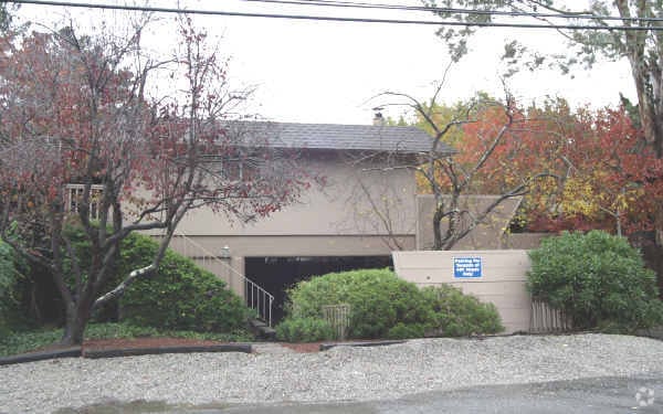
Property Detail
407 Maple St
050-241-39
MAP E7 606
Multifamilydwelling
Marin
C and X Area of minimal flood hazard, usually depicted on FIRMs as above the 500-year flood level.
California
2025
0.18 AC
2026
Tamalpais Valley
128100
North Bay/Santa Rosa
2,834 SF
San Rafael, CA
NEARBY LISTINGS FOR SALE OR LEASE
DEMOGRAPHICS near 407 Maple St
1 mile
3 mile
5 mile
2025 Total Population
8,553
42,361
79,223
2030 Population
8,361
41,791
78,470
Pop Growth 2025-2030
(2.24%)
(1.35%)
(0.95%)
Average Age
45
46
46
2025 Total Households
3,371
18,170
34,195
HH Growth 2025-2030
(2.31%)
(1.39%)
(0.99%)
Median Household Inc
$231,247
$184,500
$188,847
Avg Household Size
2.50
2.30
2.30
2025 Avg HH Vehicles
2.00
2.00
2.00
Median Home Value
$1,137,431
$1,128,730
$1,128,815
Median Year Built
1966
1965
1965
Nearby Places
Map Layers
Map Styles
 Street
 Aerial
Layers
 Traffic
 Biking
Places
Listings with unknown addresses are not visible on the map
- Restaurants
- Banks
- Shops
- Fitness
- Groceries
PUBLIC TRANSPORTATION
COMMUTER RAIL
Drive
Walk
Distance
12 min
6.7 mi
Drive
Walk
Distance
14 min
8.7 mi
AIRPORT
San Francisco International
Drive
Walk
Distance
San Francisco International
43 min
25.4 mi
Metro Oakland International
Drive
Walk
Distance
Metro Oakland International
52 min
36.3 mi
SALE & LEASE HISTORY
LISTING DATE
SALE/LEASE

Mar 21, 2024
For Sale
Dec 07, 2023
For Sale
Aug 23, 2021
For Sale
Nearby Properties
Address
Land Use
TOTAL SIZE
Lot Size
Zoning
Address
Land Use
TOTAL SIZE
Lot Size
Zoning
257,091 SF
14.21 AC
Address
Land Use
TOTAL SIZE
Lot Size
Zoning
Address
Land Use
TOTAL SIZE
Lot Size
Zoning
64,780 SF
50 AC
Address
Land Use
TOTAL SIZE
Lot Size
Zoning
110,272 SF
10.69 AC
Address
Land Use
TOTAL SIZE
Lot Size
Zoning
175,913 SF
19.81 AC
Address
Land Use
TOTAL SIZE
Lot Size
Zoning
100,000 SF
6.30 AC
Address
Land Use
TOTAL SIZE
Lot Size
Zoning
189,422 SF
7.67 AC
Address
Land Use
TOTAL SIZE
Lot Size
Zoning
23,156 SF
3.71 AC
Address
Land Use
TOTAL SIZE
Lot Size
Zoning
65,933 SF
3.11 AC
Address
Land Use
TOTAL SIZE
Lot Size
Zoning
115,264 SF
6.29 AC
Address
Land Use
TOTAL SIZE
Lot Size
Zoning
175,802 SF
10.87 AC
Address
Land Use
TOTAL SIZE
Lot Size
Zoning
159,300 SF
23.62 AC
Address
Land Use
TOTAL SIZE
Lot Size
Zoning
25,371 SF
2.15 AC
Address
Land Use
TOTAL SIZE
Lot Size
Zoning
92,278 SF
49.10 AC
Address
Land Use
TOTAL SIZE
Lot Size
Zoning
79,070 SF
3.85 AC
Address
Land Use
TOTAL SIZE
Lot Size
Zoning
36,566 SF
3.84 AC
Address
Land Use
TOTAL SIZE
Lot Size
Zoning
7.15 AC
Address
Land Use
TOTAL SIZE
Lot Size
Zoning
62,142 SF
4.75 AC
RMP148
Address
Land Use
TOTAL SIZE
Lot Size
Zoning
72,126 SF
4.36 AC
Address
Land Use
TOTAL SIZE
Lot Size
Zoning
26,298 SF
1.20 AC
Address
Land Use
TOTAL SIZE
Lot Size
Zoning
25,517 SF
13.29 AC
Address
Land Use
TOTAL SIZE
Lot Size
Zoning
32,202 SF
0.92 AC
Address
Land Use
TOTAL SIZE
Lot Size
Zoning
66,197 SF
3.60 AC
Address
Land Use
TOTAL SIZE
Lot Size
Zoning
30,192 SF
3.48 AC
Address
Land Use
TOTAL SIZE
Lot Size
Zoning
31,084 SF
8.07 AC
Address
Land Use
TOTAL SIZE
Lot Size
Zoning
2.76 AC
Address
Land Use
TOTAL SIZE
Lot Size
Zoning
32,514 SF
1.70 AC
Address
Land Use
TOTAL SIZE
Lot Size
Zoning
3.53 AC
Address
Land Use
TOTAL SIZE
Lot Size
Zoning
3.73 AC
Address
Land Use
TOTAL SIZE
Lot Size
Zoning
33,332 SF
1.29 AC
The World's #1 Commercial Real Estate Marketplace
Connect with us
© 2026 CoStar Group
The information above has been obtained from sources believed reliable. While we do not doubt its accuracy we have not verified it and make no guarantee, warranty or representation about it. It is your responsibility to independently confirm its accuracy and completeness. Any projections, opinions, assumptions, or estimates used are for example only and do not represent the current or future performance of the property. The value of this transaction to you depends on tax and other factors which should be evaluated by your tax, financial, and legal advisors. You and your advisors should conduct a careful, independent investigation of the property to determine to your satisfaction the suitability of the property for your needs.