Property Record
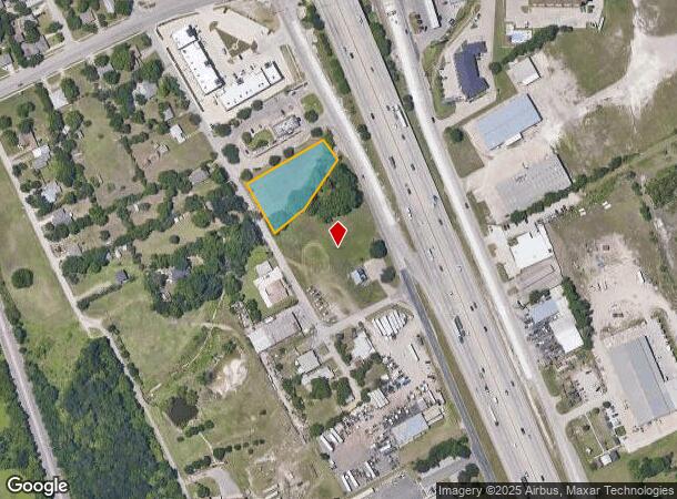
407 S Interstate 45 Service Rd, Hutchins, TX 75141

NEARBY LISTINGS FOR SALE OR LEASE
Property Detail
407 S Interstate 45 Service Rd
Dallas-Fort Worth-Arlington, TX
Thomas Freeman
65045349810410000
THOMAS FREEMAN ABST 453 PG 498 TR 41 ACS 0.8032 INT201400183054 DD06082014 CO-DC 0453498104100 23004534981
Commercialacreage
Dallas
AE
Texas
48113C0514L
0.80 AC
2024
Southwest Dallas
2025
Dallas/Ft Worth
016902
DEMOGRAPHICS near 407 S Interstate 45 Service Rd
1 Mile
3 Mile
5 Mile
2024 Total Population
4,239
12,004
75,603
2029 Population
4,280
12,144
75,993
Pop Growth 2024-2029
+ 0.97%
+ 1.17%
+ 0.52%
Average Age
33
35
34
2024 Total Households
1,303
3,056
22,457
HH Growth 2024-2029
+ 0.61%
+ 1.15%
+ 0.37%
Median Household Inc
$35,761
$39,450
$37,978
Avg Household Size
3.30
3.20
3.20
2024 Avg HH Vehicles
2.00
2.00
2.00
Median Home Value
$88,938
$113,623
$135,185
Median Year Built
1991
1991
1976
Nearby Places
Map Layers
Map Styles
 Street
 Aerial
- Restaurants
- Banks
- Shops
- Fitness
- Groceries
PUBLIC TRANSPORTATION
AIRPORT
Dallas Love Field
DRIVE
WALK
Distance
Dallas Love Field
28 min
18.0 mi
Dallas-Fort Worth International
DRIVE
WALK
Distance
Dallas-Fort Worth International
43 min
32.5 mi
Nearby Properties
Address
Land Use
TOTAL SIZE
Lot Size
Zoning
Address
Land Use
TOTAL SIZE
Lot Size
Zoning
967,886 SF
80.90 AC
Z239
Address
Land Use
TOTAL SIZE
Lot Size
Zoning
1,217,840 SF
58.27 AC
Z239
Address
Land Use
TOTAL SIZE
Lot Size
Zoning
1,097,520 SF
58.28 AC
Address
Land Use
TOTAL SIZE
Lot Size
Zoning
1,073,520 SF
55.17 AC
Z123
Address
Land Use
TOTAL SIZE
Lot Size
Zoning
1,044,647 SF
65.80 AC
Z239
Address
Land Use
TOTAL SIZE
Lot Size
Zoning
1,039,360 SF
64.13 AC
Z123
Address
Land Use
TOTAL SIZE
Lot Size
Zoning
1,033,503 SF
51.34 AC
Address
Land Use
TOTAL SIZE
Lot Size
Zoning
1,004,674 SF
63.47 AC
Z123
Address
Land Use
TOTAL SIZE
Lot Size
Zoning
999,728 SF
48.45 AC
Z319
Address
Land Use
TOTAL SIZE
Lot Size
Zoning
1,013,833 SF
54.39 AC
Z102
Address
Land Use
TOTAL SIZE
Lot Size
Zoning
800,737 SF
45.33 AC
Z123
Address
Land Use
TOTAL SIZE
Lot Size
Zoning
799,765 SF
45.66 AC
Z31
Address
Land Use
TOTAL SIZE
Lot Size
Zoning
527,731 SF
56.12 AC
Z298
Address
Land Use
TOTAL SIZE
Lot Size
Zoning
754,897 SF
42.75 AC
Z123
Address
Land Use
TOTAL SIZE
Lot Size
Zoning
698,880 SF
37.31 AC
Z31
Address
Land Use
TOTAL SIZE
Lot Size
Zoning
290,000 SF
51.91 AC
Z123
Address
Land Use
TOTAL SIZE
Lot Size
Zoning
362,767 SF
101.01 AC
Z115
Address
Land Use
TOTAL SIZE
Lot Size
Zoning
648,960 SF
52.23 AC
Z06
Address
Land Use
TOTAL SIZE
Lot Size
Zoning
588,500 SF
32.61 AC
Z123
Address
Land Use
TOTAL SIZE
Lot Size
Zoning
540,000 SF
40.02 AC
Z67
Address
Land Use
TOTAL SIZE
Lot Size
Zoning
506,285 SF
26.49 AC
Address
Land Use
TOTAL SIZE
Lot Size
Zoning
571,880 SF
19.42 AC
Z123
Address
Land Use
TOTAL SIZE
Lot Size
Zoning
696,622 SF
37.79 AC
Z116
Address
Land Use
TOTAL SIZE
Lot Size
Zoning
587,000 SF
33.94 AC
Z123
Address
Land Use
TOTAL SIZE
Lot Size
Zoning
626,100 SF
30.45 AC
Z398
Address
Land Use
TOTAL SIZE
Lot Size
Zoning
615,060 SF
53.36 AC
Z125
Address
Land Use
TOTAL SIZE
Lot Size
Zoning
309,110 SF
68.88 AC
Z31
Address
Land Use
TOTAL SIZE
Lot Size
Zoning
502,000 SF
79.24 AC
Z239
Address
Land Use
TOTAL SIZE
Lot Size
Zoning
416,000 SF
28.69 AC
Z123
Address
Land Use
TOTAL SIZE
Lot Size
Zoning
488,780 SF
41.74 AC
Z06
The World's #1 Commercial Real Estate Marketplace
Connect with us
© 2025 CoStar Group
The information above has been obtained from sources believed reliable. While we do not doubt its accuracy we have not verified it and make no guarantee, warranty or representation about it. It is your responsibility to independently confirm its accuracy and completeness. Any projections, opinions, assumptions, or estimates used are for example only and do not represent the current or future performance of the property. The value of this transaction to you depends on tax and other factors which should be evaluated by your tax, financial, and legal advisors. You and your advisors should conduct a careful, independent investigation of the property to determine to your satisfaction the suitability of the property for your needs.