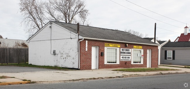
Property Record
407 S Juniata St, Havre De Grace, MD 21078


NEARBY LISTINGS FOR SALE OR LEASE
Property Detail
407 S Juniata St
Baltimore-Columbia-Towson, MD
Hoppers
06-019870
LT 1 & 2 50X150 407-409 S JUNIATA STREET HAVRE DE GRACE
Storebuilding
Harford
AE
Maryland
24025C0211E
1,2
2025
0.17 AC
2025
Aberdeen
306100
Baltimore
1,344 SF
DEMOGRAPHICS near 407 S Juniata St
1 mile
3 mile
5 mile
2024 Total Population
8,422
22,701
43,498
2029 Population
8,770
23,437
45,179
Pop Growth 2024-2029
+ 4.13%
+ 3.24%
+ 3.86%
Average Age
44
44
42
2024 Total Households
3,747
9,315
17,597
HH Growth 2024-2029
+ 4.38%
+ 3.39%
+ 3.94%
Median Household Inc
$66,547
$85,795
$79,656
Avg Household Size
2.20
2.40
2.40
2024 Avg HH Vehicles
2.00
2.00
2.00
Median Home Value
$266,845
$311,742
$279,675
Median Year Built
1967
1989
1983
Nearby Places
Map Layers
Map Styles
 Street
 Aerial
Transit
 Traffic
 Biking
Places
Listings with unknown addresses are not visible on the map
- Restaurants
- Banks
- Shops
- Fitness
- Groceries
PUBLIC TRANSPORTATION
COMMUTER RAIL
Perryville (Penn Line - Maryland Area Regional Commuter Trains (The MARC))
Drive
Walk
Distance
Perryville (Penn Line - Maryland Area Regional Commuter Trains (The MARC))
9 min
4.0 mi
Aberdeen (Penn Line - Maryland Area Regional Commuter Trains (The MARC))
Drive
Walk
Distance
Aberdeen (Penn Line - Maryland Area Regional Commuter Trains (The MARC))
10 min
4.6 mi
AIRPORT
Baltimore/Washington International Thurgood Marshall
Drive
Walk
Distance
Baltimore/Washington International Thurgood Marshall
65 min
46.2 mi
Freight Ports
Port Newark Container Terminal
Drive
Walk
Distance
Port Newark Container Terminal
26 min
14.5 mi
Nearby Properties
Address
Land Use
TOTAL SIZE
Lot Size
Zoning
Address
Land Use
TOTAL SIZE
Lot Size
Zoning
866,826 SF
267.48 AC
L2
Address
Land Use
TOTAL SIZE
Lot Size
Zoning
349.76 AC
OS
Address
Land Use
TOTAL SIZE
Lot Size
Zoning
2,589 SF
57.19 AC
R2
Address
Land Use
TOTAL SIZE
Lot Size
Zoning
623,017 SF
57.87 AC
GI
Address
Land Use
TOTAL SIZE
Lot Size
Zoning
399,600 SF
23.91 AC
M1
Address
Land Use
TOTAL SIZE
Lot Size
Zoning
29,700 SF
9.51 AC
C1
Address
Land Use
TOTAL SIZE
Lot Size
Zoning
149,622 SF
9.30 AC
GI
Address
Land Use
TOTAL SIZE
Lot Size
Zoning
100,444 SF
2.64 AC
RB
Address
Land Use
TOTAL SIZE
Lot Size
Zoning
113,412 SF
108 AC
R2
Address
Land Use
TOTAL SIZE
Lot Size
Zoning
103,470 SF
5.97 AC
R1
Address
Land Use
TOTAL SIZE
Lot Size
Zoning
426,275 SF
21.17 AC
GI
Address
Land Use
TOTAL SIZE
Lot Size
Zoning
28.03 AC
OS
Address
Land Use
TOTAL SIZE
Lot Size
Zoning
65,006 SF
29.63 AC
R1
Address
Land Use
TOTAL SIZE
Lot Size
Zoning
58,603 SF
13.26 AC
R1
Address
Land Use
TOTAL SIZE
Lot Size
Zoning
1,270 SF
61.42 AC
C
Address
Land Use
TOTAL SIZE
Lot Size
Zoning
213,790 SF
1.37 AC
RB
Address
Land Use
TOTAL SIZE
Lot Size
Zoning
184,116 SF
18.45 AC
GI
Address
Land Use
TOTAL SIZE
Lot Size
Zoning
78,944 SF
18.78 AC
GI
Address
Land Use
TOTAL SIZE
Lot Size
Zoning
72,197 SF
28.36 AC
R2
Address
Land Use
TOTAL SIZE
Lot Size
Zoning
4,800 SF
14.81 AC
C2
Address
Land Use
TOTAL SIZE
Lot Size
Zoning
18,944 SF
7.11 AC
GI
Address
Land Use
TOTAL SIZE
Lot Size
Zoning
40,584 SF
4.74 AC
C
Address
Land Use
TOTAL SIZE
Lot Size
Zoning
20,000 SF
11.32 AC
RB
Address
Land Use
TOTAL SIZE
Lot Size
Zoning
55,825 SF
10.25 AC
RB
Address
Land Use
TOTAL SIZE
Lot Size
Zoning
20,674 SF
0.54 AC
RO
Address
Land Use
TOTAL SIZE
Lot Size
Zoning
31,116 SF
9.37 AC
C
Address
Land Use
TOTAL SIZE
Lot Size
Zoning
7,586 SF
2.20 AC
RO
Address
Land Use
TOTAL SIZE
Lot Size
Zoning
39,126 SF
3.96 AC
C
Address
Land Use
TOTAL SIZE
Lot Size
Zoning
11,749 SF
10.62 AC
GI
Address
Land Use
TOTAL SIZE
Lot Size
Zoning
15,344 SF
4.96 AC
MUD
The World's #1 Commercial Real Estate Marketplace
Connect with us
© 2026 CoStar Group
The information above has been obtained from sources believed reliable. While we do not doubt its accuracy we have not verified it and make no guarantee, warranty or representation about it. It is your responsibility to independently confirm its accuracy and completeness. Any projections, opinions, assumptions, or estimates used are for example only and do not represent the current or future performance of the property. The value of this transaction to you depends on tax and other factors which should be evaluated by your tax, financial, and legal advisors. You and your advisors should conduct a careful, independent investigation of the property to determine to your satisfaction the suitability of the property for your needs.