Property Record
407 State Route 286, Seabrook, NH 03874

NEARBY LISTINGS FOR SALE OR LEASE
Property Detail
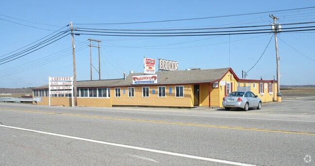
407 State Route 286
Restaurantbuilding
Rockingham
AE
New Hampshire
33015C0627F
10.50 AC
2024
Rockingham
2024
Boston
063003
Boston-Cambridge-Newton, MA-NH
6,204 SF
SEAB-000017-000000-000046
DEMOGRAPHICS near 407 State Route 286
1 Mile
3 Mile
5 Mile
2024 Total Population
1,493
16,147
44,047
2029 Population
1,599
16,864
45,728
Pop Growth 2024-2029
+ 7.10%
+ 4.44%
+ 3.82%
Average Age
53
49
48
2024 Total Households
780
7,710
20,378
HH Growth 2024-2029
+ 7.05%
+ 4.55%
+ 3.92%
Median Household Inc
$113,111
$85,108
$94,639
Avg Household Size
1.90
2.00
2.10
2024 Avg HH Vehicles
2.00
2.00
2.00
Median Home Value
$648,773
$452,350
$490,494
Median Year Built
1975
1981
1975
Nearby Places
Map Layers
Map Styles
 Street
 Aerial
- Restaurants
- Banks
- Shops
- Fitness
- Groceries
PUBLIC TRANSPORTATION
COMMUTER RAIL
Newburyport (Newburyport/Rockport Line - Massachusetts Bay Transportation Authority Commuter Rail (Purple Line))
DRIVE
WALK
Distance
Newburyport (Newburyport/Rockport Line - Massachusetts Bay Transportation Authority Commuter Rail (Purple Line))
17 min
8.1 mi
AIRPORT
Portsmouth International at Pease
DRIVE
WALK
Distance
Portsmouth International at Pease
30 min
20.0 mi
Freight Ports
Port of Boston
DRIVE
WALK
Distance
Port of Boston
63 min
45.7 mi
Nearby Properties
Address
Land Use
TOTAL SIZE
Lot Size
Zoning
Address
Land Use
TOTAL SIZE
Lot Size
Zoning
4,884 SF
40 AC
RB
Address
Land Use
TOTAL SIZE
Lot Size
Zoning
267,857 SF
13.10 AC
BC
Address
Land Use
TOTAL SIZE
Lot Size
Zoning
120,362 SF
32.29 AC
LA4
Address
Land Use
TOTAL SIZE
Lot Size
Zoning
112,708 SF
40 AC
50
Address
Land Use
TOTAL SIZE
Lot Size
Zoning
116,112 SF
4.52 AC
BS1
Address
Land Use
TOTAL SIZE
Lot Size
Zoning
143,335 SF
16.72 AC
LA4
Address
Land Use
TOTAL SIZE
Lot Size
Zoning
179,840 SF
13.46 AC
LA4
Address
Land Use
TOTAL SIZE
Lot Size
Zoning
30,440 SF
17.99 AC
LA4
Address
Land Use
TOTAL SIZE
Lot Size
Zoning
850 SF
0.94 AC
BS
Address
Land Use
TOTAL SIZE
Lot Size
Zoning
134,617 SF
15.89 AC
LA4
Address
Land Use
TOTAL SIZE
Lot Size
Zoning
87,374 SF
21.66 AC
LA3
Address
Land Use
TOTAL SIZE
Lot Size
Zoning
101,044 SF
13.24 AC
LA4
Address
Land Use
TOTAL SIZE
Lot Size
Zoning
25,867 SF
9.17 AC
BS
Address
Land Use
TOTAL SIZE
Lot Size
Zoning
116,650 SF
21.07 AC
LA4
Address
Land Use
TOTAL SIZE
Lot Size
Zoning
3,820 SF
9.15 AC
40
Address
Land Use
TOTAL SIZE
Lot Size
Zoning
577.79 AC
I2
Address
Land Use
TOTAL SIZE
Lot Size
Zoning
106,787 SF
22.25 AC
C
Address
Land Use
TOTAL SIZE
Lot Size
Zoning
20,518 SF
6.05 AC
BC
Address
Land Use
TOTAL SIZE
Lot Size
Zoning
139,877 SF
11.09 AC
LA4
Address
Land Use
TOTAL SIZE
Lot Size
Zoning
34,416 SF
11.50 AC
A
Address
Land Use
TOTAL SIZE
Lot Size
Zoning
Address
Land Use
TOTAL SIZE
Lot Size
Zoning
21,375 SF
11.80 AC
LA4
Address
Land Use
TOTAL SIZE
Lot Size
Zoning
39,728 SF
2.25 AC
Address
Land Use
TOTAL SIZE
Lot Size
Zoning
11,907 SF
4.03 AC
A
Address
Land Use
TOTAL SIZE
Lot Size
Zoning
144 SF
9.18 AC
BC
Address
Land Use
TOTAL SIZE
Lot Size
Zoning
42,828 SF
4.69 AC
LA2
Address
Land Use
TOTAL SIZE
Lot Size
Zoning
5,120 SF
1.30 AC
BS1
Address
Land Use
TOTAL SIZE
Lot Size
Zoning
13,120 SF
13.26 AC
50
Address
Land Use
TOTAL SIZE
Lot Size
Zoning
90,912 SF
14.50 AC
LA3
Address
Land Use
TOTAL SIZE
Lot Size
Zoning
10,944 SF
2.47 AC
LA4
The World's #1 Commercial Real Estate Marketplace
Connect with us
© 2025 CoStar Group
The information above has been obtained from sources believed reliable. While we do not doubt its accuracy we have not verified it and make no guarantee, warranty or representation about it. It is your responsibility to independently confirm its accuracy and completeness. Any projections, opinions, assumptions, or estimates used are for example only and do not represent the current or future performance of the property. The value of this transaction to you depends on tax and other factors which should be evaluated by your tax, financial, and legal advisors. You and your advisors should conduct a careful, independent investigation of the property to determine to your satisfaction the suitability of the property for your needs.