Property Record
408 E Lumsden Rd, Brandon, FL 33511
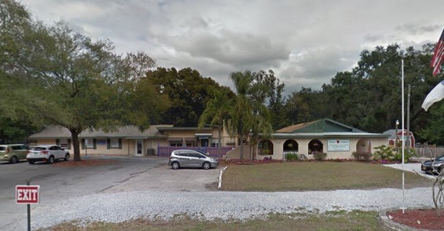


Property Detail
408 E Lumsden Rd
U-26-29-20-ZZZ-000002-63610.0
S 285 FT OF SW 1/4 OF SE 1/4 OF SW 1/4 LESS E 205 FT AND LESS W 150 FT AND LESS LUMSDEN RD R/W LESS W 92.57 FT OF E 297.57 FT OF S 285.00 FT OF SW 1/4 OF SE 1/4 OF SW 1/4
Daycare
Hillsborough
RSC-6
Florida
B and X Area of moderate flood hazard, usually the area between the limits of the 100-year and 500-year floods.
63610
2024
1.12 AC
2025
East Tampa
013311
Tampa/St Petersburg
5,375 SF
Tampa-St. Petersburg-Clearwater, FL
NEARBY LISTINGS FOR SALE OR LEASE
-
-
View all Brandon listings for sale on LoopNet.com
DEMOGRAPHICS near 408 E Lumsden Rd
1 mile
3 mile
5 mile
2025 Total Population
8,617
102,809
233,101
2030 Population
9,206
110,028
249,778
Pop Growth 2025-2030
+ 6.84%
+ 7.02%
+ 7.15%
Average Age
41
40
40
2025 Total Households
3,317
39,184
88,435
HH Growth 2025-2030
+ 7.02%
+ 7.19%
+ 7.41%
Median Household Inc
$82,795
$81,655
$84,248
Avg Household Size
2.50
2.60
2.60
2025 Avg HH Vehicles
2.00
2.00
2.00
Median Home Value
$384,932
$374,106
$376,848
Median Year Built
1978
1990
1994
Nearby Places
Map Layers
Map Styles
 Street
 Aerial
Transit
 Traffic
 Biking
Places
Listings with unknown addresses are not visible on the map
- Restaurants
- Banks
- Shops
- Fitness
- Groceries
PUBLIC TRANSPORTATION
AIRPORT
Tampa International
Drive
Walk
Distance
Tampa International
32 min
21.0 mi
St Pete-Clearwater International
Drive
Walk
Distance
St Pete-Clearwater International
43 min
29.5 mi
Freight Ports
Port of Tampa Bay
Drive
Walk
Distance
Port of Tampa Bay
21 min
11.0 mi
Nearby Properties
Address
Land Use
TOTAL SIZE
Lot Size
Zoning
Address
Land Use
TOTAL SIZE
Lot Size
Zoning
733,263 SF
72.88 AC
PD
Address
Land Use
TOTAL SIZE
Lot Size
Zoning
868,482 SF
60.83 AC
PD
Address
Land Use
TOTAL SIZE
Lot Size
Zoning
536,433 SF
18.23 AC
PD
Address
Land Use
TOTAL SIZE
Lot Size
Zoning
501,085 SF
41.18 AC
PD
Address
Land Use
TOTAL SIZE
Lot Size
Zoning
379,023 SF
22.16 AC
PD
Address
Land Use
TOTAL SIZE
Lot Size
Zoning
378,206 SF
20.48 AC
PD
Address
Land Use
TOTAL SIZE
Lot Size
Zoning
427,830 SF
23.95 AC
PD
Address
Land Use
TOTAL SIZE
Lot Size
Zoning
317,413 SF
14.60 AC
PD
Address
Land Use
TOTAL SIZE
Lot Size
Zoning
358,987 SF
49.16 AC
PD
Address
Land Use
TOTAL SIZE
Lot Size
Zoning
402,388 SF
34.49 AC
PD
Address
Land Use
TOTAL SIZE
Lot Size
Zoning
378,173 SF
20.06 AC
PD
Address
Land Use
TOTAL SIZE
Lot Size
Zoning
391,668 SF
27.43 AC
PD
Address
Land Use
TOTAL SIZE
Lot Size
Zoning
273,935 SF
15.42 AC
PD
Address
Land Use
TOTAL SIZE
Lot Size
Zoning
288,270 SF
78.75 AC
PD
Address
Land Use
TOTAL SIZE
Lot Size
Zoning
340,192 SF
18.70 AC
PD
Address
Land Use
TOTAL SIZE
Lot Size
Zoning
286,084 SF
15.67 AC
PD
Address
Land Use
TOTAL SIZE
Lot Size
Zoning
283,777 SF
36.66 AC
PD
Address
Land Use
TOTAL SIZE
Lot Size
Zoning
181,587 SF
17.57 AC
PD
Address
Land Use
TOTAL SIZE
Lot Size
Zoning
237,943 SF
8.25 AC
PD
Address
Land Use
TOTAL SIZE
Lot Size
Zoning
197,357 SF
14.90 AC
PD
Address
Land Use
TOTAL SIZE
Lot Size
Zoning
219,902 SF
16.65 AC
PD
Address
Land Use
TOTAL SIZE
Lot Size
Zoning
172,136 SF
21.94 AC
PD
Address
Land Use
TOTAL SIZE
Lot Size
Zoning
182,688 SF
14.69 AC
PD
Address
Land Use
TOTAL SIZE
Lot Size
Zoning
244,203 SF
23.61 AC
PD
Address
Land Use
TOTAL SIZE
Lot Size
Zoning
135,650 SF
14.61 AC
PD
Address
Land Use
TOTAL SIZE
Lot Size
Zoning
143,487 SF
8.85 AC
RMC-9
Address
Land Use
TOTAL SIZE
Lot Size
Zoning
190,080 SF
22.45 AC
PD
Address
Land Use
TOTAL SIZE
Lot Size
Zoning
123,646 SF
16.10 AC
RSC-6
Address
Land Use
TOTAL SIZE
Lot Size
Zoning
134,594 SF
13.22 AC
PD
Address
Land Use
TOTAL SIZE
Lot Size
Zoning
233,838 SF
17.40 AC
PD
The World's #1 Commercial Real Estate Marketplace
Connect with us
© 2026 CoStar Group
The information above has been obtained from sources believed reliable. While we do not doubt its accuracy we have not verified it and make no guarantee, warranty or representation about it. It is your responsibility to independently confirm its accuracy and completeness. Any projections, opinions, assumptions, or estimates used are for example only and do not represent the current or future performance of the property. The value of this transaction to you depends on tax and other factors which should be evaluated by your tax, financial, and legal advisors. You and your advisors should conduct a careful, independent investigation of the property to determine to your satisfaction the suitability of the property for your needs.