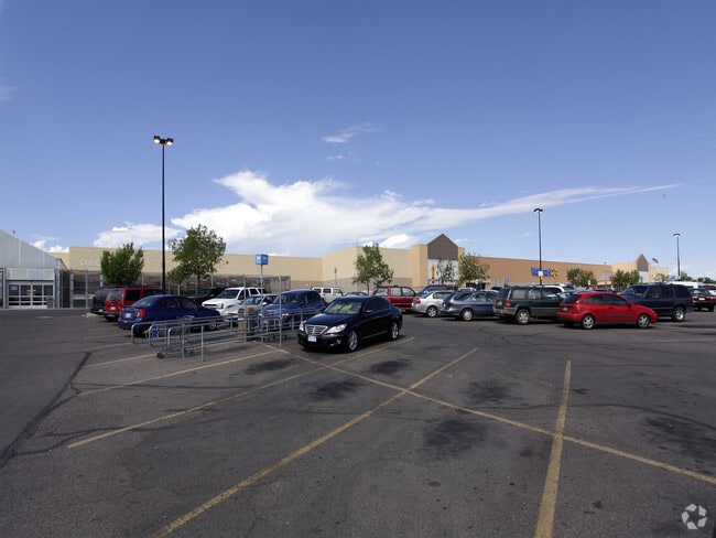
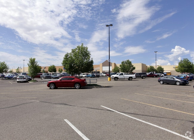
Property Record
4080 W Northern Ave, Pueblo, CO 81005
NEARBY LISTINGS FOR SALE OR LEASE
Property Detail
4080 W Northern Ave
Pueblo, CO
Com-Regency Bd
1-5-09-4-69-001
THAT POR OF LOT 1 BLK 1 PUEBLO METRO CENTER MALL FILING,NO 4 FORMERLY BEING A PART OF PUEBLO METRO CENTER MALL,FILING NO 2 FORMERLY #15-094-54-006
Commercialacreage
Pueblo
X
Colorado
08101C0706D
1
2024
13.48 AC
2024
Colorado East Area
002801
Other Market Areas
199,914 SF
DEMOGRAPHICS near 4080 W Northern Ave
1 Mile
3 Mile
5 Mile
2024 Total Population
13,713
53,271
78,014
2029 Population
13,998
54,499
79,855
Pop Growth 2024-2029
+ 2.08%
+ 2.31%
+ 2.36%
Average Age
42
41
41
2024 Total Households
5,479
22,102
32,105
HH Growth 2024-2029
+ 2.19%
+ 2.38%
+ 2.50%
Median Household Inc
$59,108
$53,878
$48,025
Avg Household Size
2.40
2.30
2.30
2024 Avg HH Vehicles
2.00
2.00
2.00
Median Home Value
$235,426
$231,648
$214,635
Median Year Built
1974
1965
1960
Nearby Places
Map Layers
Map Styles
 Street
 Aerial
- Restaurants
- Banks
- Shops
- Fitness
- Groceries
Nearby Properties
Address
Land Use
TOTAL SIZE
Lot Size
Zoning
Address
Land Use
TOTAL SIZE
Lot Size
Zoning
79,394 SF
5.57 AC
R5:RES/MUL
Address
Land Use
TOTAL SIZE
Lot Size
Zoning
40,986 SF
0.65 AC
R5:RES/MUL
Address
Land Use
TOTAL SIZE
Lot Size
Zoning
56,088 SF
4 AC
Address
Land Use
TOTAL SIZE
Lot Size
Zoning
33,866 SF
3.34 AC
Address
Land Use
TOTAL SIZE
Lot Size
Zoning
1,070,193 SF
43.08 AC
R5:RES/MUL
Address
Land Use
TOTAL SIZE
Lot Size
Zoning
45,219 SF
4.46 AC
Address
Land Use
TOTAL SIZE
Lot Size
Zoning
35,530 SF
0.55 AC
R-4
Address
Land Use
TOTAL SIZE
Lot Size
Zoning
19,763 SF
2.50 AC
R2:RES/1 F
Address
Land Use
TOTAL SIZE
Lot Size
Zoning
86,458 SF
20 AC
I3:IND/HEA
Address
Land Use
TOTAL SIZE
Lot Size
Zoning
136,337 SF
14.81 AC
PUD
Address
Land Use
TOTAL SIZE
Lot Size
Zoning
71,751 SF
2.73 AC
R3:RES/2 F
Address
Land Use
TOTAL SIZE
Lot Size
Zoning
12,150 SF
1.10 AC
Address
Land Use
TOTAL SIZE
Lot Size
Zoning
12,018 SF
0.76 AC
B2:COMM/SU
Address
Land Use
TOTAL SIZE
Lot Size
Zoning
93,055 SF
9 AC
PUD
Address
Land Use
TOTAL SIZE
Lot Size
Zoning
42,408 SF
5.97 AC
B1:COMM/NG
Address
Land Use
TOTAL SIZE
Lot Size
Zoning
81,140 SF
3.22 AC
Address
Land Use
TOTAL SIZE
Lot Size
Zoning
154,378 SF
14.33 AC
B4:COMM/RE
Address
Land Use
TOTAL SIZE
Lot Size
Zoning
54,947 SF
2.03 AC
B3:COMM/H&
Address
Land Use
TOTAL SIZE
Lot Size
Zoning
29,338 SF
0.89 AC
B-4
Address
Land Use
TOTAL SIZE
Lot Size
Zoning
12,600 SF
0.23 AC
I3:IND/HEA
Address
Land Use
TOTAL SIZE
Lot Size
Zoning
61,485 SF
2.39 AC
I3:IND/HEA
Address
Land Use
TOTAL SIZE
Lot Size
Zoning
83,900 SF
0.83 AC
B-3
Address
Land Use
TOTAL SIZE
Lot Size
Zoning
95,309 SF
8.74 AC
B4:COMM/RE
Address
Land Use
TOTAL SIZE
Lot Size
Zoning
76,149 SF
4.29 AC
B3:COMM/H&
Address
Land Use
TOTAL SIZE
Lot Size
Zoning
58,440 SF
4.42 AC
B-3
Address
Land Use
TOTAL SIZE
Lot Size
Zoning
54,628 SF
8.28 AC
Address
Land Use
TOTAL SIZE
Lot Size
Zoning
10,200 SF
0.60 AC
R-3
Address
Land Use
TOTAL SIZE
Lot Size
Zoning
25 SF
5.74 AC
B3:COMM/H&
Address
Land Use
TOTAL SIZE
Lot Size
Zoning
28,997 SF
3.40 AC
B-4
The World's #1 Commercial Real Estate Marketplace
Connect with us
© 2026 CoStar Group
The information above has been obtained from sources believed reliable. While we do not doubt its accuracy we have not verified it and make no guarantee, warranty or representation about it. It is your responsibility to independently confirm its accuracy and completeness. Any projections, opinions, assumptions, or estimates used are for example only and do not represent the current or future performance of the property. The value of this transaction to you depends on tax and other factors which should be evaluated by your tax, financial, and legal advisors. You and your advisors should conduct a careful, independent investigation of the property to determine to your satisfaction the suitability of the property for your needs.