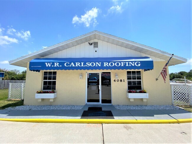
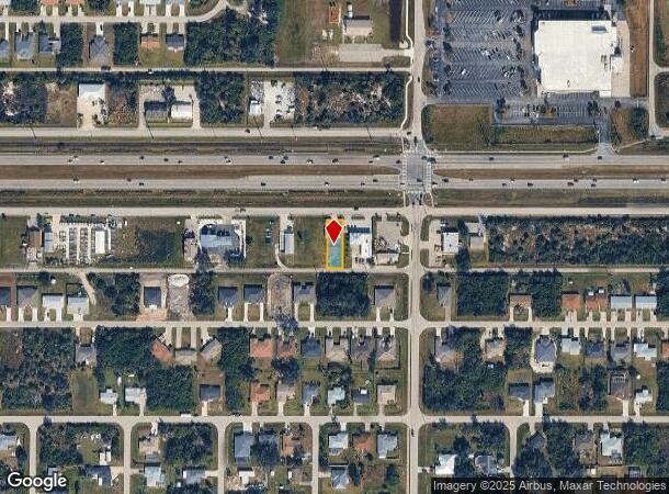
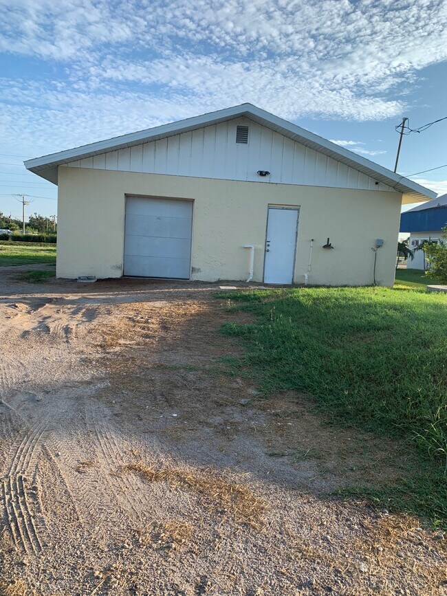
Property Record
4081 S Access Rd, Englewood, FL 34224
NEARBY LISTINGS FOR SALE OR LEASE
Property Detail
4081 S Access Rd
Punta Gorda, FL
Port Charlotte
412002478021
PORT CHARLOTTE SEC64 BLK3630 LT 31 603/690 753/1458 1016/1484 CD1024/1332 RE1037/2191 CD1583/1097 1695/516 2789/1919 3070/676 3328/577 3407/52 L/E3761/607 4024/1829 4802/1587
Commercialnec
Charlotte
X
Florida
12015C0192G
31
2024
0.17 AC
2025
Charlotte County
030201
Southwest Florida
1,500 SF
DEMOGRAPHICS near 4081 S Access Rd
1 Mile
3 Mile
5 Mile
2024 Total Population
4,709
26,983
55,577
2029 Population
5,599
32,581
67,473
Pop Growth 2024-2029
+ 18.90%
+ 20.75%
+ 21.40%
Average Age
49
56
57
2024 Total Households
2,131
12,838
26,997
HH Growth 2024-2029
+ 19.05%
+ 20.98%
+ 21.61%
Median Household Inc
$59,950
$55,782
$58,488
Avg Household Size
2.20
2.10
2.00
2024 Avg HH Vehicles
2.00
2.00
2.00
Median Home Value
$226,138
$248,277
$270,701
Median Year Built
1991
1993
1993
Nearby Places
- Restaurants
- Banks
- Shops
- Fitness
- Groceries
PUBLIC TRANSPORTATION
AIRPORT
Punta Gorda
DRIVE
WALK
Distance
Punta Gorda
40 min
23.7 mi
SALE & LEASE HISTORY
LISTING DATE
SALE/LEASE

Sep 18, 2023
For Lease
May 04, 2021
For Sale
Jul 13, 2021
For Lease
Nearby Properties
Address
Land Use
TOTAL SIZE
Lot Size
Zoning
Address
Land Use
TOTAL SIZE
Lot Size
Zoning
193,100 SF
26.30 AC
PD
Address
Land Use
TOTAL SIZE
Lot Size
Zoning
28,490 SF
172 AC
PKR
Address
Land Use
TOTAL SIZE
Lot Size
Zoning
91,934 SF
8.39 AC
PD
Address
Land Use
TOTAL SIZE
Lot Size
Zoning
107,736 SF
35.90 AC
RMF5
Address
Land Use
TOTAL SIZE
Lot Size
Zoning
27.65 AC
RMF15
Address
Land Use
TOTAL SIZE
Lot Size
Zoning
58,185 SF
3.40 AC
IG
Address
Land Use
TOTAL SIZE
Lot Size
Zoning
108,048 SF
14.84 AC
CG
Address
Land Use
TOTAL SIZE
Lot Size
Zoning
25,777 SF
12.18 AC
PD
Address
Land Use
TOTAL SIZE
Lot Size
Zoning
25,478 SF
11.06 AC
IG
Address
Land Use
TOTAL SIZE
Lot Size
Zoning
51,683 SF
7.16 AC
CG
Address
Land Use
TOTAL SIZE
Lot Size
Zoning
100,910 SF
22.85 AC
RSF3.5
Address
Land Use
TOTAL SIZE
Lot Size
Zoning
106,737 SF
20.80 AC
RMF5
Address
Land Use
TOTAL SIZE
Lot Size
Zoning
34.11 AC
CG
Address
Land Use
TOTAL SIZE
Lot Size
Zoning
33,047 SF
10.17 AC
PKR
Address
Land Use
TOTAL SIZE
Lot Size
Zoning
25,568 SF
2.73 AC
CG
Address
Land Use
TOTAL SIZE
Lot Size
Zoning
20.12 AC
CG
Address
Land Use
TOTAL SIZE
Lot Size
Zoning
24,708 SF
14.89 AC
CT
Address
Land Use
TOTAL SIZE
Lot Size
Zoning
38.14 AC
IG
Address
Land Use
TOTAL SIZE
Lot Size
Zoning
14,200 SF
2.26 AC
IG
Address
Land Use
TOTAL SIZE
Lot Size
Zoning
38.60 AC
PD
Address
Land Use
TOTAL SIZE
Lot Size
Zoning
26,248 SF
6.32 AC
PD
Address
Land Use
TOTAL SIZE
Lot Size
Zoning
11,509 SF
12.06 AC
RSF3.5
Address
Land Use
TOTAL SIZE
Lot Size
Zoning
14,482 SF
1.89 AC
CG
Address
Land Use
TOTAL SIZE
Lot Size
Zoning
15,190 SF
154.40 AC
RSF5
Address
Land Use
TOTAL SIZE
Lot Size
Zoning
21,180 SF
2.91 AC
CG
Address
Land Use
TOTAL SIZE
Lot Size
Zoning
27,650 SF
3 AC
IG
Address
Land Use
TOTAL SIZE
Lot Size
Zoning
30,620 SF
4.31 AC
IG
Address
Land Use
TOTAL SIZE
Lot Size
Zoning
23,927 SF
0.17 AC
CG
Address
Land Use
TOTAL SIZE
Lot Size
Zoning
5,222 SF
85.60 AC
RMF10
The World's #1 Commercial Real Estate Marketplace
Connect with us
© 2025 CoStar Group
The information above has been obtained from sources believed reliable. While we do not doubt its accuracy we have not verified it and make no guarantee, warranty or representation about it. It is your responsibility to independently confirm its accuracy and completeness. Any projections, opinions, assumptions, or estimates used are for example only and do not represent the current or future performance of the property. The value of this transaction to you depends on tax and other factors which should be evaluated by your tax, financial, and legal advisors. You and your advisors should conduct a careful, independent investigation of the property to determine to your satisfaction the suitability of the property for your needs.