Property Record
4081 S Frontage Rd, Pahrump, NV 89048


NEARBY LISTINGS FOR SALE OR LEASE
-
-
View all Pahrump listings for sale on LoopNet.com
Property Detail
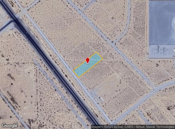
4081 S Frontage Rd
Pahrump, NV
Calvada Valley U.9B
37-291-10
T20S R54E S34 U.9B B.41 L.22 CALVADA VALLEY .766AC 33,351.289 SQ FT +/-
Commercialacreage
Nye
X
Nevada
32023C8845G
22
2024
0.77 AC
2025
Carson City/Nevada Area
9604011033
Other Market Areas
DEMOGRAPHICS near 4081 S Frontage Rd
1 Mile
3 Mile
5 Mile
2024 Total Population
1,527
8,147
18,362
2029 Population
1,826
9,712
21,577
Pop Growth 2024-2029
+ 19.58%
+ 19.21%
+ 17.51%
Average Age
56
52
50
2024 Total Households
742
3,599
7,859
HH Growth 2024-2029
+ 19.54%
+ 19.34%
+ 17.64%
Median Household Inc
$59,585
$71,424
$62,651
Avg Household Size
2.10
2.20
2.30
2024 Avg HH Vehicles
2.00
2.00
2.00
Median Home Value
$314,869
$316,294
$301,249
Median Year Built
2007
2006
2001
Nearby Places
Map Layers
Map Styles
 Street
 Aerial
- Restaurants
- Banks
- Shops
- Fitness
- Groceries
Nearby Properties
Address
Land Use
TOTAL SIZE
Lot Size
Zoning
Address
Land Use
TOTAL SIZE
Lot Size
Zoning
45,264 SF
280.67 AC
Address
Land Use
TOTAL SIZE
Lot Size
Zoning
16,945 SF
210.63 AC
Address
Land Use
TOTAL SIZE
Lot Size
Zoning
54,979 SF
11.54 AC
SP
Address
Land Use
TOTAL SIZE
Lot Size
Zoning
1 AC
GC
Address
Land Use
TOTAL SIZE
Lot Size
Zoning
635.76 AC
R
Address
Land Use
TOTAL SIZE
Lot Size
Zoning
53,707 SF
4.55 AC
Address
Land Use
TOTAL SIZE
Lot Size
Zoning
2.22 AC
LI
Address
Land Use
TOTAL SIZE
Lot Size
Zoning
20,398 SF
4.02 AC
SP
Address
Land Use
TOTAL SIZE
Lot Size
Zoning
12,806 SF
5.39 AC
SP
Address
Land Use
TOTAL SIZE
Lot Size
Zoning
0.46 AC
GC
Address
Land Use
TOTAL SIZE
Lot Size
Zoning
10 SF
1.08 AC
SP
Address
Land Use
TOTAL SIZE
Lot Size
Zoning
24.39 AC
VR-20
Address
Land Use
TOTAL SIZE
Lot Size
Zoning
8,737 SF
1.10 AC
MU
Address
Land Use
TOTAL SIZE
Lot Size
Zoning
8,737 SF
1.10 AC
MU
Address
Land Use
TOTAL SIZE
Lot Size
Zoning
1,552 SF
190 AC
Address
Land Use
TOTAL SIZE
Lot Size
Zoning
274.43 AC
R
Address
Land Use
TOTAL SIZE
Lot Size
Zoning
15,400 SF
3.79 AC
NC
Address
Land Use
TOTAL SIZE
Lot Size
Zoning
2.69 AC
Address
Land Use
TOTAL SIZE
Lot Size
Zoning
18,266 SF
5 AC
CM
Address
Land Use
TOTAL SIZE
Lot Size
Zoning
15,000 SF
2.73 AC
Address
Land Use
TOTAL SIZE
Lot Size
Zoning
660.85 AC
R
Address
Land Use
TOTAL SIZE
Lot Size
Zoning
195.93 AC
Address
Land Use
TOTAL SIZE
Lot Size
Zoning
8,876 SF
1.25 AC
MU
Address
Land Use
TOTAL SIZE
Lot Size
Zoning
3,600 SF
45.33 AC
R
Address
Land Use
TOTAL SIZE
Lot Size
Zoning
6.64 AC
GC
Address
Land Use
TOTAL SIZE
Lot Size
Zoning
4,800 SF
2 AC
NC
Address
Land Use
TOTAL SIZE
Lot Size
Zoning
120 AC
SPLIT
Address
Land Use
TOTAL SIZE
Lot Size
Zoning
12,513 SF
32.40 AC
VR-20
Address
Land Use
TOTAL SIZE
Lot Size
Zoning
Address
Land Use
TOTAL SIZE
Lot Size
Zoning
6,672 SF
1.68 AC
SP
The World's #1 Commercial Real Estate Marketplace
Connect with us
© 2025 CoStar Group
The information above has been obtained from sources believed reliable. While we do not doubt its accuracy we have not verified it and make no guarantee, warranty or representation about it. It is your responsibility to independently confirm its accuracy and completeness. Any projections, opinions, assumptions, or estimates used are for example only and do not represent the current or future performance of the property. The value of this transaction to you depends on tax and other factors which should be evaluated by your tax, financial, and legal advisors. You and your advisors should conduct a careful, independent investigation of the property to determine to your satisfaction the suitability of the property for your needs.