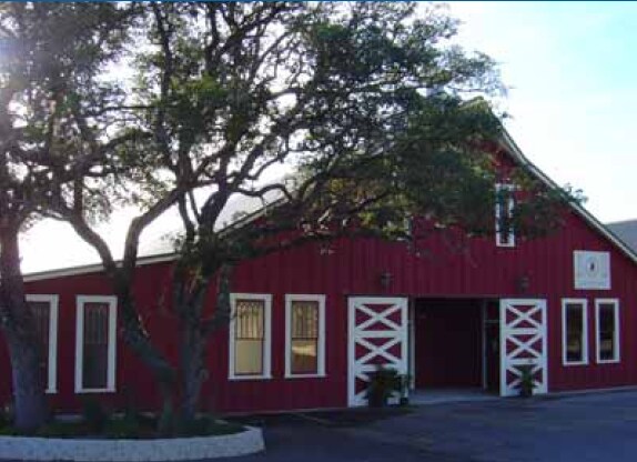
Property Record
40895 Interstate 10 W, Boerne, TX 78006


NEARBY LISTINGS FOR SALE OR LEASE
Property Detail
40895 Interstate 10 W
San Antonio-New Braunfels, TX
Survey 174 N Flores
12909
Kendall
Residentialnec
Texas
A
31.45 AC
48259C0400G
Kendall County
1,080 SF
San Antonio
DEMOGRAPHICS near 40895 Interstate 10 W
1 Mile
3 Mile
5 Mile
2024 Total Population
43
4,053
17,776
2029 Population
53
5,007
22,123
Pop Growth 2024-2029
+ 23.26%
+ 23.54%
+ 24.45%
Average Age
49
46
43
2024 Total Households
16
1,581
6,915
HH Growth 2024-2029
+ 25.00%
+ 23.97%
+ 24.92%
Median Household Inc
$137,500
$110,168
$89,737
Avg Household Size
2.40
2.60
2.50
2024 Avg HH Vehicles
3.00
2.00
2.00
Median Home Value
$483,333
$407,609
$381,313
Median Year Built
1994
1993
1998
Nearby Places
Map Layers
Map Styles
 Street
 Aerial
- Restaurants
- Banks
- Shops
- Fitness
- Groceries
PUBLIC TRANSPORTATION
AIRPORT
San Antonio International
DRIVE
WALK
Distance
San Antonio International
42 min
33.5 mi
Freight Ports
Calhoun Port
DRIVE
WALK
Distance
Calhoun Port
220 min
185.1 mi
Nearby Properties
Address
Land Use
TOTAL SIZE
Lot Size
Zoning
Address
Land Use
TOTAL SIZE
Lot Size
Zoning
4,080 SF
302.27 AC
Address
Land Use
TOTAL SIZE
Lot Size
Zoning
86,137 SF
Address
Land Use
TOTAL SIZE
Lot Size
Zoning
128,730 SF
Address
Land Use
TOTAL SIZE
Lot Size
Zoning
90,229 SF
13.38 AC
Address
Land Use
TOTAL SIZE
Lot Size
Zoning
31,678 SF
30 AC
Address
Land Use
TOTAL SIZE
Lot Size
Zoning
14,144 SF
12.25 AC
Address
Land Use
TOTAL SIZE
Lot Size
Zoning
91,270 SF
6.74 AC
Address
Land Use
TOTAL SIZE
Lot Size
Zoning
Address
Land Use
TOTAL SIZE
Lot Size
Zoning
7.35 AC
Address
Land Use
TOTAL SIZE
Lot Size
Zoning
12,393 SF
2.52 AC
Address
Land Use
TOTAL SIZE
Lot Size
Zoning
77,640 SF
3.52 AC
Address
Land Use
TOTAL SIZE
Lot Size
Zoning
53,650 SF
1.77 AC
Address
Land Use
TOTAL SIZE
Lot Size
Zoning
38,570 SF
Address
Land Use
TOTAL SIZE
Lot Size
Zoning
11,179 SF
1.37 AC
Address
Land Use
TOTAL SIZE
Lot Size
Zoning
7.10 AC
Address
Land Use
TOTAL SIZE
Lot Size
Zoning
4.01 AC
Address
Land Use
TOTAL SIZE
Lot Size
Zoning
37,882 SF
6.87 AC
Address
Land Use
TOTAL SIZE
Lot Size
Zoning
10,391 SF
91.99 AC
Address
Land Use
TOTAL SIZE
Lot Size
Zoning
16,524 SF
2.37 AC
Address
Land Use
TOTAL SIZE
Lot Size
Zoning
22,344 SF
5.48 AC
Address
Land Use
TOTAL SIZE
Lot Size
Zoning
7,930 SF
12.81 AC
Address
Land Use
TOTAL SIZE
Lot Size
Zoning
22,860 SF
3.10 AC
Address
Land Use
TOTAL SIZE
Lot Size
Zoning
39,450 SF
10.47 AC
Address
Land Use
TOTAL SIZE
Lot Size
Zoning
Address
Land Use
TOTAL SIZE
Lot Size
Zoning
10,000 SF
2.05 AC
Address
Land Use
TOTAL SIZE
Lot Size
Zoning
4,936 SF
1.03 AC
Address
Land Use
TOTAL SIZE
Lot Size
Zoning
18,000 SF
1.43 AC
Address
Land Use
TOTAL SIZE
Lot Size
Zoning
5,445 SF
2.06 AC
Address
Land Use
TOTAL SIZE
Lot Size
Zoning
15,200 SF
2.35 AC
Address
Land Use
TOTAL SIZE
Lot Size
Zoning
25,000 SF
2.42 AC
The World's #1 Commercial Real Estate Marketplace
Connect with us
© 2025 CoStar Group
The information above has been obtained from sources believed reliable. While we do not doubt its accuracy we have not verified it and make no guarantee, warranty or representation about it. It is your responsibility to independently confirm its accuracy and completeness. Any projections, opinions, assumptions, or estimates used are for example only and do not represent the current or future performance of the property. The value of this transaction to you depends on tax and other factors which should be evaluated by your tax, financial, and legal advisors. You and your advisors should conduct a careful, independent investigation of the property to determine to your satisfaction the suitability of the property for your needs.