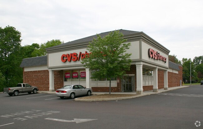
Property Record
409 Harleysville Pike, Souderton, PA 18964

NEARBY LISTINGS FOR SALE OR LEASE
Property Detail
409 Harleysville Pike
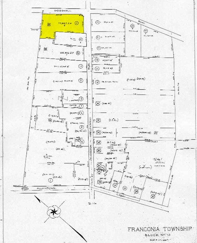
34-00-02215-001
191 X IRR 77847 SF
Storemultistory
Montgomery
X
Pennsylvania
42091C0136G
2
2024
1.79 AC
2025
West Montgomery County
207101
Philadelphia
10,465 SF
Philadelphia-Camden-Wilmington, PA-NJ-DE-MD
DEMOGRAPHICS near 409 Harleysville Pike
1 Mile
3 Mile
5 Mile
2024 Total Population
2,797
37,898
90,016
2029 Population
2,823
38,507
91,114
Pop Growth 2024-2029
+ 0.93%
+ 1.61%
+ 1.22%
Average Age
44
43
43
2024 Total Households
995
14,556
34,509
HH Growth 2024-2029
+ 0.90%
+ 1.55%
+ 1.14%
Median Household Inc
$104,500
$95,620
$100,859
Avg Household Size
2.70
2.50
2.50
2024 Avg HH Vehicles
2.00
2.00
2.00
Median Home Value
$378,989
$341,938
$363,248
Median Year Built
1973
1977
1981
Nearby Places
Map Layers
Map Styles
 Street
 Aerial
- Restaurants
- Banks
- Shops
- Fitness
- Groceries
PUBLIC TRANSPORTATION
COMMUTER RAIL
Fortuna (R5 - Southeastern Pennsylvania Transportation Authority Regional Rail (SEPTA Regional Rail))
DRIVE
WALK
Distance
Fortuna (R5 - Southeastern Pennsylvania Transportation Authority Regional Rail (SEPTA Regional Rail))
13 min
6.0 mi
Lansdale (R5 - Southeastern Pennsylvania Transportation Authority Regional Rail (SEPTA Regional Rail))
DRIVE
WALK
Distance
Lansdale (R5 - Southeastern Pennsylvania Transportation Authority Regional Rail (SEPTA Regional Rail))
14 min
6.9 mi
AIRPORT
Lehigh Valley International
DRIVE
WALK
Distance
Lehigh Valley International
50 min
28.5 mi
Philadelphia International
DRIVE
WALK
Distance
Philadelphia International
61 min
41.8 mi
Trenton Mercer
DRIVE
WALK
Distance
Trenton Mercer
67 min
49.3 mi
Freight Ports
Port of Philadelphia
DRIVE
WALK
Distance
Port of Philadelphia
55 min
30.5 mi
Nearby Properties
Address
Land Use
TOTAL SIZE
Lot Size
Zoning
Address
Land Use
TOTAL SIZE
Lot Size
Zoning
437,908 SF
104.29 AC
INST
Address
Land Use
TOTAL SIZE
Lot Size
Zoning
677,546 SF
92.50 AC
INST
Address
Land Use
TOTAL SIZE
Lot Size
Zoning
412,306 SF
40.91 AC
I
Address
Land Use
TOTAL SIZE
Lot Size
Zoning
139,733 SF
46.65 AC
R130
Address
Land Use
TOTAL SIZE
Lot Size
Zoning
152,085 SF
38.16 AC
INST
Address
Land Use
TOTAL SIZE
Lot Size
Zoning
149,259 SF
4.30 AC
R3
Address
Land Use
TOTAL SIZE
Lot Size
Zoning
324,796 SF
42.20 AC
LI
Address
Land Use
TOTAL SIZE
Lot Size
Zoning
156,186 SF
31.41 AC
R1
Address
Land Use
TOTAL SIZE
Lot Size
Zoning
136,281 SF
4.05 AC
R3
Address
Land Use
TOTAL SIZE
Lot Size
Zoning
52,348 SF
21.30 AC
R5
Address
Land Use
TOTAL SIZE
Lot Size
Zoning
216,372 SF
18.46 AC
INST
Address
Land Use
TOTAL SIZE
Lot Size
Zoning
84,887 SF
38.07 AC
INST
Address
Land Use
TOTAL SIZE
Lot Size
Zoning
35.37 AC
LI
Address
Land Use
TOTAL SIZE
Lot Size
Zoning
184,471 SF
0.80 AC
INST
Address
Land Use
TOTAL SIZE
Lot Size
Zoning
112,282 SF
11.23 AC
R5
Address
Land Use
TOTAL SIZE
Lot Size
Zoning
94,598 SF
27.72 AC
INST
Address
Land Use
TOTAL SIZE
Lot Size
Zoning
90,053 SF
24.28 AC
LI
Address
Land Use
TOTAL SIZE
Lot Size
Zoning
77,878 SF
17.60 AC
INST
Address
Land Use
TOTAL SIZE
Lot Size
Zoning
176,700 SF
16.03 AC
LI
Address
Land Use
TOTAL SIZE
Lot Size
Zoning
96,305 SF
3.02 AC
Address
Land Use
TOTAL SIZE
Lot Size
Zoning
95,494 SF
13.67 AC
C
Address
Land Use
TOTAL SIZE
Lot Size
Zoning
60,470 SF
14.60 AC
ER
Address
Land Use
TOTAL SIZE
Lot Size
Zoning
85,508 SF
25.83 AC
Address
Land Use
TOTAL SIZE
Lot Size
Zoning
54,212 SF
18.38 AC
RR
Address
Land Use
TOTAL SIZE
Lot Size
Zoning
9.46 AC
LI
Address
Land Use
TOTAL SIZE
Lot Size
Zoning
237,667 SF
37.86 AC
LI
Address
Land Use
TOTAL SIZE
Lot Size
Zoning
9.46 AC
LI
Address
Land Use
TOTAL SIZE
Lot Size
Zoning
140,008 SF
10.25 AC
C
Address
Land Use
TOTAL SIZE
Lot Size
Zoning
63,183 SF
23.05 AC
INST
Address
Land Use
TOTAL SIZE
Lot Size
Zoning
90,211 SF
1.38 AC
C
The World's #1 Commercial Real Estate Marketplace
Connect with us
© 2026 CoStar Group
The information above has been obtained from sources believed reliable. While we do not doubt its accuracy we have not verified it and make no guarantee, warranty or representation about it. It is your responsibility to independently confirm its accuracy and completeness. Any projections, opinions, assumptions, or estimates used are for example only and do not represent the current or future performance of the property. The value of this transaction to you depends on tax and other factors which should be evaluated by your tax, financial, and legal advisors. You and your advisors should conduct a careful, independent investigation of the property to determine to your satisfaction the suitability of the property for your needs.