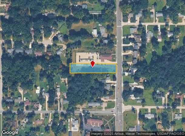
Property Record
4092 Darrow Rd, Stow, OH 44224

NEARBY LISTINGS FOR SALE OR LEASE
Property Detail
4092 Darrow Rd
Akron, OH
Moyer Acs
56-04510
LOT 55 SUB 1 MOYER ACS DARROW RD 1.040A AUD#11255
Religious
Summit
X
Ohio
39153C0137F
55
2023
0.93 AC
2025
Akron
530604
Cleveland
DEMOGRAPHICS near 4092 Darrow Rd
1 mile
3 mile
5 mile
2024 Total Population
7,946
56,350
129,988
2029 Population
7,833
55,865
129,007
Pop Growth 2024-2029
(1.42%)
(0.86%)
(0.75%)
Average Age
42
42
42
2024 Total Households
3,296
24,038
56,129
HH Growth 2024-2029
(1.43%)
(0.84%)
(0.80%)
Median Household Inc
$81,233
$76,570
$72,896
Avg Household Size
2.30
2.30
2.20
2024 Avg HH Vehicles
2.00
2.00
2.00
Median Home Value
$192,592
$204,131
$197,509
Median Year Built
1966
1974
1970
Nearby Places
Map Layers
Map Styles
 Street
 Aerial
Transit
 Traffic
 Biking
Places
Listings with unknown addresses are not visible on the map
- Restaurants
- Banks
- Shops
- Fitness
- Groceries
PUBLIC TRANSPORTATION
COMMUTER RAIL
Big Bend (National Park Scenic Railway - Cuyahoga Valley Scenic Railroad)
Drive
Walk
Distance
Big Bend (National Park Scenic Railway - Cuyahoga Valley Scenic Railroad)
19 min
8.2 mi
Botzum (National Park Scenic Railway - Cuyahoga Valley Scenic Railroad)
Drive
Walk
Distance
Botzum (National Park Scenic Railway - Cuyahoga Valley Scenic Railroad)
20 min
9.9 mi
AIRPORT
Akron-Canton Regional
Drive
Walk
Distance
Akron-Canton Regional
32 min
22.1 mi
Cleveland-Hopkins International
Drive
Walk
Distance
Cleveland-Hopkins International
52 min
37.1 mi
Freight Ports
Port of Toledo
Drive
Walk
Distance
Port of Toledo
155 min
131.6 mi
Nearby Properties
Address
Land Use
TOTAL SIZE
Lot Size
Zoning
Address
Land Use
TOTAL SIZE
Lot Size
Zoning
342,850 SF
86.98 AC
Address
Land Use
TOTAL SIZE
Lot Size
Zoning
Address
Land Use
TOTAL SIZE
Lot Size
Zoning
57,908 SF
6.36 AC
Address
Land Use
TOTAL SIZE
Lot Size
Zoning
64,501 SF
175.97 AC
Address
Land Use
TOTAL SIZE
Lot Size
Zoning
297,758 SF
23.28 AC
Address
Land Use
TOTAL SIZE
Lot Size
Zoning
1,302,677 SF
121.15 AC
Address
Land Use
TOTAL SIZE
Lot Size
Zoning
52,646 SF
69.69 AC
Address
Land Use
TOTAL SIZE
Lot Size
Zoning
278,319 SF
34.50 AC
Address
Land Use
TOTAL SIZE
Lot Size
Zoning
214,120 SF
14.64 AC
Address
Land Use
TOTAL SIZE
Lot Size
Zoning
15.41 AC
Address
Land Use
TOTAL SIZE
Lot Size
Zoning
118,740 SF
15.25 AC
Address
Land Use
TOTAL SIZE
Lot Size
Zoning
145,844 SF
9.80 AC
Address
Land Use
TOTAL SIZE
Lot Size
Zoning
Address
Land Use
TOTAL SIZE
Lot Size
Zoning
84,500 SF
8.14 AC
Address
Land Use
TOTAL SIZE
Lot Size
Zoning
625,640 SF
45.31 AC
Address
Land Use
TOTAL SIZE
Lot Size
Zoning
17,731 SF
216.50 AC
Address
Land Use
TOTAL SIZE
Lot Size
Zoning
Address
Land Use
TOTAL SIZE
Lot Size
Zoning
157,827 SF
26.63 AC
Address
Land Use
TOTAL SIZE
Lot Size
Zoning
90,820 SF
23.72 AC
Address
Land Use
TOTAL SIZE
Lot Size
Zoning
165,600 SF
11.21 AC
Address
Land Use
TOTAL SIZE
Lot Size
Zoning
78,446 SF
18.02 AC
Address
Land Use
TOTAL SIZE
Lot Size
Zoning
68,855 SF
32.57 AC
Address
Land Use
TOTAL SIZE
Lot Size
Zoning
136,220 SF
33 AC
Address
Land Use
TOTAL SIZE
Lot Size
Zoning
140,288 SF
19.51 AC
Address
Land Use
TOTAL SIZE
Lot Size
Zoning
26,231 SF
14.40 AC
Address
Land Use
TOTAL SIZE
Lot Size
Zoning
90,512 SF
9.53 AC
Address
Land Use
TOTAL SIZE
Lot Size
Zoning
118,516 SF
22.07 AC
Address
Land Use
TOTAL SIZE
Lot Size
Zoning
21.80 AC
Address
Land Use
TOTAL SIZE
Lot Size
Zoning
12.94 AC
Address
Land Use
TOTAL SIZE
Lot Size
Zoning
The World's #1 Commercial Real Estate Marketplace
Connect with us
© 2026 CoStar Group
The information above has been obtained from sources believed reliable. While we do not doubt its accuracy we have not verified it and make no guarantee, warranty or representation about it. It is your responsibility to independently confirm its accuracy and completeness. Any projections, opinions, assumptions, or estimates used are for example only and do not represent the current or future performance of the property. The value of this transaction to you depends on tax and other factors which should be evaluated by your tax, financial, and legal advisors. You and your advisors should conduct a careful, independent investigation of the property to determine to your satisfaction the suitability of the property for your needs.