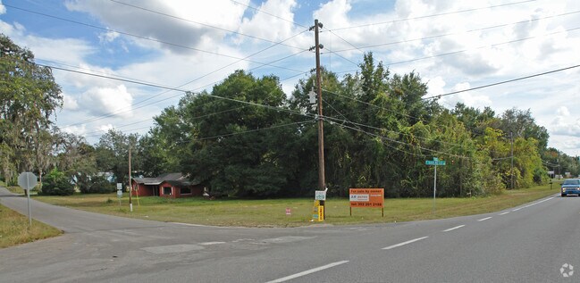
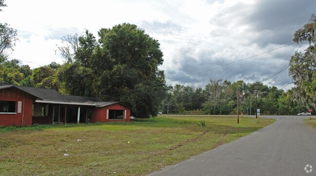
Property Record
4094 E Van Ness Rd, Hernando, FL 34442

Property Detail
4094 E Van Ness Rd
19E-18S-36-0020-000N0-0010
HERNANDO CITY HGTS PB 103 PG 1284 LOTS 1 2 3 4 5 6 7 8 9 & 10 BLK N
Commercialacreage
CITRUS
GNC
Florida
AE The base floodplain where base flood elevations are provided. AE Zones are now used on new format FIRMs instead of A1-A30 Zones.
1
2024
1.55 AC
2025
Florida Central North Area
450104
Other Market Areas
1,583 SF
Homosassa Springs, FL
NEARBY LISTINGS FOR SALE OR LEASE
DEMOGRAPHICS near 4094 E Van Ness Rd
1 mile
3 mile
5 mile
2025 Total Population
1,971
14,666
35,389
2030 Population
2,153
16,031
38,585
Pop Growth 2025-2030
+ 9.23%
+ 9.31%
+ 9.03%
Average Age
47
49
51
2025 Total Households
847
6,619
16,291
HH Growth 2025-2030
+ 9.45%
+ 9.50%
+ 9.23%
Median Household Inc
$43,833
$53,950
$54,621
Avg Household Size
2.20
2.20
2.10
2025 Avg HH Vehicles
2.00
2.00
2.00
Median Home Value
$193,146
$243,813
$288,560
Median Year Built
1990
1992
1989
Nearby Places
Map Layers
Map Styles
 Street
 Aerial
Transit
 Traffic
 Biking
Places
Listings with unknown addresses are not visible on the map
- Restaurants
- Banks
- Shops
- Fitness
- Groceries
Nearby Properties
Address
Land Use
TOTAL SIZE
Lot Size
Zoning
Address
Land Use
TOTAL SIZE
Lot Size
Zoning
3,088,386 SF
35.29 AC
GNC
Address
Land Use
TOTAL SIZE
Lot Size
Zoning
316,654 SF
16.13 AC
GNC
Address
Land Use
TOTAL SIZE
Lot Size
Zoning
84,611 SF
33.22 AC
PSI
Address
Land Use
TOTAL SIZE
Lot Size
Zoning
273,301 SF
20.99 AC
GNC
Address
Land Use
TOTAL SIZE
Lot Size
Zoning
32,920 SF
20.03 AC
PSP
Address
Land Use
TOTAL SIZE
Lot Size
Zoning
162,123 SF
10.82 AC
C
Address
Land Use
TOTAL SIZE
Lot Size
Zoning
271,131 SF
6.34 AC
GNC
Address
Land Use
TOTAL SIZE
Lot Size
Zoning
119,399 SF
4.77 AC
GNC
Address
Land Use
TOTAL SIZE
Lot Size
Zoning
74,320 SF
4.51 AC
GNC
Address
Land Use
TOTAL SIZE
Lot Size
Zoning
40,648 SF
4.85 AC
GNC
Address
Land Use
TOTAL SIZE
Lot Size
Zoning
18,114 SF
9.11 AC
GNC
Address
Land Use
TOTAL SIZE
Lot Size
Zoning
31,008 SF
1.85 AC
GNC
Address
Land Use
TOTAL SIZE
Lot Size
Zoning
728 SF
14.64 AC
MHP
Address
Land Use
TOTAL SIZE
Lot Size
Zoning
24,600 SF
1.64 AC
LDR
Address
Land Use
TOTAL SIZE
Lot Size
Zoning
84,300 SF
4.54 AC
GNC
Address
Land Use
TOTAL SIZE
Lot Size
Zoning
46,900 SF
2.04 AC
GNC
Address
Land Use
TOTAL SIZE
Lot Size
Zoning
10,038 SF
1.65 AC
GNC
Address
Land Use
TOTAL SIZE
Lot Size
Zoning
58,148 SF
5.60 AC
IM
Address
Land Use
TOTAL SIZE
Lot Size
Zoning
31,709 SF
3.15 AC
GNC
Address
Land Use
TOTAL SIZE
Lot Size
Zoning
42,640 SF
5.04 AC
GNC
Address
Land Use
TOTAL SIZE
Lot Size
Zoning
17,008 SF
5.07 AC
LDRMH
Address
Land Use
TOTAL SIZE
Lot Size
Zoning
28,222 SF
15.81 AC
LDRMH
Address
Land Use
TOTAL SIZE
Lot Size
Zoning
9,963 SF
1.98 AC
GNC
Address
Land Use
TOTAL SIZE
Lot Size
Zoning
11,544 SF
1.37 AC
GNC
Address
Land Use
TOTAL SIZE
Lot Size
Zoning
28,078 SF
3.48 AC
GNC
Address
Land Use
TOTAL SIZE
Lot Size
Zoning
6,118 SF
1.25 AC
GNC
Address
Land Use
TOTAL SIZE
Lot Size
Zoning
3,914 SF
5.02 AC
CLR
Address
Land Use
TOTAL SIZE
Lot Size
Zoning
31,200 SF
3.58 AC
GNC
Address
Land Use
TOTAL SIZE
Lot Size
Zoning
3,149 SF
1.23 AC
GNC
Address
Land Use
TOTAL SIZE
Lot Size
Zoning
18,922 SF
1.82 AC
GNC
The World's #1 Commercial Real Estate Marketplace
Connect with us
© 2026 CoStar Group
The information above has been obtained from sources believed reliable. While we do not doubt its accuracy we have not verified it and make no guarantee, warranty or representation about it. It is your responsibility to independently confirm its accuracy and completeness. Any projections, opinions, assumptions, or estimates used are for example only and do not represent the current or future performance of the property. The value of this transaction to you depends on tax and other factors which should be evaluated by your tax, financial, and legal advisors. You and your advisors should conduct a careful, independent investigation of the property to determine to your satisfaction the suitability of the property for your needs.