Property Record
4097 Rosemeade Pky, Dallas, TX 75287
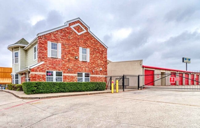


Property Detail
4097 Rosemeade Pky
R-3439-00P-001A-1
LEE ANN SUBDIVISION, BLK P/8740, LOT 1A
Commercialnec
Collin
PD-165
Texas
B and X Area of moderate flood hazard, usually the area between the limits of the 100-year and 500-year floods.
1a
2025
3.31 AC
2025
Upper Tollway/West Plano
031722
Dallas/Ft Worth
100,900 SF
Dallas-Fort Worth-Arlington, TX
NEARBY LISTINGS FOR SALE OR LEASE
-
-
View all Dallas listings for sale on LoopNet.com
DEMOGRAPHICS near 4097 Rosemeade Pky
1 mile
3 mile
5 mile
2025 Total Population
23,346
152,999
380,226
2030 Population
26,244
170,078
417,446
Pop Growth 2025-2030
+ 12.41%
+ 11.16%
+ 9.79%
Average Age
37
40
40
2025 Total Households
12,094
70,454
168,581
HH Growth 2025-2030
+ 12.60%
+ 11.43%
+ 9.95%
Median Household Inc
$67,244
$87,247
$95,141
Avg Household Size
1.90
2.10
2.20
2025 Avg HH Vehicles
1.00
2.00
2.00
Median Home Value
$457,391
$494,951
$503,425
Median Year Built
1989
1989
1990
Nearby Places
Map Layers
Map Styles
 Street
 Aerial
Transit
 Traffic
 Biking
Places
Listings with unknown addresses are not visible on the map
- Restaurants
- Banks
- Shops
- Fitness
- Groceries
PUBLIC TRANSPORTATION
COMMUTER RAIL
Trinity Mills Station (Green Line - Dallas Area Rapid Transit (DART))
Drive
Walk
Distance
Trinity Mills Station (Green Line - Dallas Area Rapid Transit (DART))
10 min
6.5 mi
AIRPORT
Dallas Love Field
Drive
Walk
Distance
Dallas Love Field
24 min
16.0 mi
Dallas-Fort Worth International
Drive
Walk
Distance
Dallas-Fort Worth International
24 min
19.1 mi
Nearby Properties
Address
Land Use
TOTAL SIZE
Lot Size
Zoning
Address
Land Use
TOTAL SIZE
Lot Size
Zoning
542,570 SF
75.67 AC
Address
Land Use
TOTAL SIZE
Lot Size
Zoning
343,539 SF
34.74 AC
S-164
Address
Land Use
TOTAL SIZE
Lot Size
Zoning
719,177 SF
27.02 AC
O-2
Address
Land Use
TOTAL SIZE
Lot Size
Zoning
526,509 SF
135.02 AC
Address
Land Use
TOTAL SIZE
Lot Size
Zoning
615,249 SF
16.17 AC
COMM
Address
Land Use
TOTAL SIZE
Lot Size
Zoning
481,366 SF
6.31 AC
LC
Address
Land Use
TOTAL SIZE
Lot Size
Zoning
545,224 SF
42.80 AC
Address
Land Use
TOTAL SIZE
Lot Size
Zoning
417,990 SF
10.42 AC
Address
Land Use
TOTAL SIZE
Lot Size
Zoning
429,576 SF
22.03 AC
Z236
Address
Land Use
TOTAL SIZE
Lot Size
Zoning
482,025 SF
11.73 AC
LC
Address
Land Use
TOTAL SIZE
Lot Size
Zoning
561,142 SF
4.64 AC
MU-2
Address
Land Use
TOTAL SIZE
Lot Size
Zoning
384,424 SF
377.56 AC
Z119
Address
Land Use
TOTAL SIZE
Lot Size
Zoning
517,362 SF
23.61 AC
MF-2
Address
Land Use
TOTAL SIZE
Lot Size
Zoning
396,669 SF
18.50 AC
Address
Land Use
TOTAL SIZE
Lot Size
Zoning
245,542 SF
26.31 AC
RT/O-M
Address
Land Use
TOTAL SIZE
Lot Size
Zoning
462,888 SF
20.17 AC
Address
Land Use
TOTAL SIZE
Lot Size
Zoning
366,470 SF
31.19 AC
LC
Address
Land Use
TOTAL SIZE
Lot Size
Zoning
434,639 SF
16.20 AC
Address
Land Use
TOTAL SIZE
Lot Size
Zoning
255,627 SF
14.79 AC
Z123
Address
Land Use
TOTAL SIZE
Lot Size
Zoning
254,691 SF
7.87 AC
RC
Address
Land Use
TOTAL SIZE
Lot Size
Zoning
239,913 SF
10.36 AC
RC
Address
Land Use
TOTAL SIZE
Lot Size
Zoning
387,098 SF
18.40 AC
MF-29
Address
Land Use
TOTAL SIZE
Lot Size
Zoning
239,384 SF
5.52 AC
RE
Address
Land Use
TOTAL SIZE
Lot Size
Zoning
580,201 SF
16.66 AC
Address
Land Use
TOTAL SIZE
Lot Size
Zoning
344,276 SF
23.02 AC
MF-M
Address
Land Use
TOTAL SIZE
Lot Size
Zoning
179,740 SF
2.65 AC
Address
Land Use
TOTAL SIZE
Lot Size
Zoning
341,480 SF
15.04 AC
MU-2
Address
Land Use
TOTAL SIZE
Lot Size
Zoning
287,002 SF
9.61 AC
Address
Land Use
TOTAL SIZE
Lot Size
Zoning
338,886 SF
18.82 AC
PD-165
Address
Land Use
TOTAL SIZE
Lot Size
Zoning
341,474 SF
17.35 AC
MF-H
The World's #1 Commercial Real Estate Marketplace
Connect with us
© 2026 CoStar Group
The information above has been obtained from sources believed reliable. While we do not doubt its accuracy we have not verified it and make no guarantee, warranty or representation about it. It is your responsibility to independently confirm its accuracy and completeness. Any projections, opinions, assumptions, or estimates used are for example only and do not represent the current or future performance of the property. The value of this transaction to you depends on tax and other factors which should be evaluated by your tax, financial, and legal advisors. You and your advisors should conduct a careful, independent investigation of the property to determine to your satisfaction the suitability of the property for your needs.