Property Record
3475 Thruston Dermont Rd, Owensboro, KY 42303
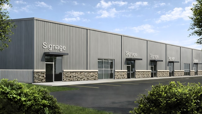

Current Lease Availabilities
Property Detail
3475 Thruston Dermont Rd
074-00-00-180-00-000
3475 THRUSTON DERMONT RD
Taxexempt
DAVIESS
B and X Area of moderate flood hazard, usually the area between the limits of the 100-year and 500-year floods.
Kentucky
0
10.50 AC
2025
Kentucky West Area
001401
Other Market Areas
4,268 SF
Owensboro, KY
NEARBY LISTINGS FOR SALE OR LEASE
DEMOGRAPHICS near 3475 Thruston Dermont Rd
1 mile
3 mile
5 mile
2025 Total Population
5,712
24,455
58,139
2030 Population
5,791
24,869
59,211
Pop Growth 2025-2030
+ 1.38%
+ 1.69%
+ 1.84%
Average Age
42
41
40
2025 Total Households
2,215
9,611
23,236
HH Growth 2025-2030
+ 1.44%
+ 1.79%
+ 1.92%
Median Household Inc
$94,907
$68,845
$61,690
Avg Household Size
2.60
2.40
2.40
2025 Avg HH Vehicles
2.00
2.00
2.00
Median Home Value
$274,038
$240,703
$210,627
Median Year Built
1996
1987
1974
Nearby Places
Map Layers
Map Styles
 Street
 Aerial
Layers
 Traffic
 Biking
Places
Listings with unknown addresses are not visible on the map
- Restaurants
- Banks
- Shops
- Fitness
- Groceries
Nearby Properties
Address
Land Use
TOTAL SIZE
Lot Size
Zoning
Address
Land Use
TOTAL SIZE
Lot Size
Zoning
975,956 SF
143.98 AC
Address
Land Use
TOTAL SIZE
Lot Size
Zoning
4,361 SF
17.09 AC
Address
Land Use
TOTAL SIZE
Lot Size
Zoning
31.59 AC
Address
Land Use
TOTAL SIZE
Lot Size
Zoning
227,450 SF
30.70 AC
Address
Land Use
TOTAL SIZE
Lot Size
Zoning
28,032 SF
18.13 AC
Address
Land Use
TOTAL SIZE
Lot Size
Zoning
9,725 SF
22.36 AC
Address
Land Use
TOTAL SIZE
Lot Size
Zoning
4.73 AC
Address
Land Use
TOTAL SIZE
Lot Size
Zoning
214,489 SF
22.72 AC
Address
Land Use
TOTAL SIZE
Lot Size
Zoning
7.63 AC
Address
Land Use
TOTAL SIZE
Lot Size
Zoning
Address
Land Use
TOTAL SIZE
Lot Size
Zoning
655,471 SF
31.03 AC
Address
Land Use
TOTAL SIZE
Lot Size
Zoning
67,431 SF
3.53 AC
Address
Land Use
TOTAL SIZE
Lot Size
Zoning
Address
Land Use
TOTAL SIZE
Lot Size
Zoning
207,292 SF
17.74 AC
Address
Land Use
TOTAL SIZE
Lot Size
Zoning
69,732 SF
14.74 AC
Address
Land Use
TOTAL SIZE
Lot Size
Zoning
2.92 AC
Address
Land Use
TOTAL SIZE
Lot Size
Zoning
17,920 SF
10.60 AC
Address
Land Use
TOTAL SIZE
Lot Size
Zoning
9.53 AC
Address
Land Use
TOTAL SIZE
Lot Size
Zoning
91,284 SF
9.99 AC
Address
Land Use
TOTAL SIZE
Lot Size
Zoning
39,729 SF
3.44 AC
Address
Land Use
TOTAL SIZE
Lot Size
Zoning
60,902 SF
24.82 AC
Address
Land Use
TOTAL SIZE
Lot Size
Zoning
9,000 SF
25 AC
Address
Land Use
TOTAL SIZE
Lot Size
Zoning
Address
Land Use
TOTAL SIZE
Lot Size
Zoning
58,573 SF
5.93 AC
Address
Land Use
TOTAL SIZE
Lot Size
Zoning
16,373 SF
20.90 AC
Address
Land Use
TOTAL SIZE
Lot Size
Zoning
46,646 SF
3.53 AC
Address
Land Use
TOTAL SIZE
Lot Size
Zoning
65,400 SF
8.93 AC
Address
Land Use
TOTAL SIZE
Lot Size
Zoning
57,072 SF
6.28 AC
Address
Land Use
TOTAL SIZE
Lot Size
Zoning
3,026 SF
7.56 AC
Address
Land Use
TOTAL SIZE
Lot Size
Zoning
161,940 SF
17.95 AC
The World's #1 Commercial Real Estate Marketplace
Connect with us
© 2026 CoStar Group
The information above has been obtained from sources believed reliable. While we do not doubt its accuracy we have not verified it and make no guarantee, warranty or representation about it. It is your responsibility to independently confirm its accuracy and completeness. Any projections, opinions, assumptions, or estimates used are for example only and do not represent the current or future performance of the property. The value of this transaction to you depends on tax and other factors which should be evaluated by your tax, financial, and legal advisors. You and your advisors should conduct a careful, independent investigation of the property to determine to your satisfaction the suitability of the property for your needs.