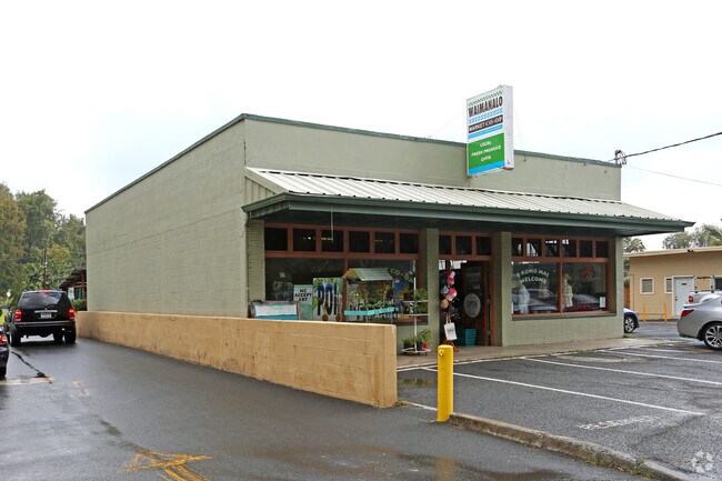
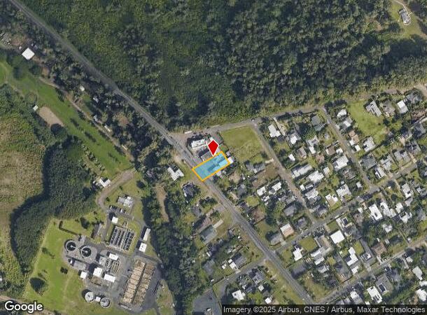
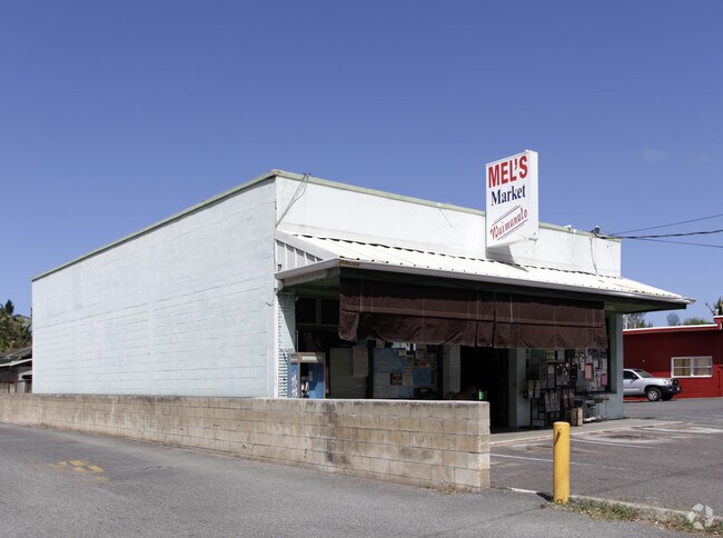
Property Record
41-1029 Kalanianaole Hwy, Waimanalo, HI 96795

NEARBY LISTINGS FOR SALE OR LEASE
Property Detail
41-1029 Kalanianaole Hwy
Urban Honolulu, HI
Waimanalo Beach Lots
1-4-1-007-036-0000
LOT 167 WAIMANALO BEACH LOTS LP GR 13,351 12,617 SF DES
Commercialnec
Honolulu
AO
Hawaii
15003C0385G
167
2024
0.29 AC
2025
Windward
940003
Hawaii
2,698 SF
DEMOGRAPHICS near 41-1029 Kalanianaole Hwy
1 Mile
3 Mile
5 Mile
2024 Total Population
4,461
21,293
79,652
2029 Population
4,203
20,325
77,105
Pop Growth 2024-2029
(5.78%)
(4.55%)
(3.20%)
Average Age
41
42
44
2024 Total Households
1,036
6,060
26,463
HH Growth 2024-2029
(6.85%)
(5.21%)
(3.87%)
Median Household Inc
$115,060
$130,757
$136,229
Avg Household Size
3.80
3.20
2.80
2024 Avg HH Vehicles
2.00
2.00
2.00
Median Home Value
$815,251
$930,407
$1,012,130
Median Year Built
1973
1973
1972
Nearby Places
Map Layers
Map Styles
 Street
 Aerial
- Restaurants
- Banks
- Shops
- Fitness
- Groceries
PUBLIC TRANSPORTATION
AIRPORT
Daniel K Inouye International
DRIVE
WALK
Distance
Daniel K Inouye International
34 min
22.8 mi
Freight Ports
Honolulu Harbor, Oahu
DRIVE
WALK
Distance
Honolulu Harbor, Oahu
1 min
10.9 mi
Nearby Properties
Address
Land Use
TOTAL SIZE
Lot Size
Zoning
Address
Land Use
TOTAL SIZE
Lot Size
Zoning
13,380 SF
129.86 AC
P-2
Address
Land Use
TOTAL SIZE
Lot Size
Zoning
36,421 SF
1.61 AC
B-1
Address
Land Use
TOTAL SIZE
Lot Size
Zoning
11.25 AC
AG-1
Address
Land Use
TOTAL SIZE
Lot Size
Zoning
25.31 AC
P-2
Address
Land Use
TOTAL SIZE
Lot Size
Zoning
139.12 AC
AG-2
Address
Land Use
TOTAL SIZE
Lot Size
Zoning
59.33 AC
AG-1
Address
Land Use
TOTAL SIZE
Lot Size
Zoning
64.07 AC
AG-2
Address
Land Use
TOTAL SIZE
Lot Size
Zoning
112.04 AC
P-1
Address
Land Use
TOTAL SIZE
Lot Size
Zoning
60.03 AC
AG-1
Address
Land Use
TOTAL SIZE
Lot Size
Zoning
3,176 SF
0.54 AC
R-10
Address
Land Use
TOTAL SIZE
Lot Size
Zoning
3,928 SF
0.36 AC
B-1
Address
Land Use
TOTAL SIZE
Lot Size
Zoning
4,006 SF
0.26 AC
R-10
Address
Land Use
TOTAL SIZE
Lot Size
Zoning
3,629 SF
0.76 AC
R-10
Address
Land Use
TOTAL SIZE
Lot Size
Zoning
10.89 AC
AG-2
Address
Land Use
TOTAL SIZE
Lot Size
Zoning
22,837 SF
8.86 AC
AG-1
Address
Land Use
TOTAL SIZE
Lot Size
Zoning
2,893 SF
0.97 AC
R-10
Address
Land Use
TOTAL SIZE
Lot Size
Zoning
17.06 AC
AG-1
Address
Land Use
TOTAL SIZE
Lot Size
Zoning
9,902 SF
2 AC
AG-2
Address
Land Use
TOTAL SIZE
Lot Size
Zoning
69.01 AC
P-2
Address
Land Use
TOTAL SIZE
Lot Size
Zoning
1.68 AC
AG-2
Address
Land Use
TOTAL SIZE
Lot Size
Zoning
1,026 SF
9.57 AC
AG-1
Address
Land Use
TOTAL SIZE
Lot Size
Zoning
3.61 AC
AG-1
Address
Land Use
TOTAL SIZE
Lot Size
Zoning
10.09 AC
AG-1
Address
Land Use
TOTAL SIZE
Lot Size
Zoning
15.10 AC
AG-1
Address
Land Use
TOTAL SIZE
Lot Size
Zoning
1,728 SF
15.59 AC
AG-1
Address
Land Use
TOTAL SIZE
Lot Size
Zoning
4,556 SF
19.96 AC
AG-1
Address
Land Use
TOTAL SIZE
Lot Size
Zoning
11.98 AC
AG-2
Address
Land Use
TOTAL SIZE
Lot Size
Zoning
12.42 AC
AG-1
Address
Land Use
TOTAL SIZE
Lot Size
Zoning
6,727 SF
2.39 AC
AG-2
Address
Land Use
TOTAL SIZE
Lot Size
Zoning
4,080 SF
11 AC
AG-1
The World's #1 Commercial Real Estate Marketplace
Connect with us
© 2025 CoStar Group
The information above has been obtained from sources believed reliable. While we do not doubt its accuracy we have not verified it and make no guarantee, warranty or representation about it. It is your responsibility to independently confirm its accuracy and completeness. Any projections, opinions, assumptions, or estimates used are for example only and do not represent the current or future performance of the property. The value of this transaction to you depends on tax and other factors which should be evaluated by your tax, financial, and legal advisors. You and your advisors should conduct a careful, independent investigation of the property to determine to your satisfaction the suitability of the property for your needs.