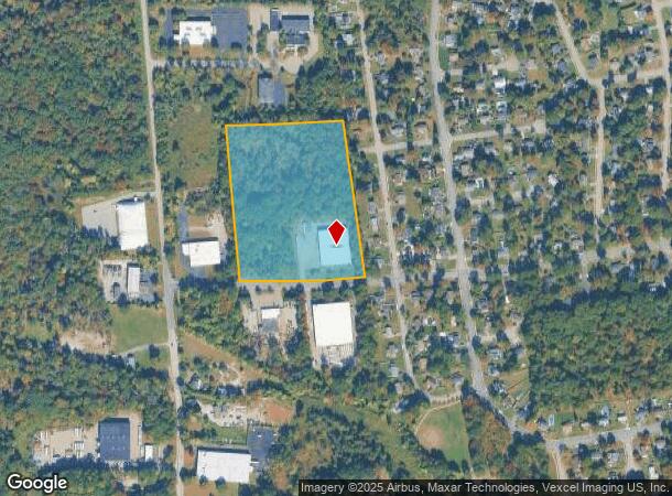
Property Record
41 Bog And Vly Ln, Lincoln Park, NJ 07035

NEARBY LISTINGS FOR SALE OR LEASE
Property Detail
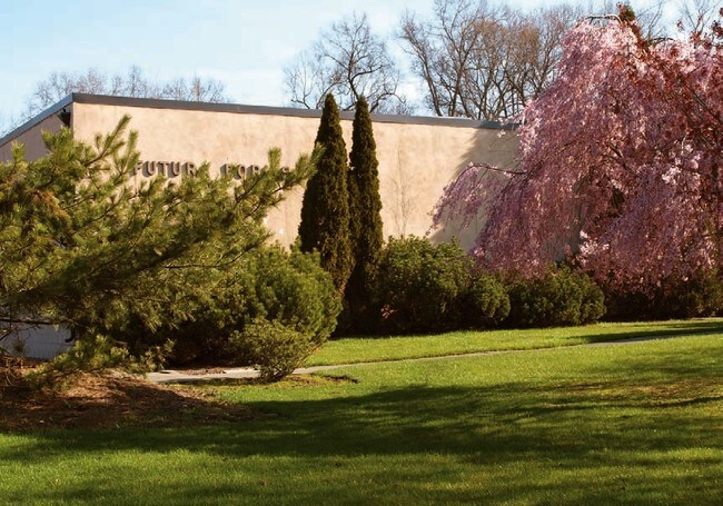
41 Bog And Vly Ln
16-00004-0000-00012
Morris
Industrialgeneral
New Jersey
AE
13
34027C0191F
12.98 AC
2024
Eastern Morris
2025
Northern New Jersey
040101
Newark, NJ-PA
34,875 SF
DEMOGRAPHICS near 41 Bog And Vly Ln
1 Mile
3 Mile
5 Mile
2024 Total Population
5,949
43,083
133,799
2029 Population
5,946
43,117
133,090
Pop Growth 2024-2029
(0.05%)
+ 0.08%
(0.53%)
Average Age
42
43
43
2024 Total Households
2,192
15,110
48,894
HH Growth 2024-2029
(0.05%)
+ 0.07%
(0.69%)
Median Household Inc
$118,787
$129,972
$123,639
Avg Household Size
2.70
2.80
2.70
2024 Avg HH Vehicles
2.00
2.00
2.00
Median Home Value
$458,156
$495,010
$528,637
Median Year Built
1965
1964
1967
Nearby Places
Map Layers
Map Styles
 Street
 Aerial
- Restaurants
- Banks
- Shops
- Fitness
- Groceries
PUBLIC TRANSPORTATION
COMMUTER RAIL
Lincoln Park (Montclair-Boonton Line - NJ Transit Commuter Rail (NJ Transit))
DRIVE
WALK
Distance
Lincoln Park (Montclair-Boonton Line - NJ Transit Commuter Rail (NJ Transit))
2 min
17 min
0.9 mi
Towaco (Montclair-Boonton Line - NJ Transit Commuter Rail (NJ Transit))
DRIVE
WALK
Distance
Towaco (Montclair-Boonton Line - NJ Transit Commuter Rail (NJ Transit))
6 min
3.1 mi
AIRPORT
Newark Liberty International
DRIVE
WALK
Distance
Newark Liberty International
32 min
26.1 mi
LaGuardia
DRIVE
WALK
Distance
LaGuardia
48 min
34.1 mi
Freight Ports
Port Newark Container Terminal
DRIVE
WALK
Distance
Port Newark Container Terminal
38 min
25.4 mi
Nearby Properties
Address
Land Use
TOTAL SIZE
Lot Size
Zoning
Address
Land Use
TOTAL SIZE
Lot Size
Zoning
21.99 AC
H
Address
Land Use
TOTAL SIZE
Lot Size
Zoning
49,701 SF
29.34 AC
GAR
Address
Land Use
TOTAL SIZE
Lot Size
Zoning
18.76 AC
C-3
Address
Land Use
TOTAL SIZE
Lot Size
Zoning
32.21 AC
R-15
Address
Land Use
TOTAL SIZE
Lot Size
Zoning
5,880 SF
17.46 AC
I
Address
Land Use
TOTAL SIZE
Lot Size
Zoning
192,206 SF
7.73 AC
R-20
Address
Land Use
TOTAL SIZE
Lot Size
Zoning
41.71 AC
C-4
Address
Land Use
TOTAL SIZE
Lot Size
Zoning
97,631 SF
10.01 AC
B-2
Address
Land Use
TOTAL SIZE
Lot Size
Zoning
9.08 AC
H-C
Address
Land Use
TOTAL SIZE
Lot Size
Zoning
9.28 AC
R-11
Address
Land Use
TOTAL SIZE
Lot Size
Zoning
10.07 AC
R-15
Address
Land Use
TOTAL SIZE
Lot Size
Zoning
143,500 SF
14.73 AC
I
Address
Land Use
TOTAL SIZE
Lot Size
Zoning
12.24 AC
H-C
Address
Land Use
TOTAL SIZE
Lot Size
Zoning
82,061 SF
12.39 AC
R-15
Address
Land Use
TOTAL SIZE
Lot Size
Zoning
634 SF
14.76 AC
H
Address
Land Use
TOTAL SIZE
Lot Size
Zoning
47,312 SF
12.34 AC
R-20
Address
Land Use
TOTAL SIZE
Lot Size
Zoning
26.25 AC
CR
Address
Land Use
TOTAL SIZE
Lot Size
Zoning
101,685 SF
9.64 AC
I
Address
Land Use
TOTAL SIZE
Lot Size
Zoning
57,880 SF
9.25 AC
B-2
Address
Land Use
TOTAL SIZE
Lot Size
Zoning
34.77 AC
R-15
Address
Land Use
TOTAL SIZE
Lot Size
Zoning
5.89 AC
R-9
Address
Land Use
TOTAL SIZE
Lot Size
Zoning
10.97 AC
R-15
Address
Land Use
TOTAL SIZE
Lot Size
Zoning
7.54 AC
R-15
Address
Land Use
TOTAL SIZE
Lot Size
Zoning
8.98 AC
R-11
Address
Land Use
TOTAL SIZE
Lot Size
Zoning
69,765 SF
23.74 AC
R-20
Address
Land Use
TOTAL SIZE
Lot Size
Zoning
4,320 SF
11.59 AC
PRD
Address
Land Use
TOTAL SIZE
Lot Size
Zoning
2.44 AC
C-1
Address
Land Use
TOTAL SIZE
Lot Size
Zoning
62,431 SF
4.49 AC
I
Address
Land Use
TOTAL SIZE
Lot Size
Zoning
1,434 SF
6.10 AC
I
Address
Land Use
TOTAL SIZE
Lot Size
Zoning
2,239 SF
13.04 AC
R-11
The World's #1 Commercial Real Estate Marketplace
Connect with us
© 2025 CoStar Group
The information above has been obtained from sources believed reliable. While we do not doubt its accuracy we have not verified it and make no guarantee, warranty or representation about it. It is your responsibility to independently confirm its accuracy and completeness. Any projections, opinions, assumptions, or estimates used are for example only and do not represent the current or future performance of the property. The value of this transaction to you depends on tax and other factors which should be evaluated by your tax, financial, and legal advisors. You and your advisors should conduct a careful, independent investigation of the property to determine to your satisfaction the suitability of the property for your needs.