Property Record
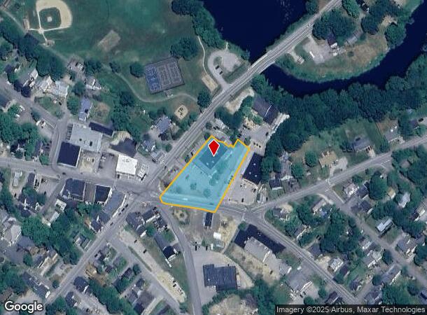
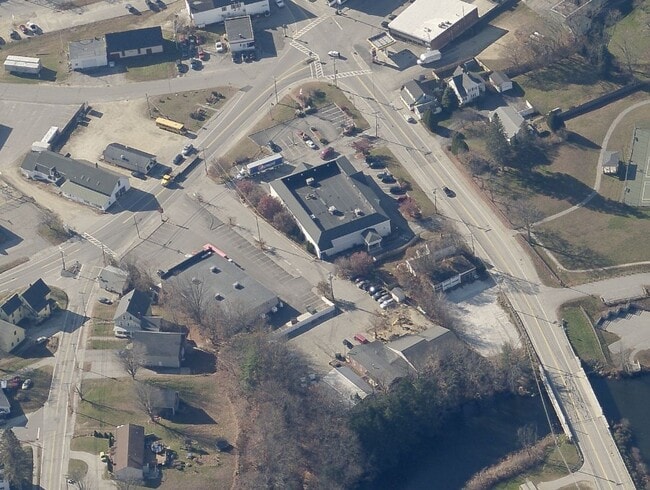
41 Carroll St, Pittsfield, NH 03263
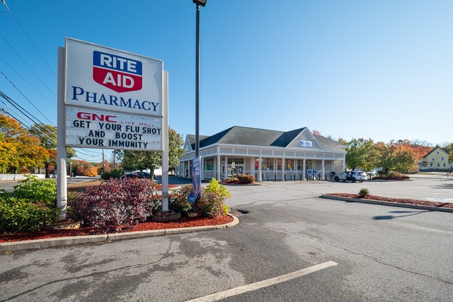
This Property Is For Sale
NEARBY LISTINGS FOR SALE OR LEASE
Property Detail
41 Carroll St
PTFD-000001-000000-000008-U000000
Merrimack
Commercialbuilding
New Hampshire
X
8
33013C0387E
1.36 AC
2024
Concord/New Hampshire North Area
2024
Other Market Areas
035000
Concord, NH
11,084 SF
DEMOGRAPHICS near 41 Carroll St
1 Mile
3 Mile
5 Mile
2024 Total Population
2,360
5,082
8,541
2029 Population
2,500
5,373
9,004
Pop Growth 2024-2029
+ 5.93%
+ 5.73%
+ 5.42%
Average Age
41
41
42
2024 Total Households
961
2,026
3,330
HH Growth 2024-2029
+ 5.83%
+ 5.58%
+ 5.26%
Median Household Inc
$52,358
$59,383
$73,505
Avg Household Size
2.40
2.40
2.50
2024 Avg HH Vehicles
2.00
2.00
2.00
Median Home Value
$235,171
$250,812
$270,930
Median Year Built
1972
1975
1978
Nearby Places
Map Layers
Map Styles
 Street
 Aerial
- Restaurants
- Banks
- Shops
- Fitness
- Groceries
PUBLIC TRANSPORTATION
AIRPORT
Manchester Boston Regional
DRIVE
WALK
Distance
Manchester Boston Regional
60 min
34.3 mi
Portsmouth International at Pease
DRIVE
WALK
Distance
Portsmouth International at Pease
61 min
35.2 mi
Freight Ports
Portland, ME
DRIVE
WALK
Distance
Portland, ME
111 min
72.5 mi
Nearby Properties
Address
Land Use
TOTAL SIZE
Lot Size
Zoning
Address
Land Use
TOTAL SIZE
Lot Size
Zoning
17 AC
SUBURB
Address
Land Use
TOTAL SIZE
Lot Size
Zoning
101 RE
Address
Land Use
TOTAL SIZE
Lot Size
Zoning
0.30 AC
LIGHT
Address
Land Use
TOTAL SIZE
Lot Size
Zoning
81,197 SF
6.51 AC
LIGHT
Address
Land Use
TOTAL SIZE
Lot Size
Zoning
40,091 SF
42.44 AC
SUBURB
Address
Land Use
TOTAL SIZE
Lot Size
Zoning
2,943 SF
19.57 AC
RURAL
Address
Land Use
TOTAL SIZE
Lot Size
Zoning
6.64 AC
LIGHT
Address
Land Use
TOTAL SIZE
Lot Size
Zoning
2.77 AC
URBAN
Address
Land Use
TOTAL SIZE
Lot Size
Zoning
67,900 SF
5 AC
LIGHT
Address
Land Use
TOTAL SIZE
Lot Size
Zoning
47.20 AC
SUBURB
Address
Land Use
TOTAL SIZE
Lot Size
Zoning
28,047 SF
1.07 AC
LIGHT
Address
Land Use
TOTAL SIZE
Lot Size
Zoning
4,117 SF
192.30 AC
RA
Address
Land Use
TOTAL SIZE
Lot Size
Zoning
LIGHT
Address
Land Use
TOTAL SIZE
Lot Size
Zoning
Address
Land Use
TOTAL SIZE
Lot Size
Zoning
5.54 AC
301 CO
Address
Land Use
TOTAL SIZE
Lot Size
Zoning
10.68 AC
LIGHT
Address
Land Use
TOTAL SIZE
Lot Size
Zoning
9,960 SF
5.81 AC
COMM/I
Address
Land Use
TOTAL SIZE
Lot Size
Zoning
82,400 SF
11.20 AC
LIGHT
Address
Land Use
TOTAL SIZE
Lot Size
Zoning
8.68 AC
LIGHT
Address
Land Use
TOTAL SIZE
Lot Size
Zoning
34,761 SF
5 AC
LIGHT
Address
Land Use
TOTAL SIZE
Lot Size
Zoning
5.21 AC
URBAN
Address
Land Use
TOTAL SIZE
Lot Size
Zoning
Address
Land Use
TOTAL SIZE
Lot Size
Zoning
3,821 SF
32 AC
202 LI
Address
Land Use
TOTAL SIZE
Lot Size
Zoning
16,079 SF
8.10 AC
LIGHT
Address
Land Use
TOTAL SIZE
Lot Size
Zoning
182.55 AC
RURAL
Address
Land Use
TOTAL SIZE
Lot Size
Zoning
19,364 SF
13.95 AC
LIGHT
Address
Land Use
TOTAL SIZE
Lot Size
Zoning
18 AC
RURAL
Address
Land Use
TOTAL SIZE
Lot Size
Zoning
4,344 SF
28.93 AC
RA
Address
Land Use
TOTAL SIZE
Lot Size
Zoning
0.46 AC
COMMER
The World's #1 Commercial Real Estate Marketplace
Connect with us
© 2025 CoStar Group
The information above has been obtained from sources believed reliable. While we do not doubt its accuracy we have not verified it and make no guarantee, warranty or representation about it. It is your responsibility to independently confirm its accuracy and completeness. Any projections, opinions, assumptions, or estimates used are for example only and do not represent the current or future performance of the property. The value of this transaction to you depends on tax and other factors which should be evaluated by your tax, financial, and legal advisors. You and your advisors should conduct a careful, independent investigation of the property to determine to your satisfaction the suitability of the property for your needs.