Property Record
41 Commonwealth Ave, Chestnut Hill, MA 02467

Property Detail
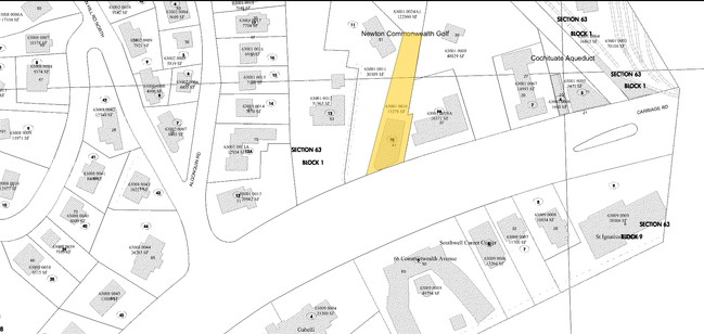
41 Commonwealth Ave
NEWT-000063-000001-000010
Middlesex
Apartment
Massachusetts
MR1
10
B and X Area of moderate flood hazard, usually the area between the limits of the 100-year and 500-year floods.
0.31 AC
2025
Chestnut Hill Middlesex
2025
Boston
373500
Boston-Cambridge-Newton, MA-NH
11,427 SF
NEARBY LISTINGS FOR SALE OR LEASE
DEMOGRAPHICS near 41 Commonwealth Ave
1 mile
3 mile
5 mile
2025 Total Population
31,547
247,053
780,788
2030 Population
32,153
253,676
803,926
Pop Growth 2025-2030
+ 1.92%
+ 2.68%
+ 2.96%
Average Age
35
38
38
2025 Total Households
10,954
101,170
316,087
HH Growth 2025-2030
+ 2.31%
+ 2.91%
+ 3.26%
Median Household Inc
$107,543
$121,260
$116,960
Avg Household Size
2.10
2.20
2.20
2025 Avg HH Vehicles
1.00
1.00
1.00
Median Home Value
$997,750
$1,026,090
$975,964
Median Year Built
1949
1949
1949
Nearby Places
Map Layers
Map Styles
 Street
 Aerial
Layers
 Traffic
 Biking
Places
Listings with unknown addresses are not visible on the map
- Restaurants
- Banks
- Shops
- Fitness
- Groceries
PUBLIC TRANSPORTATION
TRANSIT/SUBWAY
Boston College Station (Green Line - B - Massachusetts Bay Transportation Authority Subway (The T))
Drive
Walk
Distance
Boston College Station (Green Line - B - Massachusetts Bay Transportation Authority Subway (The T))
2 min
3 min
0.2 mi
South Street Station (Green Line - B - Massachusetts Bay Transportation Authority Subway (The T))
Drive
Walk
Distance
South Street Station (Green Line - B - Massachusetts Bay Transportation Authority Subway (The T))
3 min
12 min
0.6 mi
Chestnut Hill Avenue Station (Green Line - B - Massachusetts Bay Transportation Authority Subway (The T))
Drive
Walk
Distance
Chestnut Hill Avenue Station (Green Line - B - Massachusetts Bay Transportation Authority Subway (The T))
3 min
18 min
0.9 mi
Chiswick Road Station (Green Line - B - Massachusetts Bay Transportation Authority Subway (The T))
Drive
Walk
Distance
Chiswick Road Station (Green Line - B - Massachusetts Bay Transportation Authority Subway (The T))
4 min
20 min
1.0 mi
COMMUTER RAIL
Newtonville (Framingham/Worcester Line - Massachusetts Bay Transportation Authority Commuter Rail (Purple Line))
Drive
Walk
Distance
Newtonville (Framingham/Worcester Line - Massachusetts Bay Transportation Authority Commuter Rail (Purple Line))
8 min
3.9 mi
Drive
Walk
Distance
9 min
4.8 mi
AIRPORT
General Edward Lawrence Logan International
Drive
Walk
Distance
General Edward Lawrence Logan International
20 min
11.2 mi
Freight Ports
Port of Boston
Drive
Walk
Distance
Port of Boston
19 min
9.5 mi
Nearby Properties
Address
Land Use
TOTAL SIZE
Lot Size
Zoning
Address
Land Use
TOTAL SIZE
Lot Size
Zoning
439,500 SF
9.21 AC
E
Address
Land Use
TOTAL SIZE
Lot Size
Zoning
150,192 SF
10.27 AC
E
Address
Land Use
TOTAL SIZE
Lot Size
Zoning
530,200 SF
62.08 AC
E
Address
Land Use
TOTAL SIZE
Lot Size
Zoning
419,722 SF
2.03 AC
RC
Address
Land Use
TOTAL SIZE
Lot Size
Zoning
4,355 SF
13.12 AC
E
Address
Land Use
TOTAL SIZE
Lot Size
Zoning
336,518 SF
6.15 AC
I-3
Address
Land Use
TOTAL SIZE
Lot Size
Zoning
387,550 SF
7.99 AC
MU1
Address
Land Use
TOTAL SIZE
Lot Size
Zoning
220,671 SF
2.52 AC
I-2
Address
Land Use
TOTAL SIZE
Lot Size
Zoning
506,534 SF
2.75 AC
C
Address
Land Use
TOTAL SIZE
Lot Size
Zoning
176,625 SF
5.76 AC
I-3
Address
Land Use
TOTAL SIZE
Lot Size
Zoning
30,170 SF
19 AC
SR2
Address
Land Use
TOTAL SIZE
Lot Size
Zoning
147,997 SF
2.03 AC
GMR2
Address
Land Use
TOTAL SIZE
Lot Size
Zoning
8.18 AC
A-2
Address
Land Use
TOTAL SIZE
Lot Size
Zoning
228,483 SF
7.57 AC
BU1
Address
Land Use
TOTAL SIZE
Lot Size
Zoning
317,049 SF
11.22 AC
M05
Address
Land Use
TOTAL SIZE
Lot Size
Zoning
1,050 SF
8.77 AC
BU4
Address
Land Use
TOTAL SIZE
Lot Size
Zoning
14.59 AC
S40
Address
Land Use
TOTAL SIZE
Lot Size
Zoning
203,252 SF
236.88 AC
S40
Address
Land Use
TOTAL SIZE
Lot Size
Zoning
253,440 SF
3.20 AC
C-3
Address
Land Use
TOTAL SIZE
Lot Size
Zoning
134,136 SF
1.35 AC
M25
Address
Land Use
TOTAL SIZE
Lot Size
Zoning
157,828 SF
4.39 AC
E
Address
Land Use
TOTAL SIZE
Lot Size
Zoning
163,364 SF
3.08 AC
O10
Address
Land Use
TOTAL SIZE
Lot Size
Zoning
351,680 SF
4.01 AC
RC
Address
Land Use
TOTAL SIZE
Lot Size
Zoning
62,924 SF
3.97 AC
T-5
Address
Land Use
TOTAL SIZE
Lot Size
Zoning
179,834 SF
8.57 AC
PUB
Address
Land Use
TOTAL SIZE
Lot Size
Zoning
241,737 SF
4.67 AC
BU1
Address
Land Use
TOTAL SIZE
Lot Size
Zoning
25,744 SF
35.80 AC
S40
Address
Land Use
TOTAL SIZE
Lot Size
Zoning
103,030 SF
0.77 AC
G175
Address
Land Use
TOTAL SIZE
Lot Size
Zoning
5,119 SF
119.98 AC
S15
Address
Land Use
TOTAL SIZE
Lot Size
Zoning
191,142 SF
1.08 AC
A
The World's #1 Commercial Real Estate Marketplace
Connect with us
© 2026 CoStar Group
The information above has been obtained from sources believed reliable. While we do not doubt its accuracy we have not verified it and make no guarantee, warranty or representation about it. It is your responsibility to independently confirm its accuracy and completeness. Any projections, opinions, assumptions, or estimates used are for example only and do not represent the current or future performance of the property. The value of this transaction to you depends on tax and other factors which should be evaluated by your tax, financial, and legal advisors. You and your advisors should conduct a careful, independent investigation of the property to determine to your satisfaction the suitability of the property for your needs.