Property Record
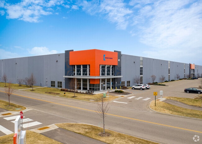
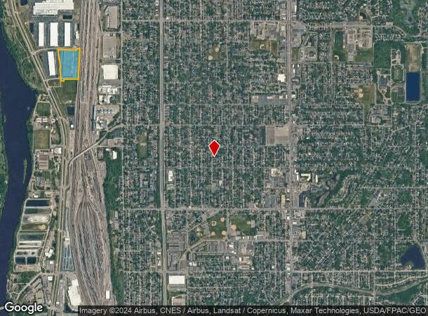
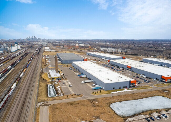
41 Northern Stacks Dr, Minneapolis, MN 55421
Property Detail
41 Northern Stacks Dr
Minneapolis-St. Paul-Bloomington, MN-WI
LOT 1 BLOCK 1 NORTHERN STACKS 3RD ADDITION
27-30-24-42-0009
ANOKA
Industrialgeneral
Minnesota
B and X Area of moderate flood hazard, usually the area between the limits of the 100-year and 500-year floods.
1
2026
13.21 AC
2026
North Central
051400
Minneapolis/St Paul
213,200 SF
NEARBY LISTINGS FOR SALE OR LEASE
DEMOGRAPHICS near 41 Northern Stacks Dr
1 mile
3 mile
5 mile
2025 Total Population
9,183
117,967
327,664
2030 Population
9,295
118,715
328,061
Pop Growth 2025-2030
+ 1.22%
+ 0.63%
+ 0.12%
Average Age
38
38
38
2025 Total Households
3,497
44,912
129,150
HH Growth 2025-2030
+ 1.43%
+ 0.67%
+ 0.18%
Median Household Inc
$77,077
$78,938
$81,621
Avg Household Size
2.50
2.50
2.40
2025 Avg HH Vehicles
2.00
2.00
2.00
Median Home Value
$256,573
$274,789
$295,714
Median Year Built
1956
1960
1965
Nearby Places
Map Layers
Map Styles
 Street
 Aerial
Layers
 Traffic
 Biking
Places
Listings with unknown addresses are not visible on the map
- Restaurants
- Banks
- Shops
- Fitness
- Groceries
PUBLIC TRANSPORTATION
COMMUTER RAIL
Fridley Station (Northstar Corridor - Northstar Commuter Rail)
Drive
Walk
Distance
Fridley Station (Northstar Corridor - Northstar Commuter Rail)
7 min
3.4 mi
Target Field Station (Northstar Corridor - Northstar Commuter Rail)
Drive
Walk
Distance
Target Field Station (Northstar Corridor - Northstar Commuter Rail)
14 min
5.4 mi
AIRPORT
Minneapolis-St Paul International/Wold-Chamberlain
Drive
Walk
Distance
Minneapolis-St Paul International/Wold-Chamberlain
32 min
15.6 mi
Freight Ports
Port Milwaukee
Drive
Walk
Distance
Port Milwaukee
382 min
345.6 mi
SALE & LEASE HISTORY
LISTING DATE
SALE/LEASE

Mar 16, 2022
For Lease
Jan 08, 2020
For Lease
Nearby Properties
Address
Land Use
TOTAL SIZE
Lot Size
Zoning
Address
Land Use
TOTAL SIZE
Lot Size
Zoning
1 SF
69.72 AC
I3
Address
Land Use
TOTAL SIZE
Lot Size
Zoning
9,900 SF
Address
Land Use
TOTAL SIZE
Lot Size
Zoning
142,933 SF
5.57 AC
Address
Land Use
TOTAL SIZE
Lot Size
Zoning
431,472 SF
7.04 AC
Address
Land Use
TOTAL SIZE
Lot Size
Zoning
Address
Land Use
TOTAL SIZE
Lot Size
Zoning
225,845 SF
1 AC
C3A
Address
Land Use
TOTAL SIZE
Lot Size
Zoning
166.50 AC
Address
Land Use
TOTAL SIZE
Lot Size
Zoning
Address
Land Use
TOTAL SIZE
Lot Size
Zoning
1 SF
6 AC
Address
Land Use
TOTAL SIZE
Lot Size
Zoning
19,514 SF
70.59 AC
Address
Land Use
TOTAL SIZE
Lot Size
Zoning
255,096 SF
2.61 AC
Address
Land Use
TOTAL SIZE
Lot Size
Zoning
264,574 SF
12.71 AC
Address
Land Use
TOTAL SIZE
Lot Size
Zoning
249,884 SF
Address
Land Use
TOTAL SIZE
Lot Size
Zoning
393,252 SF
40 AC
Address
Land Use
TOTAL SIZE
Lot Size
Zoning
334,568 SF
30.27 AC
Address
Land Use
TOTAL SIZE
Lot Size
Zoning
6.11 AC
Address
Land Use
TOTAL SIZE
Lot Size
Zoning
27,175 SF
1.86 AC
Address
Land Use
TOTAL SIZE
Lot Size
Zoning
Address
Land Use
TOTAL SIZE
Lot Size
Zoning
213,984 SF
12.21 AC
Address
Land Use
TOTAL SIZE
Lot Size
Zoning
276,211 SF
2.57 AC
I1
Address
Land Use
TOTAL SIZE
Lot Size
Zoning
194,221 SF
27.83 AC
Address
Land Use
TOTAL SIZE
Lot Size
Zoning
147,614 SF
24.05 AC
Address
Land Use
TOTAL SIZE
Lot Size
Zoning
1 SF
0.90 AC
Address
Land Use
TOTAL SIZE
Lot Size
Zoning
1 SF
84.49 AC
I2
Address
Land Use
TOTAL SIZE
Lot Size
Zoning
169,628 SF
2.67 AC
Address
Land Use
TOTAL SIZE
Lot Size
Zoning
Address
Land Use
TOTAL SIZE
Lot Size
Zoning
10.28 AC
Address
Land Use
TOTAL SIZE
Lot Size
Zoning
161,560 SF
1.09 AC
C2
Address
Land Use
TOTAL SIZE
Lot Size
Zoning
266,084 SF
15.60 AC
The World's #1 Commercial Real Estate Marketplace
Connect with us
© 2026 CoStar Group
The information above has been obtained from sources believed reliable. While we do not doubt its accuracy we have not verified it and make no guarantee, warranty or representation about it. It is your responsibility to independently confirm its accuracy and completeness. Any projections, opinions, assumptions, or estimates used are for example only and do not represent the current or future performance of the property. The value of this transaction to you depends on tax and other factors which should be evaluated by your tax, financial, and legal advisors. You and your advisors should conduct a careful, independent investigation of the property to determine to your satisfaction the suitability of the property for your needs.