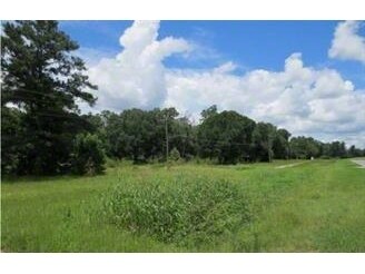
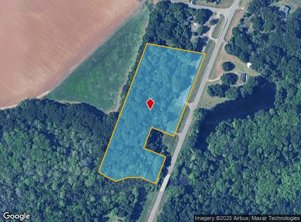
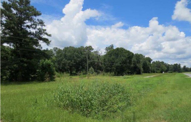
Property Record
41 Hay Rd, Perry, GA 31069

NEARBY LISTINGS FOR SALE OR LEASE
Property Detail
41 Hay Rd
Warner Robins, GA
Hwy 41 P 25
0P0340047000
TRACT A 7.75 ACRES LL 80 14TH LD
Commercialacreage
Houston
A
Georgia
13193C0250E
7.75 AC
2024
Perry/Warner Robins
2024
Other Market Areas
021206
DEMOGRAPHICS near 41 Hay Rd
1 Mile
3 Mile
5 Mile
2024 Total Population
341
3,034
14,138
2029 Population
376
3,340
15,618
Pop Growth 2024-2029
+ 10.26%
+ 10.09%
+ 10.47%
Average Age
41
41
40
2024 Total Households
141
1,171
5,558
HH Growth 2024-2029
+ 10.64%
+ 9.91%
+ 10.29%
Median Household Inc
$89,166
$71,854
$62,758
Avg Household Size
2.40
2.50
2.40
2024 Avg HH Vehicles
2.00
2.00
2.00
Median Home Value
$162,698
$154,810
$163,542
Median Year Built
1984
1979
1985
Nearby Places
Map Layers
Map Styles
 Street
 Aerial
- Restaurants
- Banks
- Shops
- Fitness
- Groceries
SALE & LEASE HISTORY
LISTING DATE
SALE/LEASE

Sep 24, 2016
For Sale
Dec 06, 2016
For Sale
Nearby Properties
Address
Land Use
TOTAL SIZE
Lot Size
Zoning
Address
Land Use
TOTAL SIZE
Lot Size
Zoning
68,186 SF
562.30 AC
GU
Address
Land Use
TOTAL SIZE
Lot Size
Zoning
528,578 SF
32.75 AC
M2
Address
Land Use
TOTAL SIZE
Lot Size
Zoning
19,125 SF
27.94 AC
R1
Address
Land Use
TOTAL SIZE
Lot Size
Zoning
255.39 AC
GU/M1
Address
Land Use
TOTAL SIZE
Lot Size
Zoning
134,145 SF
3.08 AC
M2
Address
Land Use
TOTAL SIZE
Lot Size
Zoning
134,145 SF
3.08 AC
M2
Address
Land Use
TOTAL SIZE
Lot Size
Zoning
35.91 AC
M2
Address
Land Use
TOTAL SIZE
Lot Size
Zoning
57,534 SF
2.50 AC
IMU
Address
Land Use
TOTAL SIZE
Lot Size
Zoning
37,923 SF
1.80 AC
IMU
Address
Land Use
TOTAL SIZE
Lot Size
Zoning
4,704 SF
107.57 AC
C1 R3 R1
Address
Land Use
TOTAL SIZE
Lot Size
Zoning
7,575 SF
4.52 AC
C2
Address
Land Use
TOTAL SIZE
Lot Size
Zoning
359.62 AC
RAG
Address
Land Use
TOTAL SIZE
Lot Size
Zoning
689.95 AC
RAG
Address
Land Use
TOTAL SIZE
Lot Size
Zoning
463.22 AC
RAG
Address
Land Use
TOTAL SIZE
Lot Size
Zoning
461.02 AC
RAG
Address
Land Use
TOTAL SIZE
Lot Size
Zoning
269.68 AC
RAG
Address
Land Use
TOTAL SIZE
Lot Size
Zoning
68.46 AC
R3
Address
Land Use
TOTAL SIZE
Lot Size
Zoning
645.75 AC
RAG
Address
Land Use
TOTAL SIZE
Lot Size
Zoning
761.17 AC
RAG
Address
Land Use
TOTAL SIZE
Lot Size
Zoning
85,998 SF
10.52 AC
M1
Address
Land Use
TOTAL SIZE
Lot Size
Zoning
345.51 AC
RAG
Address
Land Use
TOTAL SIZE
Lot Size
Zoning
442.55 AC
RAG
Address
Land Use
TOTAL SIZE
Lot Size
Zoning
14,963 SF
5.49 AC
C2/GU
Address
Land Use
TOTAL SIZE
Lot Size
Zoning
8,640 SF
5.96 AC
C1
Address
Land Use
TOTAL SIZE
Lot Size
Zoning
242.53 AC
RAG
Address
Land Use
TOTAL SIZE
Lot Size
Zoning
14,648 SF
4.65 AC
C2
Address
Land Use
TOTAL SIZE
Lot Size
Zoning
27,186 SF
1.65 AC
C2
Address
Land Use
TOTAL SIZE
Lot Size
Zoning
37.29 AC
C2
Address
Land Use
TOTAL SIZE
Lot Size
Zoning
8,100 SF
4.19 AC
IMU
Address
Land Use
TOTAL SIZE
Lot Size
Zoning
13,032 SF
2.88 AC
C2
The World's #1 Commercial Real Estate Marketplace
Connect with us
© 2025 CoStar Group
The information above has been obtained from sources believed reliable. While we do not doubt its accuracy we have not verified it and make no guarantee, warranty or representation about it. It is your responsibility to independently confirm its accuracy and completeness. Any projections, opinions, assumptions, or estimates used are for example only and do not represent the current or future performance of the property. The value of this transaction to you depends on tax and other factors which should be evaluated by your tax, financial, and legal advisors. You and your advisors should conduct a careful, independent investigation of the property to determine to your satisfaction the suitability of the property for your needs.