Property Record
41 Kaulukanu St, Waimanalo, HI 96795

NEARBY LISTINGS FOR SALE OR LEASE
Property Detail
41 Kaulukanu St
Urban Honolulu, HI
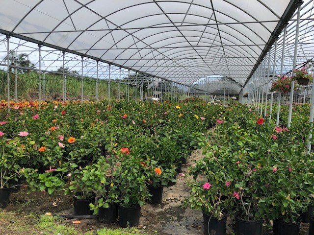
Waimanalo Farm Lots
1-4-1-024-099-0000
Honolulu
Agriculturalland
Hawaii
X
24-b
15003C0380H
2 AC
2024
Windward
2025
Hawaii
011300
DEMOGRAPHICS near 41 Kaulukanu St
1 Mile
3 Mile
5 Mile
2024 Total Population
4,041
22,258
93,514
2029 Population
3,750
21,164
90,519
Pop Growth 2024-2029
(7.20%)
(4.92%)
(3.20%)
Average Age
39
42
44
2024 Total Households
960
6,368
30,966
HH Growth 2024-2029
(8.33%)
(5.76%)
(3.93%)
Median Household Inc
$118,375
$132,956
$134,441
Avg Household Size
3.70
3.20
2.80
2024 Avg HH Vehicles
2.00
2.00
2.00
Median Home Value
$727,791
$996,067
$1,016,669
Median Year Built
1974
1971
1971
Nearby Places
Map Layers
Map Styles
 Street
 Aerial
- Restaurants
- Banks
- Shops
- Fitness
- Groceries
PUBLIC TRANSPORTATION
AIRPORT
Daniel K Inouye International
DRIVE
WALK
Distance
Daniel K Inouye International
36 min
18.7 mi
Freight Ports
Honolulu Harbor, Oahu
DRIVE
WALK
Distance
Honolulu Harbor, Oahu
38 min
17.9 mi
SALE & LEASE HISTORY
LISTING DATE
SALE/LEASE

Jun 11, 2019
For Sale
Nearby Properties
Address
Land Use
TOTAL SIZE
Lot Size
Zoning
Address
Land Use
TOTAL SIZE
Lot Size
Zoning
44,774 SF
2.74 AC
B-1
Address
Land Use
TOTAL SIZE
Lot Size
Zoning
32,742 SF
2.69 AC
B-1
Address
Land Use
TOTAL SIZE
Lot Size
Zoning
21,111 SF
1.95 AC
B-1
Address
Land Use
TOTAL SIZE
Lot Size
Zoning
123,725 SF
572.87 AC
P-1
Address
Land Use
TOTAL SIZE
Lot Size
Zoning
20,297 SF
0.77 AC
B-1
Address
Land Use
TOTAL SIZE
Lot Size
Zoning
13,380 SF
129.86 AC
P-2
Address
Land Use
TOTAL SIZE
Lot Size
Zoning
6,217 SF
0.28 AC
R-10
Address
Land Use
TOTAL SIZE
Lot Size
Zoning
36,421 SF
1.61 AC
B-1
Address
Land Use
TOTAL SIZE
Lot Size
Zoning
437 AC
AG-2
Address
Land Use
TOTAL SIZE
Lot Size
Zoning
11.25 AC
AG-1
Address
Land Use
TOTAL SIZE
Lot Size
Zoning
25.31 AC
P-2
Address
Land Use
TOTAL SIZE
Lot Size
Zoning
139.12 AC
AG-2
Address
Land Use
TOTAL SIZE
Lot Size
Zoning
1,678 SF
312.95 AC
AG-2
Address
Land Use
TOTAL SIZE
Lot Size
Zoning
1,648 SF
0.62 AC
B-1
Address
Land Use
TOTAL SIZE
Lot Size
Zoning
59.33 AC
AG-1
Address
Land Use
TOTAL SIZE
Lot Size
Zoning
64.07 AC
AG-2
Address
Land Use
TOTAL SIZE
Lot Size
Zoning
112.04 AC
P-1
Address
Land Use
TOTAL SIZE
Lot Size
Zoning
60.03 AC
AG-1
Address
Land Use
TOTAL SIZE
Lot Size
Zoning
3,176 SF
0.54 AC
R-10
Address
Land Use
TOTAL SIZE
Lot Size
Zoning
3,928 SF
0.36 AC
B-1
Address
Land Use
TOTAL SIZE
Lot Size
Zoning
4,006 SF
0.26 AC
R-10
Address
Land Use
TOTAL SIZE
Lot Size
Zoning
3,629 SF
0.76 AC
R-10
Address
Land Use
TOTAL SIZE
Lot Size
Zoning
10.89 AC
AG-2
Address
Land Use
TOTAL SIZE
Lot Size
Zoning
22,837 SF
8.86 AC
AG-1
Address
Land Use
TOTAL SIZE
Lot Size
Zoning
2,893 SF
0.97 AC
R-10
Address
Land Use
TOTAL SIZE
Lot Size
Zoning
17.06 AC
AG-1
Address
Land Use
TOTAL SIZE
Lot Size
Zoning
9,902 SF
2 AC
AG-2
Address
Land Use
TOTAL SIZE
Lot Size
Zoning
3,333 SF
0.21 AC
R-10
Address
Land Use
TOTAL SIZE
Lot Size
Zoning
1,108 SF
0.34 AC
R-10
Address
Land Use
TOTAL SIZE
Lot Size
Zoning
1.68 AC
AG-2
The World's #1 Commercial Real Estate Marketplace
Connect with us
© 2025 CoStar Group
The information above has been obtained from sources believed reliable. While we do not doubt its accuracy we have not verified it and make no guarantee, warranty or representation about it. It is your responsibility to independently confirm its accuracy and completeness. Any projections, opinions, assumptions, or estimates used are for example only and do not represent the current or future performance of the property. The value of this transaction to you depends on tax and other factors which should be evaluated by your tax, financial, and legal advisors. You and your advisors should conduct a careful, independent investigation of the property to determine to your satisfaction the suitability of the property for your needs.