Property Record
101 Le Gordon Dr, Midlothian, VA 23114
Current Lease Availabilities
NEARBY LISTINGS FOR SALE OR LEASE
Property Detail
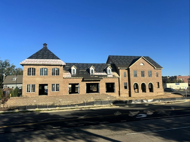
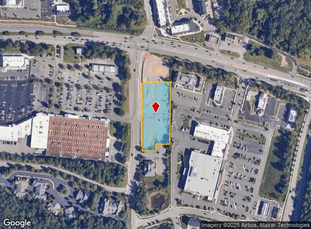
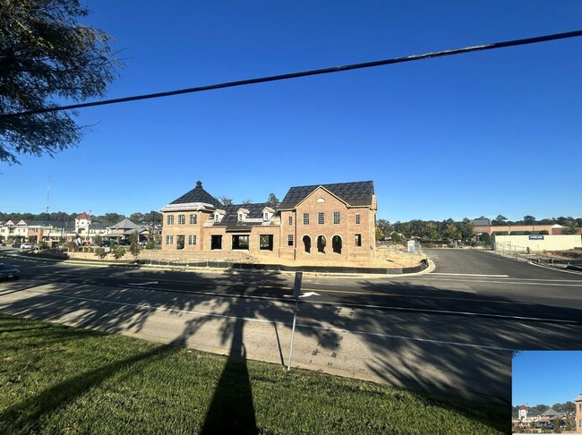
101 Le Gordon Dr
Richmond, VA
LE GORDON DR PARCEL 1
725-70-89-84-500-000
Chesterfield
Commercialnec
Virginia
2025
1.57 AC
2025
Midlothian Village
100929
Richmond VA
DEMOGRAPHICS near 101 Le Gordon Dr
1 Mile
3 Mile
5 Mile
2024 Total Population
6,468
43,666
100,682
2029 Population
7,088
48,238
110,341
Pop Growth 2024-2029
+ 9.59%
+ 10.47%
+ 9.59%
Average Age
42
42
41
2024 Total Households
2,741
16,586
37,845
HH Growth 2024-2029
+ 9.92%
+ 10.67%
+ 9.58%
Median Household Inc
$82,361
$111,598
$108,594
Avg Household Size
2.40
2.60
2.60
2024 Avg HH Vehicles
2.00
2.00
2.00
Median Home Value
$383,428
$410,077
$370,228
Median Year Built
2003
1998
1991
Nearby Places
- Restaurants
- Banks
- Shops
- Fitness
- Groceries
PUBLIC TRANSPORTATION
AIRPORT
Richmond International
DRIVE
WALK
Distance
Richmond International
41 min
25.5 mi
Freight Ports
Virginia Port Authority - Richmond
DRIVE
WALK
Distance
Virginia Port Authority - Richmond
30 min
15.6 mi
Nearby Properties
Address
Land Use
TOTAL SIZE
Lot Size
Zoning
Address
Land Use
TOTAL SIZE
Lot Size
Zoning
88,520 SF
28.29 AC
C3 - COMMU
Address
Land Use
TOTAL SIZE
Lot Size
Zoning
578,400 SF
6.77 AC
I2 - GEN I
Address
Land Use
TOTAL SIZE
Lot Size
Zoning
433,639 SF
72.37 AC
C3 - COMMU
Address
Land Use
TOTAL SIZE
Lot Size
Zoning
5,720 SF
117.22 AC
R9 - SINGL
Address
Land Use
TOTAL SIZE
Lot Size
Zoning
332,521 SF
77.65 AC
I2 - GEN I
Address
Land Use
TOTAL SIZE
Lot Size
Zoning
112,053 SF
44.11 AC
R9 - SINGL
Address
Land Use
TOTAL SIZE
Lot Size
Zoning
5,922 SF
17.83 AC
RMF - RES,
Address
Land Use
TOTAL SIZE
Lot Size
Zoning
100 SF
4.46 AC
I2 - GEN I
Address
Land Use
TOTAL SIZE
Lot Size
Zoning
100 SF
17.82 AC
R7 - SINGL
Address
Land Use
TOTAL SIZE
Lot Size
Zoning
123,252 SF
48.88 AC
R7 - SINGL
Address
Land Use
TOTAL SIZE
Lot Size
Zoning
161,600 SF
18.40 AC
R7 - SINGL
Address
Land Use
TOTAL SIZE
Lot Size
Zoning
108,805 SF
21.09 AC
RMF - RES,
Address
Land Use
TOTAL SIZE
Lot Size
Zoning
71,849 SF
25 AC
RMF - RES,
Address
Land Use
TOTAL SIZE
Lot Size
Zoning
100 SF
8.12 AC
C3 - COMMU
Address
Land Use
TOTAL SIZE
Lot Size
Zoning
241,433 SF
68.39 AC
R15 - SING
Address
Land Use
TOTAL SIZE
Lot Size
Zoning
163,704 SF
10.16 AC
I2 - GEN I
Address
Land Use
TOTAL SIZE
Lot Size
Zoning
72,417 SF
11.76 AC
R7 - SINGL
Address
Land Use
TOTAL SIZE
Lot Size
Zoning
100 SF
27.09 AC
R7 - SINGL
Address
Land Use
TOTAL SIZE
Lot Size
Zoning
89,300 SF
32.90 AC
O2 - CORP
Address
Land Use
TOTAL SIZE
Lot Size
Zoning
29.24 AC
O2 - CORP
Address
Land Use
TOTAL SIZE
Lot Size
Zoning
77,008 SF
8.55 AC
I2 - GEN I
Address
Land Use
TOTAL SIZE
Lot Size
Zoning
174,840 SF
21.13 AC
R7 - SINGL
Address
Land Use
TOTAL SIZE
Lot Size
Zoning
113,384 SF
15.89 AC
R7 - SINGL
Address
Land Use
TOTAL SIZE
Lot Size
Zoning
99,934 SF
81.69 AC
A - AGRICU
Address
Land Use
TOTAL SIZE
Lot Size
Zoning
100 SF
15 AC
O2 - CORP
Address
Land Use
TOTAL SIZE
Lot Size
Zoning
62,636 SF
9.14 AC
RMF - RES,
Address
Land Use
TOTAL SIZE
Lot Size
Zoning
118,712 SF
16.25 AC
C3 - COMMU
Address
Land Use
TOTAL SIZE
Lot Size
Zoning
206,183 SF
25.21 AC
C3 - COMMU
Address
Land Use
TOTAL SIZE
Lot Size
Zoning
4.45 AC
RMF - RES,
Address
Land Use
TOTAL SIZE
Lot Size
Zoning
12,309 SF
14.20 AC
C3 - COMMU
The World's #1 Commercial Real Estate Marketplace
Connect with us
© 2025 CoStar Group
The information above has been obtained from sources believed reliable. While we do not doubt its accuracy we have not verified it and make no guarantee, warranty or representation about it. It is your responsibility to independently confirm its accuracy and completeness. Any projections, opinions, assumptions, or estimates used are for example only and do not represent the current or future performance of the property. The value of this transaction to you depends on tax and other factors which should be evaluated by your tax, financial, and legal advisors. You and your advisors should conduct a careful, independent investigation of the property to determine to your satisfaction the suitability of the property for your needs.