Property Record
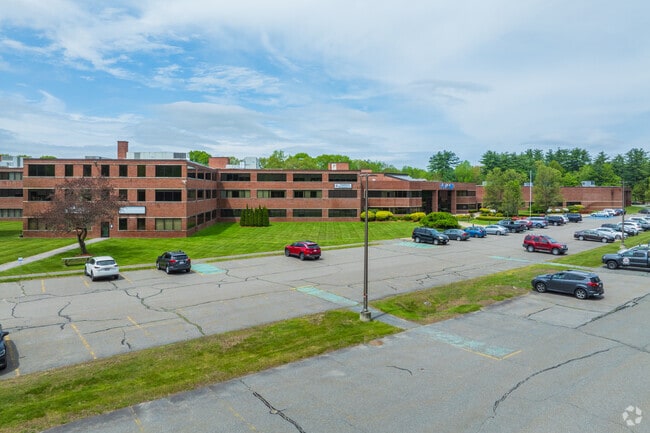
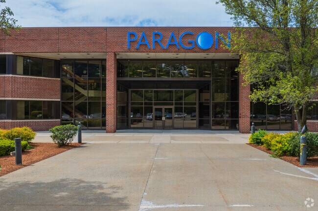
41 Main St, Bolton, MA 01740

Current Lease Availabilities
Property Detail
41 Main St
BOLT-000005E-000000-000009
WORCESTER
Manufacturinglight
Massachusetts
I
9
AE The base floodplain where base flood elevations are provided. AE Zones are now used on new format FIRMs instead of A1-A30 Zones.
72.39 AC
2025
Ayer
2025
Boston
715100
Worcester, MA
274,042 SF
NEARBY LISTINGS FOR SALE OR LEASE
DEMOGRAPHICS near 41 Main St
1 mile
3 mile
5 mile
2025 Total Population
975
12,394
51,380
2030 Population
1,009
12,845
53,300
Pop Growth 2025-2030
+ 3.49%
+ 3.64%
+ 3.74%
Average Age
43
43
43
2025 Total Households
339
4,495
19,845
HH Growth 2025-2030
+ 3.54%
+ 3.76%
+ 3.85%
Median Household Inc
$200,588
$172,926
$147,565
Avg Household Size
2.90
2.70
2.60
2025 Avg HH Vehicles
2.00
2.00
2.00
Median Home Value
$768,008
$734,558
$683,884
Median Year Built
1977
1976
1975
Nearby Places
Map Layers
Map Styles
 Street
 Aerial
Layers
 Traffic
 Biking
Places
Listings with unknown addresses are not visible on the map
- Restaurants
- Banks
- Shops
- Fitness
- Groceries
PUBLIC TRANSPORTATION
COMMUTER RAIL
South Acton (Fitchburg/South Acton Line - Massachusetts Bay Transportation Authority Commuter Rail (Purple Line))
Drive
Walk
Distance
South Acton (Fitchburg/South Acton Line - Massachusetts Bay Transportation Authority Commuter Rail (Purple Line))
16 min
6.6 mi
AIRPORT
Worcester Regional
Drive
Walk
Distance
Worcester Regional
39 min
26.0 mi
General Edward Lawrence Logan International
Drive
Walk
Distance
General Edward Lawrence Logan International
56 min
33.1 mi
Freight Ports
Port of Boston
Drive
Walk
Distance
Port of Boston
55 min
33.1 mi
Nearby Properties
Address
Land Use
TOTAL SIZE
Lot Size
Zoning
Address
Land Use
TOTAL SIZE
Lot Size
Zoning
121,434 SF
21.35 AC
SA8
Address
Land Use
TOTAL SIZE
Lot Size
Zoning
260,475 SF
70.94 AC
OP
Address
Land Use
TOTAL SIZE
Lot Size
Zoning
104,150 SF
14.98 AC
R
Address
Land Use
TOTAL SIZE
Lot Size
Zoning
134,550 SF
19.76 AC
R1
Address
Land Use
TOTAL SIZE
Lot Size
Zoning
103,680 SF
9.30 AC
Address
Land Use
TOTAL SIZE
Lot Size
Zoning
81.50 AC
I/R
Address
Land Use
TOTAL SIZE
Lot Size
Zoning
72,821 SF
16.56 AC
R
Address
Land Use
TOTAL SIZE
Lot Size
Zoning
70,246 SF
16.48 AC
I
Address
Land Use
TOTAL SIZE
Lot Size
Zoning
104,219 SF
6.59 AC
C
Address
Land Use
TOTAL SIZE
Lot Size
Zoning
34,961 SF
18 AC
R
Address
Land Use
TOTAL SIZE
Lot Size
Zoning
147,437 SF
18.20 AC
OP
Address
Land Use
TOTAL SIZE
Lot Size
Zoning
59,925 SF
7.06 AC
OP
Address
Land Use
TOTAL SIZE
Lot Size
Zoning
51,340 SF
13.85 AC
C
Address
Land Use
TOTAL SIZE
Lot Size
Zoning
12.01 AC
R
Address
Land Use
TOTAL SIZE
Lot Size
Zoning
75,163 SF
9.09 AC
C
Address
Land Use
TOTAL SIZE
Lot Size
Zoning
13.42 AC
C/RC
Address
Land Use
TOTAL SIZE
Lot Size
Zoning
21,164 SF
2.66 AC
R1
Address
Land Use
TOTAL SIZE
Lot Size
Zoning
2.42 AC
R
Address
Land Use
TOTAL SIZE
Lot Size
Zoning
29,272 SF
11.45 AC
R1
Address
Land Use
TOTAL SIZE
Lot Size
Zoning
116.13 AC
I
Address
Land Use
TOTAL SIZE
Lot Size
Zoning
151 AC
R
Address
Land Use
TOTAL SIZE
Lot Size
Zoning
16,250 SF
1.84 AC
R1
Address
Land Use
TOTAL SIZE
Lot Size
Zoning
7.35 AC
R
Address
Land Use
TOTAL SIZE
Lot Size
Zoning
16,310 SF
4.15 AC
R
Address
Land Use
TOTAL SIZE
Lot Size
Zoning
24,480 SF
32.27 AC
C
Address
Land Use
TOTAL SIZE
Lot Size
Zoning
249.15 AC
RC
Address
Land Use
TOTAL SIZE
Lot Size
Zoning
225 SF
19.57 AC
C
Address
Land Use
TOTAL SIZE
Lot Size
Zoning
45,430 SF
8.60 AC
C
Address
Land Use
TOTAL SIZE
Lot Size
Zoning
488 SF
63.90 AC
R1
The World's #1 Commercial Real Estate Marketplace
Connect with us
© 2026 CoStar Group
The information above has been obtained from sources believed reliable. While we do not doubt its accuracy we have not verified it and make no guarantee, warranty or representation about it. It is your responsibility to independently confirm its accuracy and completeness. Any projections, opinions, assumptions, or estimates used are for example only and do not represent the current or future performance of the property. The value of this transaction to you depends on tax and other factors which should be evaluated by your tax, financial, and legal advisors. You and your advisors should conduct a careful, independent investigation of the property to determine to your satisfaction the suitability of the property for your needs.