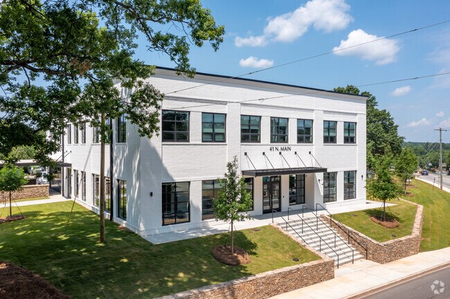
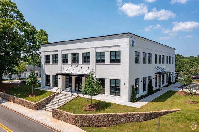
Property Record
41 N Main St, Watkinsville, GA 30677
NEARBY LISTINGS FOR SALE OR LEASE
Property Detail
41 N Main St
W05-0-30
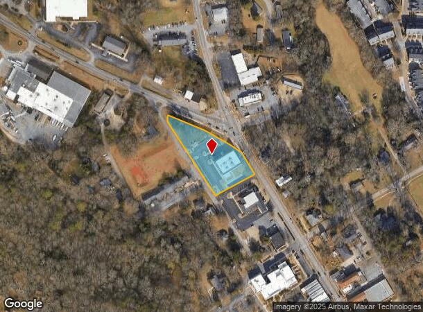
45/8 ; MAIN ST & HWY 53
Officebuilding
Oconee
X
Georgia
13219C0135E
2.50 AC
2025
Athens/Gainesville
2025
Other Market Areas
030402
Athens-Clarke County, GA
14,746 SF
DEMOGRAPHICS near 41 N Main St
1 Mile
3 Mile
5 Mile
2024 Total Population
2,957
12,787
40,500
2029 Population
3,276
14,223
43,363
Pop Growth 2024-2029
+ 10.79%
+ 11.23%
+ 7.07%
Average Age
39
40
37
2024 Total Households
1,101
4,541
15,147
HH Growth 2024-2029
+ 10.90%
+ 11.32%
+ 6.62%
Median Household Inc
$74,422
$101,484
$79,337
Avg Household Size
2.70
2.80
2.60
2024 Avg HH Vehicles
2.00
2.00
2.00
Median Home Value
$315,690
$344,673
$353,280
Median Year Built
1989
1992
1991
Nearby Places
Map Layers
Map Styles
 Street
 Aerial
- Restaurants
- Banks
- Shops
- Fitness
- Groceries
Nearby Properties
Address
Land Use
TOTAL SIZE
Lot Size
Zoning
Address
Land Use
TOTAL SIZE
Lot Size
Zoning
11,600 SF
154.32 AC
AR
Address
Land Use
TOTAL SIZE
Lot Size
Zoning
20,748 SF
80.77 AC
AG
Address
Land Use
TOTAL SIZE
Lot Size
Zoning
107,030 SF
34.62 AC
AR
Address
Land Use
TOTAL SIZE
Lot Size
Zoning
12,483 SF
8.13 AC
Address
Land Use
TOTAL SIZE
Lot Size
Zoning
5,216 SF
12.81 AC
R-3
Address
Land Use
TOTAL SIZE
Lot Size
Zoning
29,032 SF
14 AC
AG
Address
Land Use
TOTAL SIZE
Lot Size
Zoning
76,360 SF
10.25 AC
B-1
Address
Land Use
TOTAL SIZE
Lot Size
Zoning
27,200 SF
6.65 AC
002
Address
Land Use
TOTAL SIZE
Lot Size
Zoning
57,735 SF
35 AC
AG
Address
Land Use
TOTAL SIZE
Lot Size
Zoning
78,525 SF
15.81 AC
Address
Land Use
TOTAL SIZE
Lot Size
Zoning
60,596 SF
15 AC
001
Address
Land Use
TOTAL SIZE
Lot Size
Zoning
25,519 SF
7.63 AC
OIP
Address
Land Use
TOTAL SIZE
Lot Size
Zoning
45,945 SF
2.27 AC
OIP
Address
Land Use
TOTAL SIZE
Lot Size
Zoning
58,862 SF
1.15 AC
Address
Land Use
TOTAL SIZE
Lot Size
Zoning
Address
Land Use
TOTAL SIZE
Lot Size
Zoning
16,800 SF
37.92 AC
AG
Address
Land Use
TOTAL SIZE
Lot Size
Zoning
4,000 SF
253.45 AC
AG
Address
Land Use
TOTAL SIZE
Lot Size
Zoning
3,600 SF
3.28 AC
B-2
Address
Land Use
TOTAL SIZE
Lot Size
Zoning
26,837 SF
3.64 AC
AG
Address
Land Use
TOTAL SIZE
Lot Size
Zoning
20,504 SF
9.96 AC
O-B-P
Address
Land Use
TOTAL SIZE
Lot Size
Zoning
Address
Land Use
TOTAL SIZE
Lot Size
Zoning
12,000 SF
1.66 AC
002
Address
Land Use
TOTAL SIZE
Lot Size
Zoning
33,131 SF
4.37 AC
B-2
Address
Land Use
TOTAL SIZE
Lot Size
Zoning
10,476 SF
3.51 AC
AR-1
Address
Land Use
TOTAL SIZE
Lot Size
Zoning
228.73 AC
AR
Address
Land Use
TOTAL SIZE
Lot Size
Zoning
207 AC
R-1
Address
Land Use
TOTAL SIZE
Lot Size
Zoning
211.24 AC
R-1
Address
Land Use
TOTAL SIZE
Lot Size
Zoning
38,275 SF
3.06 AC
002
Address
Land Use
TOTAL SIZE
Lot Size
Zoning
179.44 AC
AR
The World's #1 Commercial Real Estate Marketplace
Connect with us
© 2026 CoStar Group
The information above has been obtained from sources believed reliable. While we do not doubt its accuracy we have not verified it and make no guarantee, warranty or representation about it. It is your responsibility to independently confirm its accuracy and completeness. Any projections, opinions, assumptions, or estimates used are for example only and do not represent the current or future performance of the property. The value of this transaction to you depends on tax and other factors which should be evaluated by your tax, financial, and legal advisors. You and your advisors should conduct a careful, independent investigation of the property to determine to your satisfaction the suitability of the property for your needs.