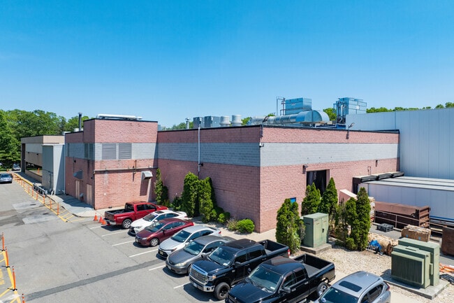
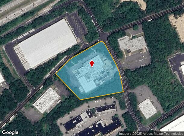
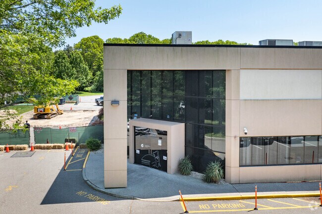
Property Record
41 Natcon Dr, Shirley, NY 11967
NEARBY LISTINGS FOR SALE OR LEASE
Property Detail
41 Natcon Dr
Nassau County-Suffolk County, NY
Map Brookhaven R & D Plaza Section One
0200-584-00-01-00-004-021
R&D PLZA 7170 SC 1 PT LT 1-NE PT N
Warehouse
Suffolk
X
New York
36103C0710H
4
2024
5.38 AC
2024
Eastern Suffolk
159407
Long Island (New York)
DEMOGRAPHICS near 41 Natcon Dr
1 Mile
3 Mile
5 Mile
2024 Total Population
4,046
20,650
80,770
2029 Population
4,033
20,456
79,954
Pop Growth 2024-2029
(0.32%)
(0.94%)
(1.01%)
Average Age
40
40
41
2024 Total Households
1,318
6,813
28,087
HH Growth 2024-2029
+ 0.23%
(0.78%)
(1.04%)
Median Household Inc
$141,105
$115,897
$96,606
Avg Household Size
3.00
2.90
2.80
2024 Avg HH Vehicles
3.00
2.00
2.00
Median Home Value
$358,931
$373,094
$371,801
Median Year Built
1980
1980
1980
Nearby Places
- Restaurants
- Banks
- Shops
- Fitness
- Groceries
PUBLIC TRANSPORTATION
COMMUTER RAIL
Yaphank Station (Greenport Branch - Long Island Rail Road)
DRIVE
WALK
Distance
Yaphank Station (Greenport Branch - Long Island Rail Road)
7 min
3.5 mi
Mastic-Shirley Station (Montauk Branch - Long Island Rail Road)
DRIVE
WALK
Distance
Mastic-Shirley Station (Montauk Branch - Long Island Rail Road)
11 min
6.0 mi
AIRPORT
Long Island MacArthur
DRIVE
WALK
Distance
Long Island MacArthur
27 min
15.6 mi
Freight Ports
Port of New Haven
DRIVE
WALK
Distance
Port of New Haven
138 min
52.6 mi
Nearby Properties
Address
Land Use
TOTAL SIZE
Lot Size
Zoning
Address
Land Use
TOTAL SIZE
Lot Size
Zoning
1,180.32 AC
Address
Land Use
TOTAL SIZE
Lot Size
Zoning
1.68 AC
Address
Land Use
TOTAL SIZE
Lot Size
Zoning
7.31 AC
LI200
Address
Land Use
TOTAL SIZE
Lot Size
Zoning
6.82 AC
LI200
Address
Land Use
TOTAL SIZE
Lot Size
Zoning
4,925 SF
0.27 AC
VILLA
Address
Land Use
TOTAL SIZE
Lot Size
Zoning
1.70 AC
RRD
Address
Land Use
TOTAL SIZE
Lot Size
Zoning
48.38 AC
Address
Land Use
TOTAL SIZE
Lot Size
Zoning
32.85 AC
Address
Land Use
TOTAL SIZE
Lot Size
Zoning
17.62 AC
Address
Land Use
TOTAL SIZE
Lot Size
Zoning
32.70 AC
Address
Land Use
TOTAL SIZE
Lot Size
Zoning
14.10 AC
Address
Land Use
TOTAL SIZE
Lot Size
Zoning
Address
Land Use
TOTAL SIZE
Lot Size
Zoning
63.90 AC
Address
Land Use
TOTAL SIZE
Lot Size
Zoning
16.04 AC
Address
Land Use
TOTAL SIZE
Lot Size
Zoning
73.70 AC
Address
Land Use
TOTAL SIZE
Lot Size
Zoning
Address
Land Use
TOTAL SIZE
Lot Size
Zoning
0.18 AC
R20
Address
Land Use
TOTAL SIZE
Lot Size
Zoning
2.70 AC
Address
Land Use
TOTAL SIZE
Lot Size
Zoning
3.33 AC
Address
Land Use
TOTAL SIZE
Lot Size
Zoning
Address
Land Use
TOTAL SIZE
Lot Size
Zoning
Address
Land Use
TOTAL SIZE
Lot Size
Zoning
83.56 AC
Address
Land Use
TOTAL SIZE
Lot Size
Zoning
93 AC
Address
Land Use
TOTAL SIZE
Lot Size
Zoning
13.90 AC
Address
Land Use
TOTAL SIZE
Lot Size
Zoning
11.68 AC
Address
Land Use
TOTAL SIZE
Lot Size
Zoning
164.50 AC
Address
Land Use
TOTAL SIZE
Lot Size
Zoning
3.24 AC
Address
Land Use
TOTAL SIZE
Lot Size
Zoning
12.65 AC
Address
Land Use
TOTAL SIZE
Lot Size
Zoning
10.05 AC
Address
Land Use
TOTAL SIZE
Lot Size
Zoning
The World's #1 Commercial Real Estate Marketplace
Connect with us
© 2025 CoStar Group
The information above has been obtained from sources believed reliable. While we do not doubt its accuracy we have not verified it and make no guarantee, warranty or representation about it. It is your responsibility to independently confirm its accuracy and completeness. Any projections, opinions, assumptions, or estimates used are for example only and do not represent the current or future performance of the property. The value of this transaction to you depends on tax and other factors which should be evaluated by your tax, financial, and legal advisors. You and your advisors should conduct a careful, independent investigation of the property to determine to your satisfaction the suitability of the property for your needs.