Property Record
41 Sanderson Rd, Smithfield, RI 02917


Save to a Folder
{{folder.Name}}
{{folder.ListingIds.length}} Properties
{{folder.ListingIds.length}} Property
Create a New Folder
This Property Is For Sale
Property Detail
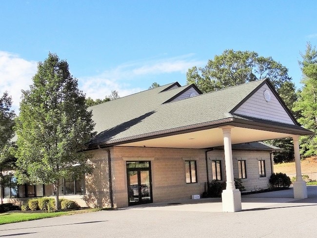
41 Sanderson Rd
SMIT-000043-000000-000152
Providence
Commercialbuilding
Rhode Island
PD
152
B and X Area of moderate flood hazard, usually the area between the limits of the 100-year and 500-year floods.
5 AC
2025
Smithfield
2025
Providence
012702
Providence-Warwick, RI-MA
33,340 SF
NEARBY LISTINGS FOR SALE OR LEASE
-
-
View all Smithfield listings for sale on LoopNet.com
DEMOGRAPHICS near 41 Sanderson Rd
1 mile
3 mile
5 mile
2025 Total Population
3,286
36,679
112,705
2030 Population
3,445
38,404
117,156
Pop Growth 2025-2030
+ 4.84%
+ 4.70%
+ 3.95%
Average Age
44
44
42
2025 Total Households
1,273
14,728
44,569
HH Growth 2025-2030
+ 4.87%
+ 4.76%
+ 4.07%
Median Household Inc
$103,303
$96,196
$89,392
Avg Household Size
2.60
2.40
2.40
2025 Avg HH Vehicles
2.00
2.00
2.00
Median Home Value
$415,617
$424,002
$388,544
Median Year Built
1968
1970
1968
Nearby Places
Map Layers
Map Styles
 Street
 Aerial
Layers
 Traffic
 Biking
Places
Listings with unknown addresses are not visible on the map
- Restaurants
- Banks
- Shops
- Fitness
- Groceries
PUBLIC TRANSPORTATION
COMMUTER RAIL
Providence (Providence/Stoughton Line - Massachusetts Bay Transportation Authority Commuter Rail (Purple Line))
Drive
Walk
Distance
Providence (Providence/Stoughton Line - Massachusetts Bay Transportation Authority Commuter Rail (Purple Line))
15 min
7.9 mi
Drive
Walk
Distance
15 min
8.4 mi
AIRPORT
Rhode Island Tf Green International
Drive
Walk
Distance
Rhode Island Tf Green International
24 min
14.7 mi
Worcester Regional
Drive
Walk
Distance
Worcester Regional
59 min
40.7 mi
Nearby Properties
Address
Land Use
TOTAL SIZE
Lot Size
Zoning
Address
Land Use
TOTAL SIZE
Lot Size
Zoning
53.18 AC
C
Address
Land Use
TOTAL SIZE
Lot Size
Zoning
123.25 AC
R40
Address
Land Use
TOTAL SIZE
Lot Size
Zoning
30.14 AC
R40
Address
Land Use
TOTAL SIZE
Lot Size
Zoning
166,368 SF
10.74 AC
R20
Address
Land Use
TOTAL SIZE
Lot Size
Zoning
31.11 AC
R20M
Address
Land Use
TOTAL SIZE
Lot Size
Zoning
Address
Land Use
TOTAL SIZE
Lot Size
Zoning
185,010 SF
7.75 AC
MG
Address
Land Use
TOTAL SIZE
Lot Size
Zoning
1 AC
R40
Address
Land Use
TOTAL SIZE
Lot Size
Zoning
56,451 SF
5 AC
C
Address
Land Use
TOTAL SIZE
Lot Size
Zoning
22,868 SF
12.22 AC
R20
Address
Land Use
TOTAL SIZE
Lot Size
Zoning
124,397 SF
13.66 AC
C
Address
Land Use
TOTAL SIZE
Lot Size
Zoning
89,788 SF
11.25 AC
R20
Address
Land Use
TOTAL SIZE
Lot Size
Zoning
72,531 SF
11.70 AC
R20
Address
Land Use
TOTAL SIZE
Lot Size
Zoning
9.59 AC
MU
Address
Land Use
TOTAL SIZE
Lot Size
Zoning
20 AC
R20M
Address
Land Use
TOTAL SIZE
Lot Size
Zoning
54,645 SF
13.40 AC
RMED
Address
Land Use
TOTAL SIZE
Lot Size
Zoning
102,497 SF
4.74 AC
RG
Address
Land Use
TOTAL SIZE
Lot Size
Zoning
87,649 SF
8 AC
R20
Address
Land Use
TOTAL SIZE
Lot Size
Zoning
78,346 SF
10.75 AC
PD
Address
Land Use
TOTAL SIZE
Lot Size
Zoning
85,130 SF
4.40 AC
R20
Address
Land Use
TOTAL SIZE
Lot Size
Zoning
44,381 SF
12.20 AC
R20
Address
Land Use
TOTAL SIZE
Lot Size
Zoning
96,723 SF
21.69 AC
PD
Address
Land Use
TOTAL SIZE
Lot Size
Zoning
5,268 SF
52.10 AC
OS
Address
Land Use
TOTAL SIZE
Lot Size
Zoning
88,147 SF
4.30 AC
CV
Address
Land Use
TOTAL SIZE
Lot Size
Zoning
1 AC
PD
Address
Land Use
TOTAL SIZE
Lot Size
Zoning
3.69 AC
C
Address
Land Use
TOTAL SIZE
Lot Size
Zoning
60,658 SF
11.40 AC
MU
Address
Land Use
TOTAL SIZE
Lot Size
Zoning
51,261 SF
8.29 AC
B3
Address
Land Use
TOTAL SIZE
Lot Size
Zoning
4.57 AC
B2
Address
Land Use
TOTAL SIZE
Lot Size
Zoning
10.18 AC
R20M
The World's #1 Commercial Real Estate Marketplace
Connect with us
© 2026 CoStar Group
The information above has been obtained from sources believed reliable. While we do not doubt its accuracy we have not verified it and make no guarantee, warranty or representation about it. It is your responsibility to independently confirm its accuracy and completeness. Any projections, opinions, assumptions, or estimates used are for example only and do not represent the current or future performance of the property. The value of this transaction to you depends on tax and other factors which should be evaluated by your tax, financial, and legal advisors. You and your advisors should conduct a careful, independent investigation of the property to determine to your satisfaction the suitability of the property for your needs.