Property Record
410 E Interstate Service Rd, Graham, NC 27253

Property Detail
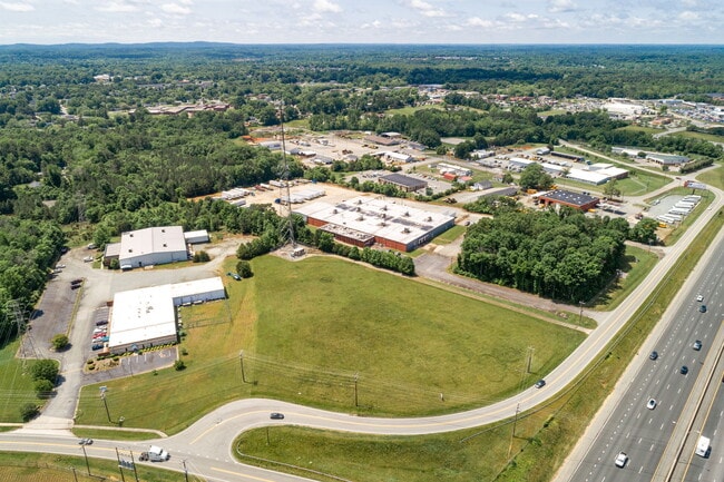
410 E Interstate Service Rd
146465
BA 408 E INTERSTATE SERV 6/9/1938
Manufacturinglight
Alamance
I 2
North Carolina
B and X Area of moderate flood hazard, usually the area between the limits of the 100-year and 500-year floods.
7.89 AC
2025
S Central Alamance County
2025
Greensboro/Winston-Salem
021102
Burlington, NC
66,041 SF
NEARBY LISTINGS FOR SALE OR LEASE
DEMOGRAPHICS near 410 E Interstate Service Rd
1 mile
3 mile
5 mile
2025 Total Population
6,841
36,759
81,576
2030 Population
7,228
38,786
86,167
Pop Growth 2025-2030
+ 5.66%
+ 5.51%
+ 5.63%
Average Age
40
40
40
2025 Total Households
2,944
14,783
33,158
HH Growth 2025-2030
+ 5.88%
+ 5.70%
+ 5.76%
Median Household Inc
$56,064
$54,858
$57,595
Avg Household Size
2.20
2.40
2.40
2025 Avg HH Vehicles
2.00
2.00
2.00
Median Home Value
$235,675
$218,619
$222,330
Median Year Built
1983
1977
1978
Nearby Places
Map Layers
Map Styles
 Street
 Aerial
Transit
 Traffic
 Biking
Places
Listings with unknown addresses are not visible on the map
- Restaurants
- Banks
- Shops
- Fitness
- Groceries
PUBLIC TRANSPORTATION
COMMUTER RAIL
Burlington Station (Piedmont - North Carolina by Train (NC Train))
Drive
Walk
Distance
Burlington Station (Piedmont - North Carolina by Train (NC Train))
9 min
4.2 mi
Freight Ports
Virginia Port Authority - Richmond
Drive
Walk
Distance
Virginia Port Authority - Richmond
201 min
174.7 mi
SALE & LEASE HISTORY
LISTING DATE
SALE/LEASE

Sep 25, 2016
For Lease
Sep 24, 2016
For Sale
Sep 24, 2016
For Sale
Oct 22, 2018
For Sale
May 20, 2024
For Lease
May 16, 2024
For Sale
Jan 02, 2019
For Lease
Nearby Properties
Address
Land Use
TOTAL SIZE
Lot Size
Zoning
Address
Land Use
TOTAL SIZE
Lot Size
Zoning
2,315 SF
55.43 AC
I 1
Address
Land Use
TOTAL SIZE
Lot Size
Zoning
159,629 SF
82.81 AC
Address
Land Use
TOTAL SIZE
Lot Size
Zoning
27,803 SF
13.10 AC
B 2
Address
Land Use
TOTAL SIZE
Lot Size
Zoning
578,100 SF
55.30 AC
Address
Land Use
TOTAL SIZE
Lot Size
Zoning
48,136 SF
14.57 AC
B 2
Address
Land Use
TOTAL SIZE
Lot Size
Zoning
37,502 SF
17.48 AC
CR
Address
Land Use
TOTAL SIZE
Lot Size
Zoning
27,803 SF
11.53 AC
Address
Land Use
TOTAL SIZE
Lot Size
Zoning
33,280 SF
9.07 AC
I2
Address
Land Use
TOTAL SIZE
Lot Size
Zoning
12,600 SF
44.61 AC
Address
Land Use
TOTAL SIZE
Lot Size
Zoning
84,881 SF
52.87 AC
I1
Address
Land Use
TOTAL SIZE
Lot Size
Zoning
72,164 SF
73.50 AC
Address
Land Use
TOTAL SIZE
Lot Size
Zoning
10,368 SF
11.35 AC
R MF
Address
Land Use
TOTAL SIZE
Lot Size
Zoning
51,994 SF
42.20 AC
OI
Address
Land Use
TOTAL SIZE
Lot Size
Zoning
71,962 SF
5.98 AC
O I
Address
Land Use
TOTAL SIZE
Lot Size
Zoning
216,968 SF
25.50 AC
CB
Address
Land Use
TOTAL SIZE
Lot Size
Zoning
31,920 SF
4.59 AC
R MF
Address
Land Use
TOTAL SIZE
Lot Size
Zoning
7,192 SF
14.08 AC
RMF
Address
Land Use
TOTAL SIZE
Lot Size
Zoning
36,000 SF
4.43 AC
Address
Land Use
TOTAL SIZE
Lot Size
Zoning
9,008 SF
6.23 AC
R MF
Address
Land Use
TOTAL SIZE
Lot Size
Zoning
2,923 SF
10.13 AC
Address
Land Use
TOTAL SIZE
Lot Size
Zoning
158,339 SF
16.34 AC
Address
Land Use
TOTAL SIZE
Lot Size
Zoning
20,000 SF
17.24 AC
I 1A
Address
Land Use
TOTAL SIZE
Lot Size
Zoning
60,458 SF
6.82 AC
I 2
Address
Land Use
TOTAL SIZE
Lot Size
Zoning
45,321 SF
31 AC
R 12
Address
Land Use
TOTAL SIZE
Lot Size
Zoning
8,312 SF
10.41 AC
Address
Land Use
TOTAL SIZE
Lot Size
Zoning
7,800 SF
5.51 AC
Address
Land Use
TOTAL SIZE
Lot Size
Zoning
43,170 SF
6.80 AC
O I
Address
Land Use
TOTAL SIZE
Lot Size
Zoning
41,787 SF
8.07 AC
COI
Address
Land Use
TOTAL SIZE
Lot Size
Zoning
139,530 SF
21.73 AC
Address
Land Use
TOTAL SIZE
Lot Size
Zoning
4,480 SF
11.50 AC
MF A
The World's #1 Commercial Real Estate Marketplace
Connect with us
© 2026 CoStar Group
The information above has been obtained from sources believed reliable. While we do not doubt its accuracy we have not verified it and make no guarantee, warranty or representation about it. It is your responsibility to independently confirm its accuracy and completeness. Any projections, opinions, assumptions, or estimates used are for example only and do not represent the current or future performance of the property. The value of this transaction to you depends on tax and other factors which should be evaluated by your tax, financial, and legal advisors. You and your advisors should conduct a careful, independent investigation of the property to determine to your satisfaction the suitability of the property for your needs.