Property Record
2100 E Routt Ave, Pueblo, CO 81004
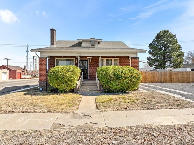
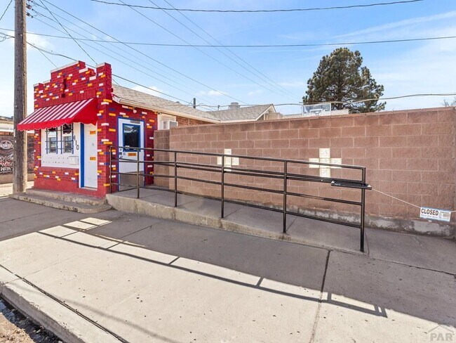
This Property Is For Sale
NEARBY LISTINGS FOR SALE OR LEASE
Property Detail
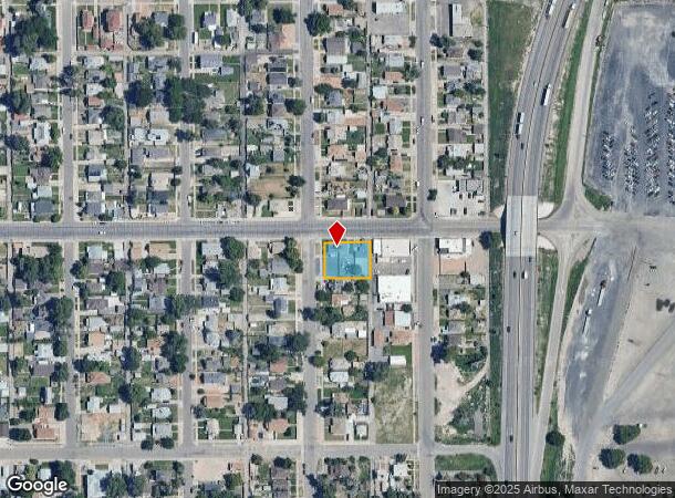
2100 E Routt Ave
Pueblo, CO
South Lake Ave Area
1-5-12-4-12-021
LOTS 1 THRU 4 BLK 37 LAKE MINNEQUA ADD FORMERLY,#15-124-12-001,-002
Commercialnec
Pueblo
X
Colorado
08101C0726D
1-4
2024
0.57 AC
2024
Colorado East Area
002200
Other Market Areas
2,758 SF
DEMOGRAPHICS near 2100 E Routt Ave
1 Mile
3 Mile
5 Mile
2024 Total Population
7,931
54,089
104,327
2029 Population
8,184
55,301
106,802
Pop Growth 2024-2029
+ 3.19%
+ 2.24%
+ 2.37%
Average Age
39
41
40
2024 Total Households
3,271
22,146
42,460
HH Growth 2024-2029
+ 3.24%
+ 2.40%
+ 2.47%
Median Household Inc
$40,571
$44,267
$47,487
Avg Household Size
2.30
2.30
2.30
2024 Avg HH Vehicles
2.00
2.00
2.00
Median Home Value
$167,424
$197,665
$217,867
Median Year Built
1948
1958
1962
Nearby Places
- Restaurants
- Banks
- Shops
- Fitness
- Groceries
Nearby Properties
Address
Land Use
TOTAL SIZE
Lot Size
Zoning
Address
Land Use
TOTAL SIZE
Lot Size
Zoning
17,710 SF
49.97 AC
Address
Land Use
TOTAL SIZE
Lot Size
Zoning
53,269 SF
4.51 AC
Address
Land Use
TOTAL SIZE
Lot Size
Zoning
4,492,279 SF
488.39 AC
Address
Land Use
TOTAL SIZE
Lot Size
Zoning
79,394 SF
5.57 AC
R5:RES/MUL
Address
Land Use
TOTAL SIZE
Lot Size
Zoning
42,289 SF
0.54 AC
B4:COMM/RE
Address
Land Use
TOTAL SIZE
Lot Size
Zoning
40,986 SF
0.65 AC
R5:RES/MUL
Address
Land Use
TOTAL SIZE
Lot Size
Zoning
56,088 SF
4 AC
Address
Land Use
TOTAL SIZE
Lot Size
Zoning
94,278 SF
2.11 AC
R-5
Address
Land Use
TOTAL SIZE
Lot Size
Zoning
33,866 SF
3.34 AC
Address
Land Use
TOTAL SIZE
Lot Size
Zoning
199,914 SF
13.48 AC
B4:COMM/RE
Address
Land Use
TOTAL SIZE
Lot Size
Zoning
1,070,193 SF
43.08 AC
R5:RES/MUL
Address
Land Use
TOTAL SIZE
Lot Size
Zoning
27,682 SF
1.85 AC
S-1
Address
Land Use
TOTAL SIZE
Lot Size
Zoning
25,714 SF
17.61 AC
Address
Land Use
TOTAL SIZE
Lot Size
Zoning
45,219 SF
4.46 AC
Address
Land Use
TOTAL SIZE
Lot Size
Zoning
84,872 SF
0.76 AC
B4:COMM/RE
Address
Land Use
TOTAL SIZE
Lot Size
Zoning
35,530 SF
0.55 AC
R-4
Address
Land Use
TOTAL SIZE
Lot Size
Zoning
35,530 SF
0.54 AC
S1:SPC/PUB
Address
Land Use
TOTAL SIZE
Lot Size
Zoning
117,715 SF
3.58 AC
Address
Land Use
TOTAL SIZE
Lot Size
Zoning
13,216 SF
0.55 AC
B4:COMM/RE
Address
Land Use
TOTAL SIZE
Lot Size
Zoning
19,763 SF
2.50 AC
R2:RES/1 F
Address
Land Use
TOTAL SIZE
Lot Size
Zoning
62,718 SF
4.76 AC
I3:IND/HEA
Address
Land Use
TOTAL SIZE
Lot Size
Zoning
86,458 SF
20 AC
I3:IND/HEA
Address
Land Use
TOTAL SIZE
Lot Size
Zoning
136,337 SF
14.81 AC
PUD
Address
Land Use
TOTAL SIZE
Lot Size
Zoning
16,800 SF
6.02 AC
Address
Land Use
TOTAL SIZE
Lot Size
Zoning
71,751 SF
2.73 AC
R3:RES/2 F
Address
Land Use
TOTAL SIZE
Lot Size
Zoning
28,490 SF
0.23 AC
R4:RES/MUL
Address
Land Use
TOTAL SIZE
Lot Size
Zoning
22,358 SF
0.36 AC
B-4
Address
Land Use
TOTAL SIZE
Lot Size
Zoning
12,150 SF
1.10 AC
Address
Land Use
TOTAL SIZE
Lot Size
Zoning
12,950 SF
0.32 AC
B4:COMM/RE
Address
Land Use
TOTAL SIZE
Lot Size
Zoning
12,018 SF
0.76 AC
B2:COMM/SU
The World's #1 Commercial Real Estate Marketplace
Connect with us
© 2025 CoStar Group
The information above has been obtained from sources believed reliable. While we do not doubt its accuracy we have not verified it and make no guarantee, warranty or representation about it. It is your responsibility to independently confirm its accuracy and completeness. Any projections, opinions, assumptions, or estimates used are for example only and do not represent the current or future performance of the property. The value of this transaction to you depends on tax and other factors which should be evaluated by your tax, financial, and legal advisors. You and your advisors should conduct a careful, independent investigation of the property to determine to your satisfaction the suitability of the property for your needs.