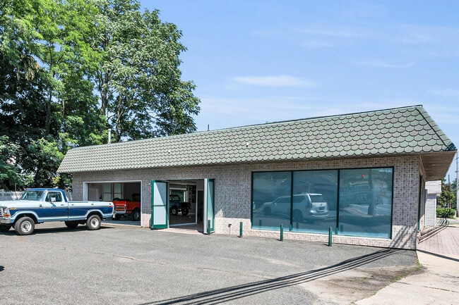
Property Record
410 Navesink Ave, Highlands, NJ 07732


NEARBY LISTINGS FOR SALE OR LEASE
Property Detail
410 Navesink Ave
19-00116-0000-00012
Monmouth
Vacantlandnec
New Jersey
X
13
34025C0088H
0.06 AC
2024
Eastern Monmouth
2025
Northern New Jersey
800101
New York-Jersey City-White Plains, NY-NJ
DEMOGRAPHICS near 410 Navesink Ave
1 Mile
3 Mile
5 Mile
2024 Total Population
6,420
21,799
50,077
2029 Population
6,601
21,946
50,159
Pop Growth 2024-2029
+ 2.82%
+ 0.67%
+ 0.16%
Average Age
46
44
43
2024 Total Households
3,234
9,301
20,125
HH Growth 2024-2029
+ 2.88%
+ 0.87%
+ 0.33%
Median Household Inc
$94,734
$124,816
$137,194
Avg Household Size
2.00
2.30
2.40
2024 Avg HH Vehicles
2.00
2.00
2.00
Median Home Value
$446,693
$643,502
$636,518
Median Year Built
1972
1969
1964
Nearby Places
Map Layers
Map Styles
 Street
 Aerial
- Restaurants
- Banks
- Shops
- Fitness
- Groceries
PUBLIC TRANSPORTATION
COMMUTER RAIL
Red Bank (North Jersey Coast Line - NJ Transit Commuter Rail (NJ Transit))
DRIVE
WALK
Distance
Red Bank (North Jersey Coast Line - NJ Transit Commuter Rail (NJ Transit))
16 min
7.0 mi
Little Silver (North Jersey Coast Line - NJ Transit Commuter Rail (NJ Transit))
DRIVE
WALK
Distance
Little Silver (North Jersey Coast Line - NJ Transit Commuter Rail (NJ Transit))
20 min
9.6 mi
AIRPORT
Newark Liberty International
DRIVE
WALK
Distance
Newark Liberty International
53 min
40.7 mi
Freight Ports
New York Container Terminal
DRIVE
WALK
Distance
New York Container Terminal
1 min
18.6 mi
SALE & LEASE HISTORY
LISTING DATE
SALE/LEASE

Sep 23, 2016
For Sale
Nearby Properties
Address
Land Use
TOTAL SIZE
Lot Size
Zoning
Address
Land Use
TOTAL SIZE
Lot Size
Zoning
167,221 SF
18.74 AC
POS
Address
Land Use
TOTAL SIZE
Lot Size
Zoning
35.84 AC
R-22
Address
Land Use
TOTAL SIZE
Lot Size
Zoning
47,470 SF
15.43 AC
POS
Address
Land Use
TOTAL SIZE
Lot Size
Zoning
37 AC
H-BP
Address
Land Use
TOTAL SIZE
Lot Size
Zoning
1,800 SF
504.53 AC
R220
Address
Land Use
TOTAL SIZE
Lot Size
Zoning
72,355 SF
11.72 AC
R-1
Address
Land Use
TOTAL SIZE
Lot Size
Zoning
48,663 SF
7.46 AC
R-2
Address
Land Use
TOTAL SIZE
Lot Size
Zoning
163,312 SF
16.21 AC
PRH
Address
Land Use
TOTAL SIZE
Lot Size
Zoning
15,866 SF
4.85 AC
POS
Address
Land Use
TOTAL SIZE
Lot Size
Zoning
50,339 SF
10.50 AC
B-3
Address
Land Use
TOTAL SIZE
Lot Size
Zoning
178 AC
R220
Address
Land Use
TOTAL SIZE
Lot Size
Zoning
162.89 AC
R220
Address
Land Use
TOTAL SIZE
Lot Size
Zoning
1.77 AC
MF-2
Address
Land Use
TOTAL SIZE
Lot Size
Zoning
23,090 SF
11.21 AC
MR
Address
Land Use
TOTAL SIZE
Lot Size
Zoning
74,620 SF
0.87 AC
MF
Address
Land Use
TOTAL SIZE
Lot Size
Zoning
17,200 SF
8.37 AC
SF80
Address
Land Use
TOTAL SIZE
Lot Size
Zoning
2,161 SF
95.96 AC
R220
Address
Land Use
TOTAL SIZE
Lot Size
Zoning
93,620 SF
12.03 AC
R102
Address
Land Use
TOTAL SIZE
Lot Size
Zoning
6,168 SF
13.09 AC
Address
Land Use
TOTAL SIZE
Lot Size
Zoning
21,208 SF
1.14 AC
R110
Address
Land Use
TOTAL SIZE
Lot Size
Zoning
23,778 SF
1.55 AC
SF0
Address
Land Use
TOTAL SIZE
Lot Size
Zoning
1,980 SF
10.20 AC
MR
Address
Land Use
TOTAL SIZE
Lot Size
Zoning
48,256 SF
87 SF
R-1
Address
Land Use
TOTAL SIZE
Lot Size
Zoning
44,755 SF
0.01 AC
B-3
Address
Land Use
TOTAL SIZE
Lot Size
Zoning
33,784 SF
6.55 AC
R203
Address
Land Use
TOTAL SIZE
Lot Size
Zoning
25,043 SF
54.66 AC
R-22
Address
Land Use
TOTAL SIZE
Lot Size
Zoning
5.32 AC
RTH9
Address
Land Use
TOTAL SIZE
Lot Size
Zoning
3,215 SF
1.68 AC
SF80
Address
Land Use
TOTAL SIZE
Lot Size
Zoning
21,330 SF
3.93 AC
B-3
Address
Land Use
TOTAL SIZE
Lot Size
Zoning
4.37 AC
POS
The World's #1 Commercial Real Estate Marketplace
Connect with us
© 2025 CoStar Group
The information above has been obtained from sources believed reliable. While we do not doubt its accuracy we have not verified it and make no guarantee, warranty or representation about it. It is your responsibility to independently confirm its accuracy and completeness. Any projections, opinions, assumptions, or estimates used are for example only and do not represent the current or future performance of the property. The value of this transaction to you depends on tax and other factors which should be evaluated by your tax, financial, and legal advisors. You and your advisors should conduct a careful, independent investigation of the property to determine to your satisfaction the suitability of the property for your needs.