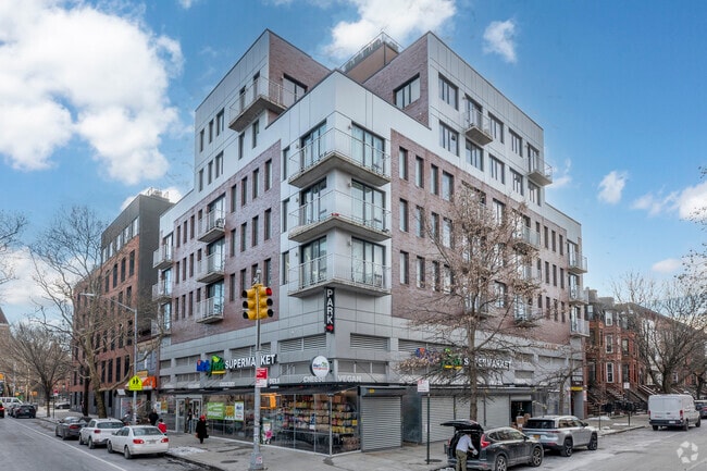
Property Record
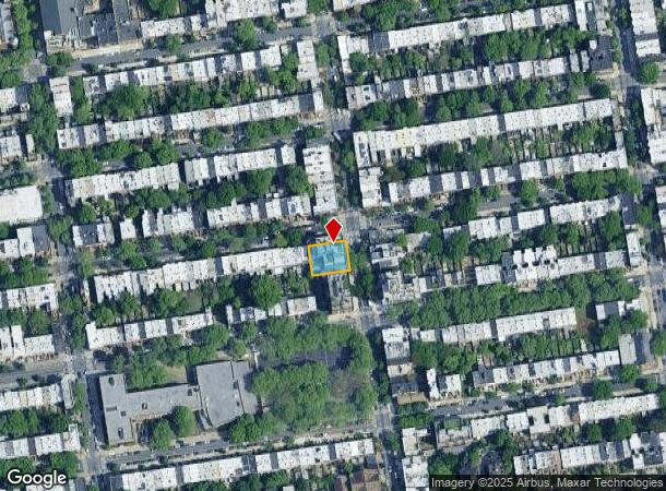
410 Tompkins Ave, Brooklyn, NY 11216

NEARBY LISTINGS FOR SALE OR LEASE
Property Detail
410 Tompkins Ave
01839-1101
DOCID-2017092700326001
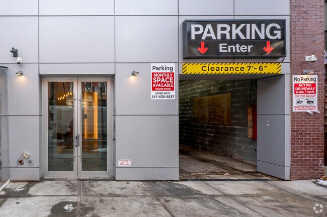
Storebuilding
Kings
X
New York
3604970212F
1101
2024
0.18 AC
2025
Bedford-Stuyvesant
024700
Long Island (New York)
8,774 SF
New York-Jersey City-White Plains, NY-NJ
DEMOGRAPHICS near 410 Tompkins Ave
1 mile
3 mile
5 mile
2024 Total Population
186,458
1,329,459
2,817,873
2029 Population
175,531
1,257,536
2,635,170
Pop Growth 2024-2029
(5.86%)
(5.41%)
(6.48%)
Average Age
37
38
38
2024 Total Households
74,285
519,117
1,103,282
HH Growth 2024-2029
(6.50%)
(5.84%)
(6.74%)
Median Household Inc
$73,383
$75,486
$78,734
Avg Household Size
2.40
2.40
2.40
2024 Avg HH Vehicles
.00
.00
.00
Median Home Value
$1,032,038
$937,239
$850,561
Median Year Built
1947
1948
1949
Nearby Places
Map Layers
Map Styles
 Street
 Aerial
Transit
 Traffic
 Biking
Places
Listings with unknown addresses are not visible on the map
- Restaurants
- Banks
- Shops
- Fitness
- Groceries
PUBLIC TRANSPORTATION
TRANSIT/SUBWAY
Kingston-Throop Avenues (A - New York MTA Subway (The Subway), C - New York MTA Subway (The Subway))
Drive
Walk
Distance
Kingston-Throop Avenues (A - New York MTA Subway (The Subway), C - New York MTA Subway (The Subway))
3 min
7 min
0.4 mi
Nostrand Avenue (A,C Line) (A - New York MTA Subway (The Subway), C - New York MTA Subway (The Subway))
Drive
Walk
Distance
Nostrand Avenue (A,C Line) (A - New York MTA Subway (The Subway), C - New York MTA Subway (The Subway))
2 min
9 min
0.5 mi
Nostrand Avenue Station (Far Rockaway Branch - Long Island Rail Road, Hempstead Branch - Long Island Rail Road, Long Beach Branch - Long Island Rail Road, West Hempstead Branch - Long Island Rail Road)
Drive
Walk
Distance
Nostrand Avenue Station (Far Rockaway Branch - Long Island Rail Road, Hempstead Branch - Long Island Rail Road, Long Beach Branch - Long Island Rail Road, West Hempstead Branch - Long Island Rail Road)
2 min
11 min
0.6 mi
Franklin Avenue (A,C,S Line) (A - New York MTA Subway (The Subway), C - New York MTA Subway (The Subway), Franklin Avenue Shuttle - New York MTA Subway (The Subway))
Drive
Walk
Distance
Franklin Avenue (A,C,S Line) (A - New York MTA Subway (The Subway), C - New York MTA Subway (The Subway), Franklin Avenue Shuttle - New York MTA Subway (The Subway))
2 min
13 min
0.7 mi
Bedford-Nostrand Avenues (G - New York MTA Subway (The Subway))
Drive
Walk
Distance
Bedford-Nostrand Avenues (G - New York MTA Subway (The Subway))
4 min
18 min
0.9 mi
COMMUTER RAIL
Nostrand Avenue Station (Far Rockaway Branch - Long Island Rail Road, Hempstead Branch - Long Island Rail Road, Long Beach Branch - Long Island Rail Road, West Hempstead Branch - Long Island Rail Road)
Drive
Walk
Distance
Nostrand Avenue Station (Far Rockaway Branch - Long Island Rail Road, Hempstead Branch - Long Island Rail Road, Long Beach Branch - Long Island Rail Road, West Hempstead Branch - Long Island Rail Road)
2 min
11 min
0.5 mi
Drive
Walk
Distance
6 min
2.0 mi
AIRPORT
LaGuardia
Drive
Walk
Distance
LaGuardia
21 min
10.7 mi
John F Kennedy International
Drive
Walk
Distance
John F Kennedy International
26 min
11.2 mi
Newark Liberty International
Drive
Walk
Distance
Newark Liberty International
31 min
17.2 mi
Freight Ports
NY - Red Hook Container Terminal
Drive
Walk
Distance
NY - Red Hook Container Terminal
13 min
4.1 mi
SALE & LEASE HISTORY
LISTING DATE
SALE/LEASE

Dec 01, 2020
For Lease
Nearby Properties
Address
Land Use
TOTAL SIZE
Lot Size
Zoning
Address
Land Use
TOTAL SIZE
Lot Size
Zoning
2,812,739 SF
2.10 AC
C5-3
Address
Land Use
TOTAL SIZE
Lot Size
Zoning
7,058,736 SF
147.61 AC
M3-1
Address
Land Use
TOTAL SIZE
Lot Size
Zoning
869,038 SF
1.53 AC
M1-1
Address
Land Use
TOTAL SIZE
Lot Size
Zoning
923,000 SF
4.87 AC
R7-2
Address
Land Use
TOTAL SIZE
Lot Size
Zoning
923,000 SF
4.87 AC
R7-2
Address
Land Use
TOTAL SIZE
Lot Size
Zoning
923,000 SF
4.87 AC
R7-2
Address
Land Use
TOTAL SIZE
Lot Size
Zoning
923,000 SF
4.87 AC
R7-2
Address
Land Use
TOTAL SIZE
Lot Size
Zoning
923,000 SF
4.87 AC
R7-2
Address
Land Use
TOTAL SIZE
Lot Size
Zoning
923,000 SF
4.87 AC
R7-2
Address
Land Use
TOTAL SIZE
Lot Size
Zoning
923,000 SF
4.87 AC
R7-2
Address
Land Use
TOTAL SIZE
Lot Size
Zoning
923,000 SF
4.87 AC
R7-2
Address
Land Use
TOTAL SIZE
Lot Size
Zoning
923,000 SF
4.87 AC
R7-2
Address
Land Use
TOTAL SIZE
Lot Size
Zoning
923,000 SF
4.87 AC
R7-2
Address
Land Use
TOTAL SIZE
Lot Size
Zoning
923,000 SF
4.87 AC
R7-2
Address
Land Use
TOTAL SIZE
Lot Size
Zoning
923,000 SF
4.87 AC
R7-2
Address
Land Use
TOTAL SIZE
Lot Size
Zoning
923,000 SF
4.87 AC
R7-2
Address
Land Use
TOTAL SIZE
Lot Size
Zoning
923,000 SF
4.87 AC
R7-2
Address
Land Use
TOTAL SIZE
Lot Size
Zoning
923,000 SF
4.87 AC
R7-2
Address
Land Use
TOTAL SIZE
Lot Size
Zoning
923,000 SF
4.87 AC
R7-2
Address
Land Use
TOTAL SIZE
Lot Size
Zoning
923,000 SF
4.87 AC
R7-2
Address
Land Use
TOTAL SIZE
Lot Size
Zoning
923,000 SF
4.87 AC
R7-2
Address
Land Use
TOTAL SIZE
Lot Size
Zoning
923,000 SF
4.87 AC
R7-2
Address
Land Use
TOTAL SIZE
Lot Size
Zoning
923,000 SF
4.87 AC
R7-2
Address
Land Use
TOTAL SIZE
Lot Size
Zoning
923,000 SF
4.87 AC
R7-2
Address
Land Use
TOTAL SIZE
Lot Size
Zoning
923,000 SF
4.87 AC
R7-2
Address
Land Use
TOTAL SIZE
Lot Size
Zoning
923,000 SF
4.87 AC
R7-2
Address
Land Use
TOTAL SIZE
Lot Size
Zoning
923,000 SF
4.87 AC
R7-2
Address
Land Use
TOTAL SIZE
Lot Size
Zoning
923,000 SF
4.87 AC
R7-2
Address
Land Use
TOTAL SIZE
Lot Size
Zoning
923,000 SF
4.87 AC
R7-2
Address
Land Use
TOTAL SIZE
Lot Size
Zoning
923,000 SF
4.87 AC
R7-2
The World's #1 Commercial Real Estate Marketplace
Connect with us
© 2026 CoStar Group
The information above has been obtained from sources believed reliable. While we do not doubt its accuracy we have not verified it and make no guarantee, warranty or representation about it. It is your responsibility to independently confirm its accuracy and completeness. Any projections, opinions, assumptions, or estimates used are for example only and do not represent the current or future performance of the property. The value of this transaction to you depends on tax and other factors which should be evaluated by your tax, financial, and legal advisors. You and your advisors should conduct a careful, independent investigation of the property to determine to your satisfaction the suitability of the property for your needs.